Import GPX to SA with waypoints
-
@luboskovar yes

-
@luboskovar What’s QA? Thanks
-
@fritzbt2013 QS apparently he means. Quantified-Self.IO
-
@Dimitrios-Kanellopoulos
 Exactly - QS
-
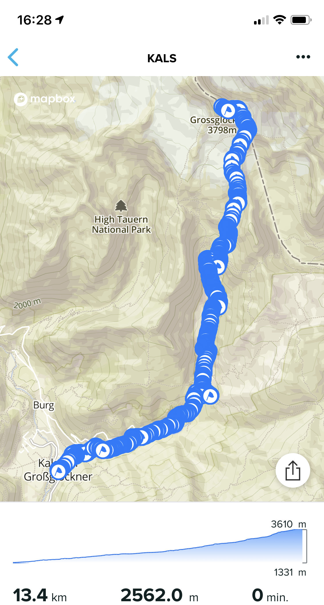
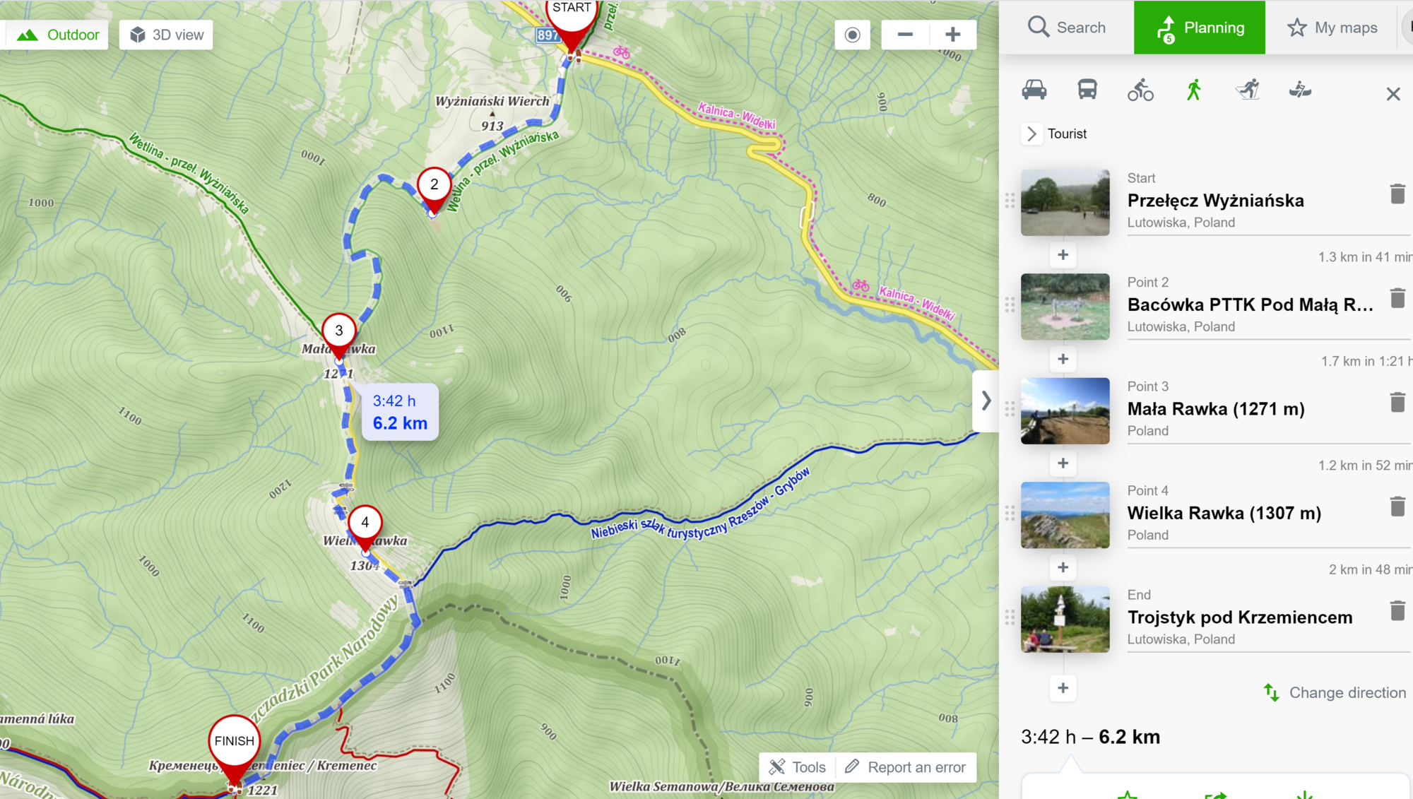
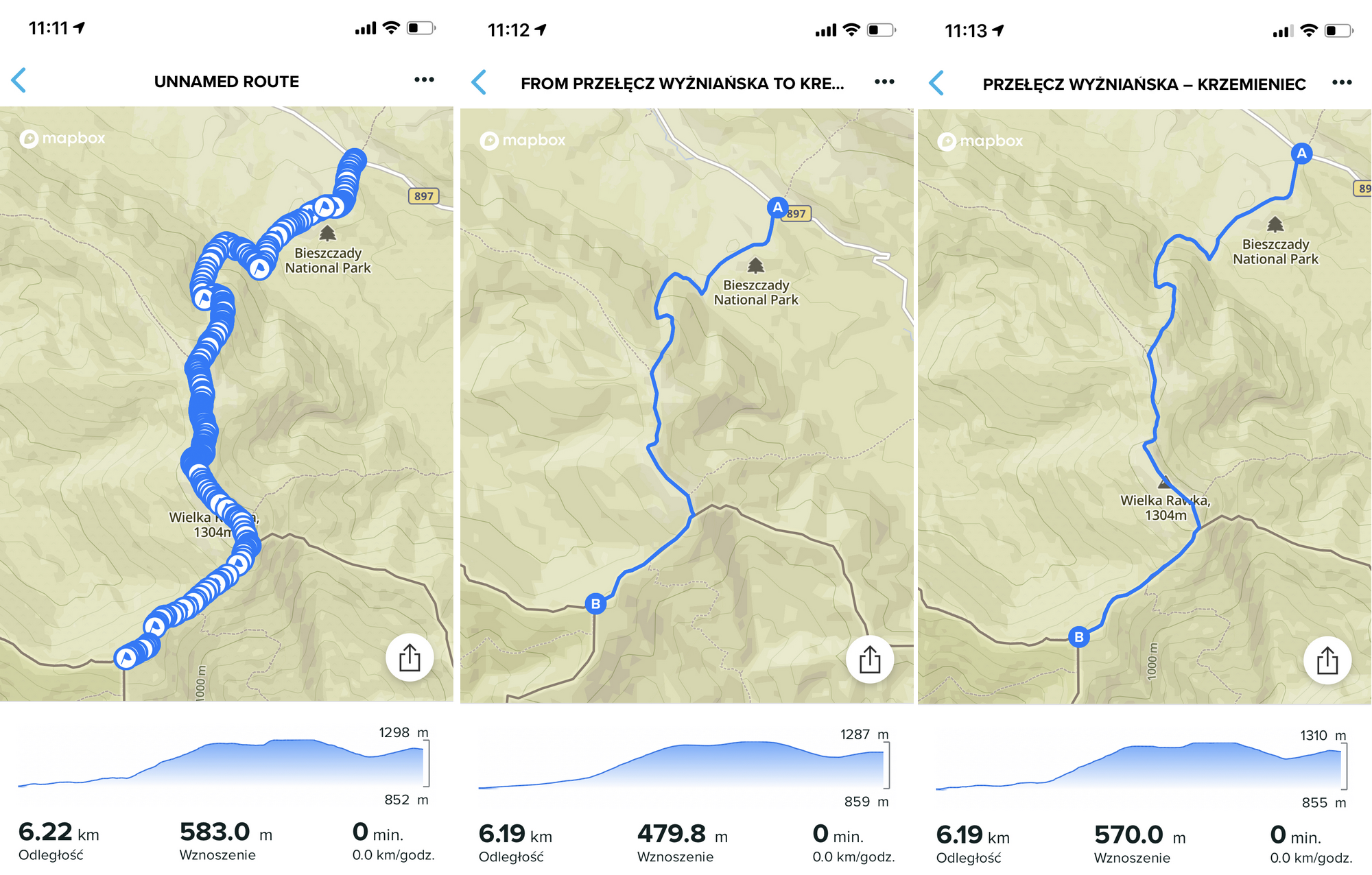
OK, so here is my attempt to import a gpx route with WP to iOS SA using QS.
It is a 13,3 km route with 2 WP.
This is how it looks like:
And this is the result in SA:
")
-
@kabzior that looks strange !
Community Manager / Admin @Suunto
Creator of quantified-self.io a portal that allows you to analyze your data from various providers, upload fit activity files to Suunto app, gpx routes and more… -
-
It can be the way it’s created. If they add a wpt (waypoint) for each dot sure.
But that should not be the cases imo.
-
@Dimitrios-Kanellopoulos said in Import GPX to SA with waypoints:
that looks strange
Indeed…
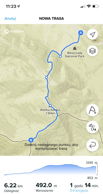
Well, since I am a scientist, I decided to check it with three repetitions on different sites that I use")
First off, here’s the route:
created in SA, it has 6.22 km and 492m ascent (the latter value seems wrong to me)
Now let’s move on to the services that offer route creation and gpx export:
- mapy.cz
- komoot
- mapa-turystyczna
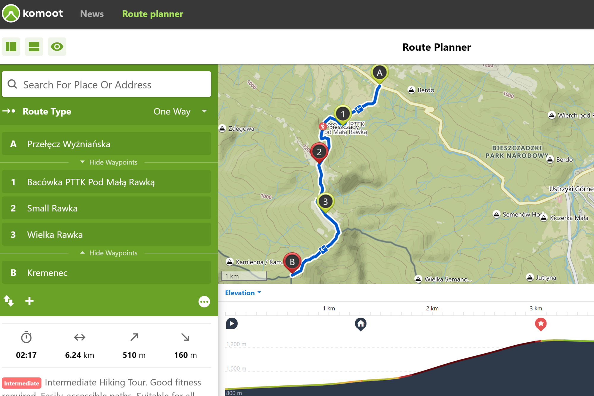
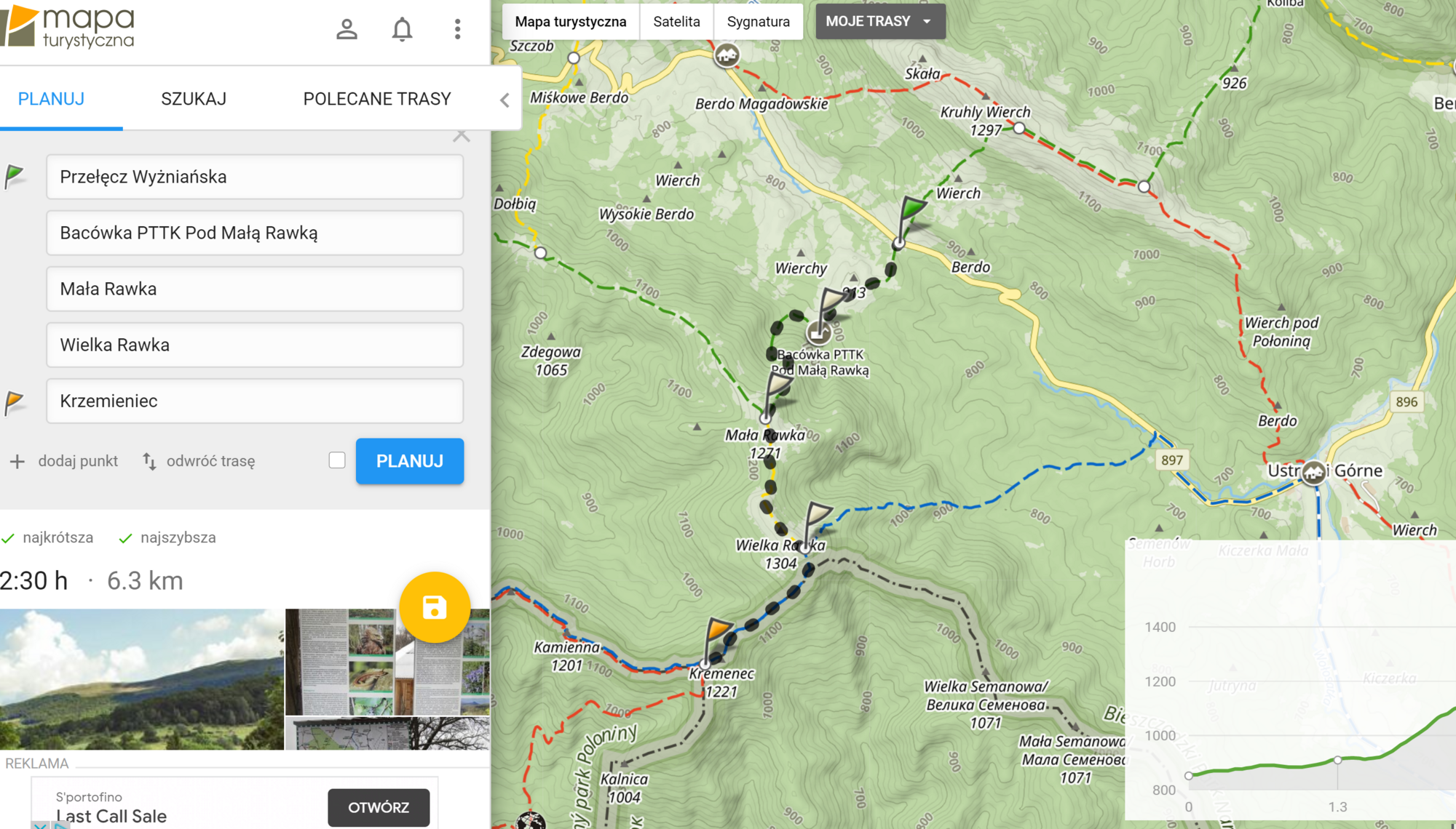
Okay, now that we have a mapped route, it’s time to import it into SA.
Below is the effect of importing a gpx file (saved in icloud) directly in SA (from the left: mapy.cz, komoot, mapa-tusrystyczna):
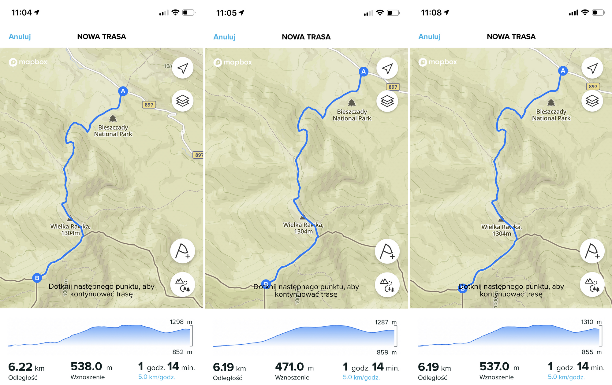
Now exactly the same files, but sent via QS (same order):
And finally a curiosity - summary of the distance/ascent from all three websites depending on the method of import (gpx file downloaded via web and uploaded directly or via QS):
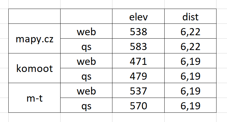
Conclusions:
- None of the services allows you to import routes with WP, whether directly or via QS
- Mapy.cz gpx imported by QS adds an infinite number of WP
- The same route has a similar distance but completely different ascent depending on the site
- The same gpx file has a different ascent depending on the import method (this is especially strange to me)
-
That’s a good report. I think it’s also mentioned in the api docs for suunto to get waypoints , they need to be inside the track, and with a valid lat,lon. No idea how services do that.
Imo suunto should improve this.
-
And just to add some context here. QS doesn’t touch anything from the file. It just does an API request.
Community Manager / Admin @Suunto
Creator of quantified-self.io a portal that allows you to analyze your data from various providers, upload fit activity files to Suunto app, gpx routes and more… -
@Dimitrios-Kanellopoulos said in Import GPX to SA with waypoints:
And just to add some context here. QS doesn’t touch anything from the file. It just does an API request.
QS is a great service, not to mention the presentation of data that is beyond the competition, but uploading gpx via QS is a bit faster and more convenient than uploading it to icloud and importing in SA (excluding the mapy.cz file of course).
It seems to me that there will always be some problems in various websites with route import with WP and the best solution is to simply allow editing of the route in SA. For me, the best service is mapy.cz because of its incredible accuracy, you can find the smallest forest paths there, and although the editor in SA is really comfortable, ergonomic and useful, the map layer in mapy.cz is simply better and I find planning routes more conveniently there. So I would like to import gpx from mapy.cz to SA (preferably via QS) and add points already in SA, which I can do, but only during import process, and if I decide to add WP then I have to start the whole process from the beginning.
However, what puzzles me the most are the differences in ascent when processing exactly the same gpx file. I understand that gpx from other services may have different values, but the same gpx uploaded by SA or by QS probably should not show a different ascent (each time the elev when using QS is greater than when uploading directly to SA). Strange. -
Approaching this non-scientifically, I took a look at a GPX, theoretically labelled with a few waypoints, exported by Mapy.cz, using different programs.
@kabzior Footnote/addition to Conclusion 2 (or maybe even its own number): “Mapy.cz does not export user-created waypoints in gpx routes.” Because what it exports are essentially tracks.
For starters, the points are “trkpt” not “rtept” and the GPX file doesn’t contain the names you might have chosen (i.e. selected from Mapy’s own offering as that’s the only way vs the default coordinates-as-labels) at all. (The KML does.)
@Dimitrios-Kanellopoulos I reckon you nailed it with
If they add a wpt (waypoint) for each dot sure.
Mapy.cz does name all the generated points with truncated versions of their coordinates. I guess it’s down to how the sites/programs choose to display labelled trackpoints in GPX imported as “routes”. E.g., Google Earth Pro considers that export to be a “track”. (The KML is a “route”)
While I like the appearance of Mapy.cz, I have to say it’s on them for not including the user-defined waypoint names, and not helpfully exporting the GPX as an unmistakeable route file. In their defence, they do sort of hint at a general limitation deep in the Help pages:
Another problem with the site is that only uses snap-to-road/-track. Great for the “the smallest forest paths”, useless for trackless areas.
-
@Fenr1r I dont understand why it’s so hard in the GPX world for companies / services to keep it consistent and “compatible”. I bet they have their reasons but I would be interested to know why.
Not that I know well, but it’s remarkable this variance.
Community Manager / Admin @Suunto
Creator of quantified-self.io a portal that allows you to analyze your data from various providers, upload fit activity files to Suunto app, gpx routes and more… -
@Fenr1r said in Import GPX to SA with waypoints:
Another problem with the site is that only uses snap-to-road/-track. Great for the “the smallest forest paths”, useless for trackless areas.
That is true, but this is where SA comes into play, their free-drawing is one of the best I have seen, easily beats komoot. And they use mapbox which is way better IMO than OSM (yes, I know mapbox is based on OSM), not as good as mapy.cz but still one of the best so far (not to mention Connect app with their google maps, that’s a joke). Mapy.cz with free- drawing like in SA would be ideal
TBH I do not know the first thing about gpx and that technology, what really confuses me is why I can not upload gpx from mapy.cz to SA via QS, while it works just fine when I upload the very same gpx directly in SA.
-
@Dimitrios-Kanellopoulos said in Import GPX to SA with waypoints:
I bet they have their reasons but I would be interested to know why.
Yeah. Me too. So many conjectures.
In the meantime, perhaps the GPX file’s versatility is also it’s curse: it can sorta be made to work even when it shouldn’t. It might be that, following the manufacturers’ proprietary format domination, things went a little bit too wild west.
-
@kabzior said in Import GPX to SA with waypoints:
None of the services allows you to import routes with WP, whether directly or via QS
from https://apizone.suunto.com/route-description :
Waypoints are generated from:
- wpt -elements that have same coordinates some rtept or trkpt -element.
- rtept and trkpt -elements that have name and/or type.
That “same coordinates” part is crucial here and that’s the reason why Suunto does not pick up waypoints from most gpx files. While there are probably few other sources for such GPX-es, I personally know only 2, and one of those is Suunto’s own Movescount.
The other is https://www.plotaroute.com/ . For a quick workaround you could load your GPX to Ploataroute and download it again, this creates GPX with wpt elements that are compatible with SA.
-
@margusl said in Import GPX to SA with waypoints:
The other is https://www.plotaroute.com/ . For a quick workaround you could load your GPX to Ploataroute and download it again, this creates GPX with wpt elements that are compatible with SA.
That is a valuable info, thanks for that.
So, here are my observations after playing with it for a little while:
- I found how to plot a route with WP (max 5 in free version), but did not find how to name/edit those points or any list of them. I must be blind
- One can export gpx in various forms: route and track, with WP as POI or Directions.
- I found that exporting as “route” does not work, neither with POI nor with Directions, both SA and QS are saying that file format is not recognized.
- When exporting as “track”:
a. with POI - WP are not imported neither with SA nor via QS
b. with Directions - WP are not imported with direct SA upload
c. with Directions - WP are imported when uploading via QS, but they are not editable in SA (and since I do not know how to edit them in website they are all just flags with description like “turn right”)
Definitely I must dig into that site since it has a huge potential
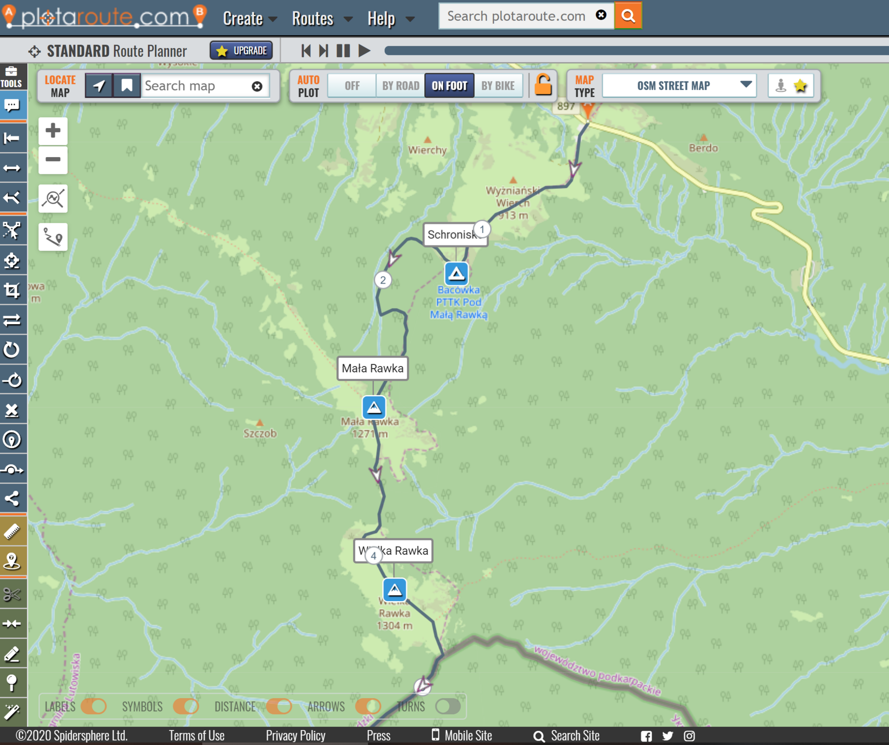
Before I figure it out I am sticking to mapy.cz / SA combo - I found how to plot a route with WP (max 5 in free version), but did not find how to name/edit those points or any list of them. I must be blind
-
@kabzior , you skipped all the tooltips in Plotaroute, didn’t you?
1 - look for “Directions”
2 - routes work just fine, as long as you use those with devices that can actually do routing. This is for cycling computers, handhelds and other turn-by-turn capable nav systems. Not for Suuntos.
4 - take a moment to read tooltips of those buttons. POIs are generated only from directions that you have labeled or added a symbol to.Besides, what I suggested was just loading an existing GPX with existing Waypoints/POIs to Plotaroute and then download it from there as track with POIs, should even work without creating an account. The track you get back is already altered and “fixed” for use with SA.
-
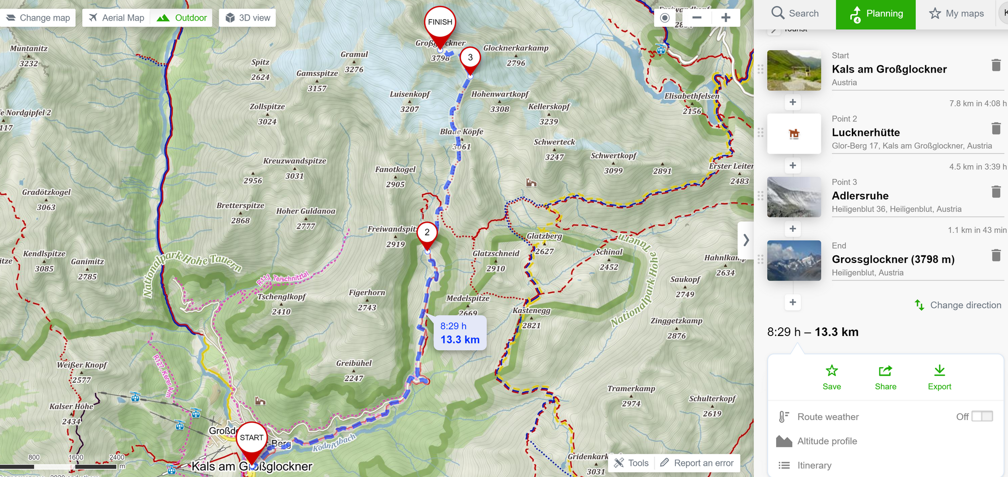
@margusl said in Import GPX to SA with waypoints:
you skipped all the tooltips in Plotaroute, didn’t you?
No… not all of them

But seriously, either I’m technologically disabled or using this site is more difficult than average. This is my route, and after importing into SA I get non-editable A-> B without any WP.