GPS altitude meter
-
@mrony Yesterday at work I take a break and look at my current altitude and decide to update it via GPS.
After few minutes the watch notify me it’s ok.
I was at -7m … I try it 3 or 4 times it vary -5m , -6m.I was close to the bigest river of France not under the sea level…
Like you 9baro. I really hope the next update will improve/correct this. -
@g287-sf i also do!! I‘ll Tell this Theme to Suunto!
-
@mrony
I need to mention something before this thread gets locked due to redundancy… if I climb summits that are between 2’500-3’500m I personally do not care about 10 or 20m. But maybe it’s just me?!Japanese cars by the way tend to show about 10% higher speeds.
living sideways
-
@freeheeler It’s clearly far from just you but I have uses for that accuracy. And, as it doesn’t increase my hiking weight by too much, better to have it and not need it than …
-
@fenr1r
true, I don’t fancy going over a cliff because of bad weather and wrong values. That’s why I also do not rely too much on the watch.
But the precision still is better than a compass, altimeter and a 50’000 map")
-
-
@freeheeler you’re right. But maybe some people need accurate gps for other thing than sport


 ️
️ -
@g287-sf
I think before we keep this discussion going we need samples from @MRony where we can see the graph and have some fix points to indicate the deviation in altitude.
Location is most of the times spot on with my watch.notice where I left the sidewalk and cut the corner? (counter clockwise direction).
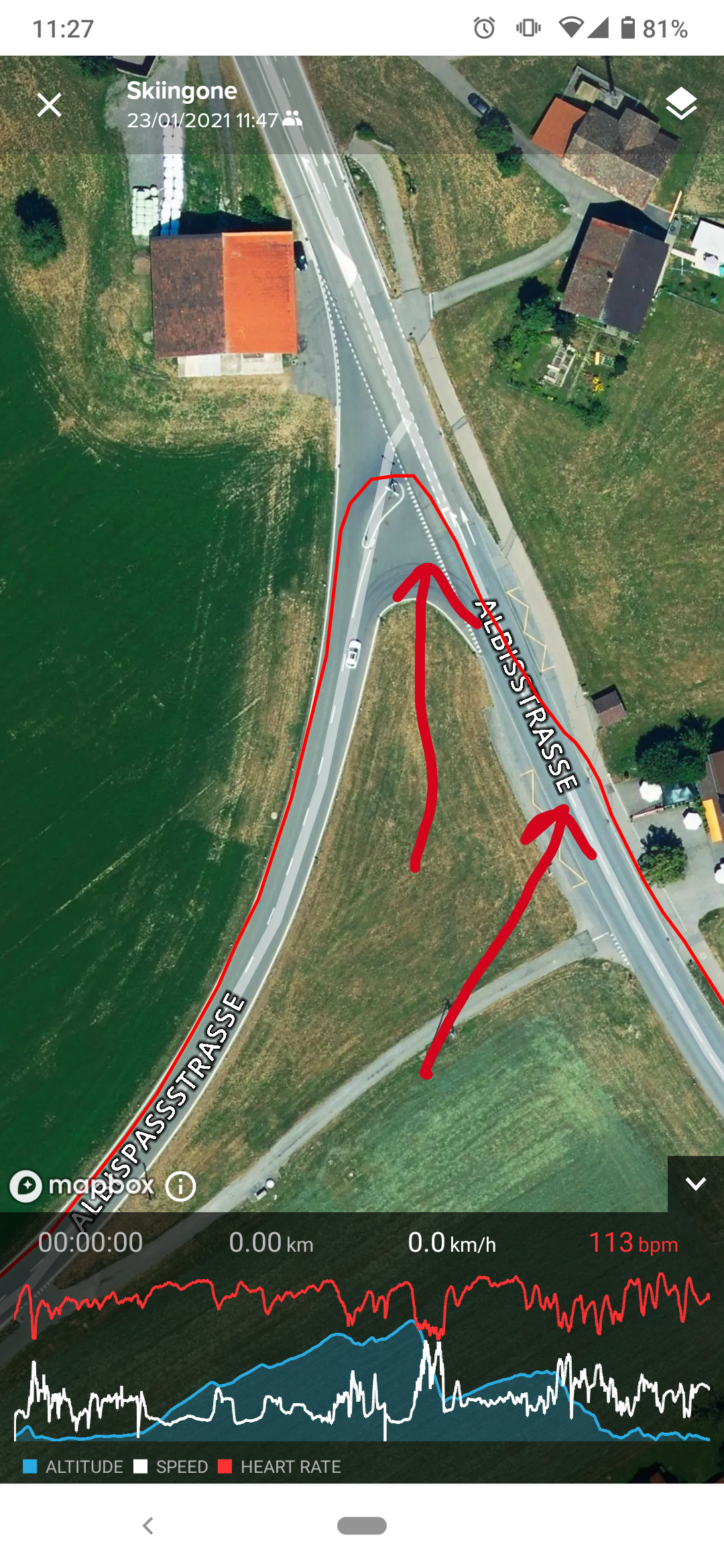
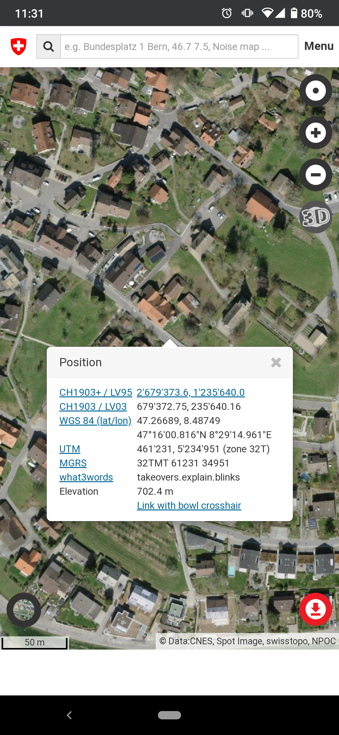
and altitude recorded e.g. at the highest point of the ride compared to what’s stored in swiss topo maps.
I think it’s close to top notch.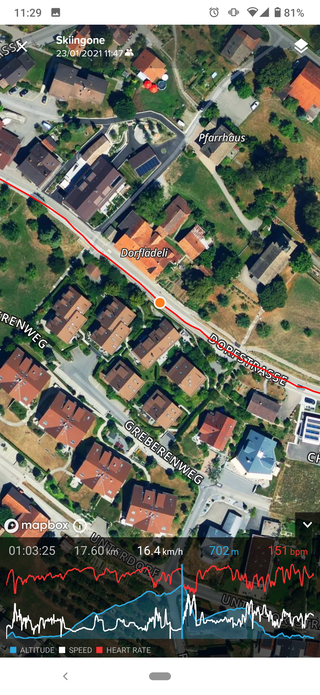
-
we need samples from @MRony where we can see the graph and have some fix points to indicate the deviation in altitude.
Preferably with simultaneous, co-located fixes from other devices with known generally superior accuracy.
-
@fenr1r
not everyone can pull an A3P out of his drawerliving sideways
-
@freeheeler said in GPS altitude meter:
not everyone can pull an A3P out of his drawer
Ha! Good point. (Altho’, as detailed elsewhere, my A3P [FusedAlti] was outclassed by an SSU [Baro only] in a comparison a while back. So it may not be at its best.)
However, as long as there is postal delivery and selfless dedication to the scientific method …
It occurs to me that there is a more definitive test: against another 9Baro of known, recently-demonstrated accuracy.
You can fall back in affection with your Airboss in the interim.
-
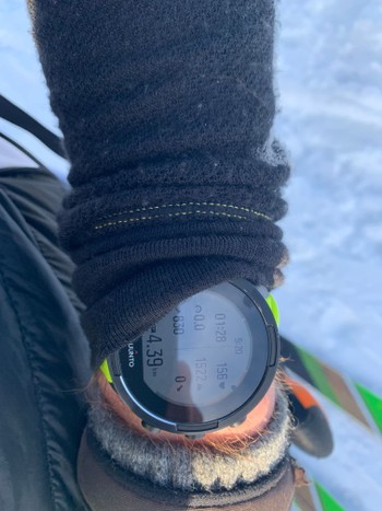
@freeheeler today i was a Tour, and the gps failed~ 100m! Photo i will load up in 3houers!
-
@mrony
let’s say, without knowing details, the altitude was wrong… not GPS failed. at least that’s what I understand from the context, it could be misleading.
I’m curious about your details.
living sideways
-
@fenr1r said in GPS altitude meter:
we need samples from @MRony where we can see the graph and have some fix points to indicate the deviation in altitude.
Preferably with simultaneous, co-located fixes from other devices with known generally superior accuracy.
All that is really needed is to get a fit file and compare corrections in Runalyze
-
@brad_olwin Will that tell you the GNSS reception conditions for the route or the corrections made for a notionally optimum route?
-
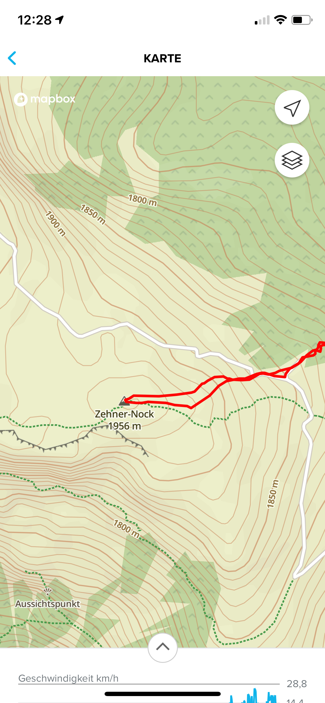
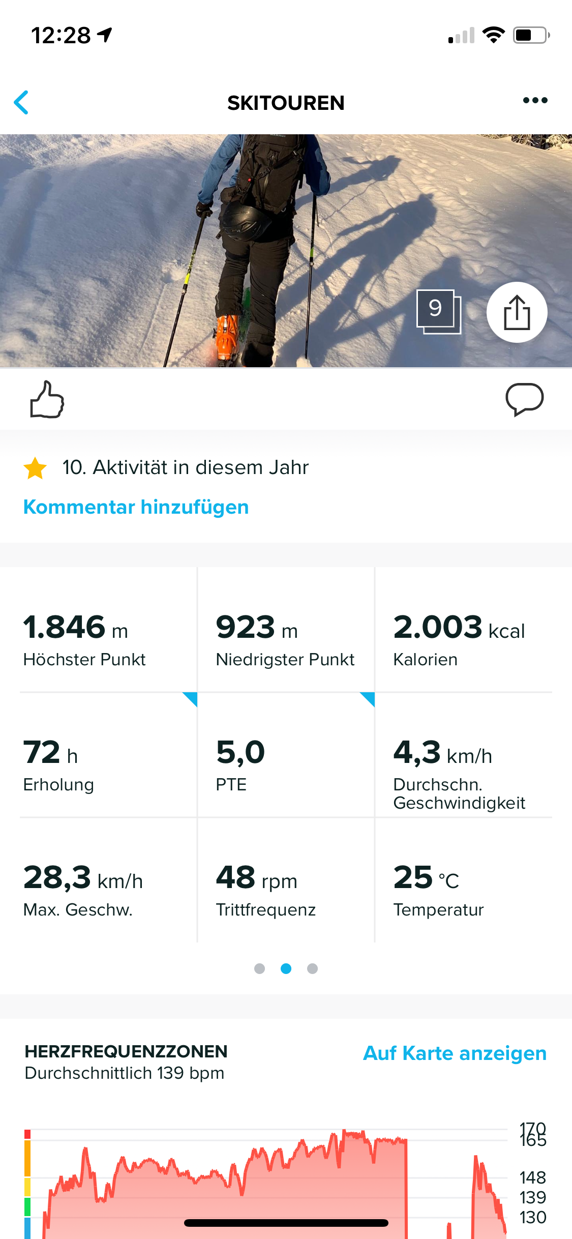
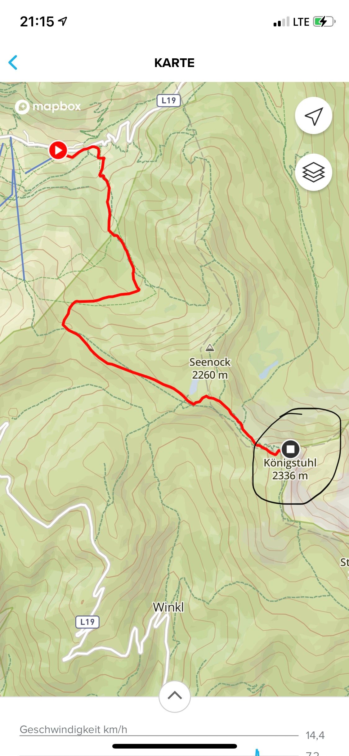
@freeheeler - Now I have attached the pictures
 --------------------------------------------
-
@freeheeler – one more
-
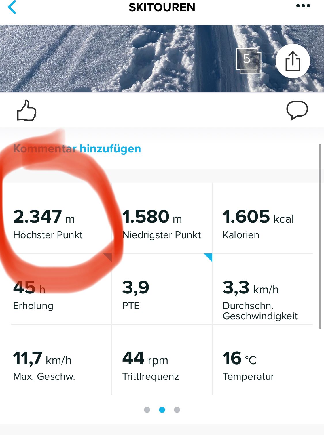
@mrony
PTE 5.0, are you running with your skis??
The pics are nice and the data, but it would be good if we could associate the info better.
@Brad_Olwin mentioned runalyze, but I don’t use that, hence, no idea about that one.
If you would upload to QS and share the link it would help to see if there are unregularities in the graph.living sideways
-
- is 14m too high
- 90m too low
- 11m too high
correct?
-
@freeheeler correct
