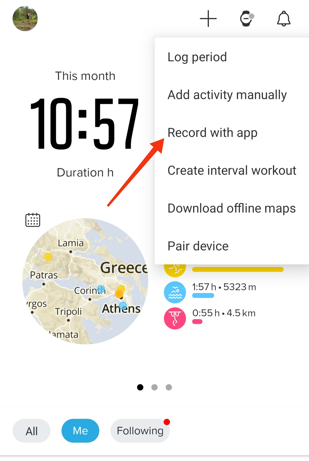
Live location S+ app
-
@michaeleaton being tested, I believe the OP will release it sooner rather than later
-
Released today
Watch: Suunto Vertical 2 Titanium Black
Blog: isazi's home
-
@isazi i use in the unknown areas record with SUUNTO APP (and with Vertical double record) for safer navigation (and is very useful bigger maps in smartphone etch…)
so the main difference with this third app?
By the way Kudos to the developerSuunto Vertical Ti
Suunto S9 gen1
Suunto Ambit3 peak -
Which developer toolkit do you have to use? Is it quite standard, with just Suunto libraries?
Which programming language is used? -
@brechtvb I use the Suunto app with my watch SV !
I start the activity record at the same time and at the end i delete from the application the record.
It’s a “patent” for viewing big maps an my trace in real time. -
@gerasimos
This third app is to share the GPS position from your watch, in live to “followers” or for emergencies. Watch GPS is very precise, with less battery consumption than phone GPS.
Phone will consume only data to share to “Internet” and you provide the unique link to people you want.
It is not made to record an activity. -
@Mff73 thanks for the info man! Very useful tool


-
Very cool. Thank you so much. I love that I can use it in airplane mode as well as a map extension. That will be great for help with maps while out in the wild. I know it will lose its “help” functions, but if I am out of cell phone range at least I will have maps with labels on them.
-
Hey everyone!
Sorry haven’t been here for months, absolutelly no time, hope you understanding!
That said, I’d really appreciate any feedback or issues you’ve encountered with the app. I can’t promise super quick replies, but I’ll be checking this thread.Suunto Race 2 Ti
Suunto Race
Suunto 9 BaroSuunto Aqua
Suunto Wings -
@brechtvb it’s developed with SuuntoPlus SDK which based on ES5
Suunto Race 2 Ti
Suunto Race
Suunto 9 BaroSuunto Aqua
Suunto Wings -
@Nikolai-Simonov Big congratulations !!! I was waiting for such feature for years ! Very good job !
Is it possible to parameter the frequency transmission ? Every 1s, 10s, 1min for example ?Suunto vertical solar
Coros arm HRM / Suunto wing 2
Android A55 Samsung
Suunto App latest official update -
@Nikolai-Simonov Thanks.
It works quite well, the configuration is not too complicated.
Two quick observations:
No easily visible link on the website/in the application to shere/view the location. Unless it is intentional at the initial stage of development so that the traffic and server load are not too high.Standard OSM maps are difficult to read in mountainous terrain.
-
@Nikolai-Simonov Thanx a lot, glad to hear it!
There’s a setting called “Continuous transmission” in the SuuntoPlus LiveTracking app.
- When it’s enabled, the watch sends a location update every second, even if the position hasn’t changed.
- When it’s disabled, it only sends data when the location changes which helps save battery. In addition, the battery mode (Performance / Endurance / Tour) set in your workout also affects GPS sampling frequency, so combining both gives you more control. e.g. you can reduce updates to roughly once per minute in low-power modes.
-
@Nikolai-Simonov congrats for that app that we were waiting for for a long time !
I’ll test properly soon I hope.
Just to let us know : have you already an idea of battery consumption impact on watch and on phone ?Suunto’s devices at home :
Vertical titanium solar
Suunto Race S
S9pp titanium sand
Suunto Wing & Spark
S9B titanium Ambassador edition, A3P, X6 -
@Antoine Thanx for feedback!
The idea was that the person going for a run shares the link themselves (via QR code or directly from the app). But I agree it would definitely be helpful to have a more convenient way to access and share the link from the website as well. That’s something I’d like to improve soon.
As for the map style 100% agree. The default OSM tiles aren’t ideal for mountainous or outdoor terrain. We tried using some paid services with better topographic layers, but they became too expensive once we had more than one active user
 . So right now I’m looking for topographic data, that we’ll hosted by ourselves.
Suunto Race 2 Ti
Suunto Race
Suunto 9 BaroSuunto Aqua
Suunto Wings -
@Tieutieu Thanx a lot!
Regarding battery consumption, I haven’t done precise measurements yet, so I can’t give exact numbers. But based on real-world use, the impact seems relatively low, actually lower than I initially expected.
e.g, with my 3y.o. phone (which already has some battery degradation), I managed around 4-5 hours of continuous tracking and battery still had some capacity. I seen some testers have reported up to 6 hours tracks.
That said, it would definitely be interesting to measure this more accurately.
-
@Nikolai-Simonov thanks !
Another question : I have read I can launch tracking during exercice.
What if I stop it or if phone loose connection to network ?
Does it need to be launched again in both cases ?
And so I guess it generates another link for tracking ? -
@Nikolai-Simonov hello
first of all thank you for the application.
i have completed the first short tests.
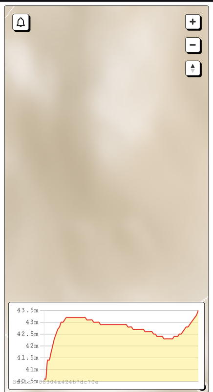
the application works very stable. only the altimeter between the watch and the application can be 3-4 m different.
the application can add a go to location feature on maps. (suggestion like Apple find)
as a more advanced level, it can be added as a widget and send the location every 10-15 minutes, not only during the event. (suggestion)
it also takes values such as temperature, I think these can be added to the page.
thanks for your efforthistory:
Suunto Vertical 2 titanium Black (new:) )
suunto vertical solar titanium
suunto 9 baro
suunto ambit 3
suunto ambit 2
Suunto Smart Heart Rate Beltsuunto App: apple iphone 14
-
Hi, I have been waiting for this function for a really long time, thank you for your commitment. Unfortunately, it doesn’t work for me. iPhone 15 Pro Max and Suunto Ocean…
Device ID Not foundhttps://photos.app.goo.gl/HQVQi9ZVvSMiRUn38
What could I do wrong?
-
Hi @Sascha-Domres From what I can see in the screenshot, it looks like there’s no location data received yet. The live session actually becomes available only after the first location point is sent.
Try starting the workout and wait until the watch gets a GPS signal once that happens, the session should go live and become visible in the web.
Hello! It looks like you're interested in this conversation, but you don't have an account yet.
Getting fed up of having to scroll through the same posts each visit? When you register for an account, you'll always come back to exactly where you were before, and choose to be notified of new replies (either via email, or push notification). You'll also be able to save bookmarks and upvote posts to show your appreciation to other community members.
With your input, this post could be even better 💗
Register Login