Map Rendering and Trail Visibility after Software Update 2.43.8/.12
-
@Milan-Šádek said in Map Rendering and Trail Visibility after Software Update 2.43.8/.12:
@sky-runner at least for Vertical you can choose 25, 50, 100, 200, 500 m and 1, 2, 5, 10 an 20 km. I find 25 m very handy e.g. while geacaching.
The same for the Race and Race S, and 25m zoom is useful for me in case of consecutive forks and/or complex terrain topology. Actually, trails visibility is often challenging, unless you are following a route, since they are way thicker!
-
@Milan-Šádek said in Map Rendering and Trail Visibility after Software Update 2.43.8/.12:
@sky-runner at least for Vertical you can choose 25, 50, 100, 200, 500 m and 1, 2, 5, 10 an 20 km. I find 25 m very handy e.g. while geacaching.
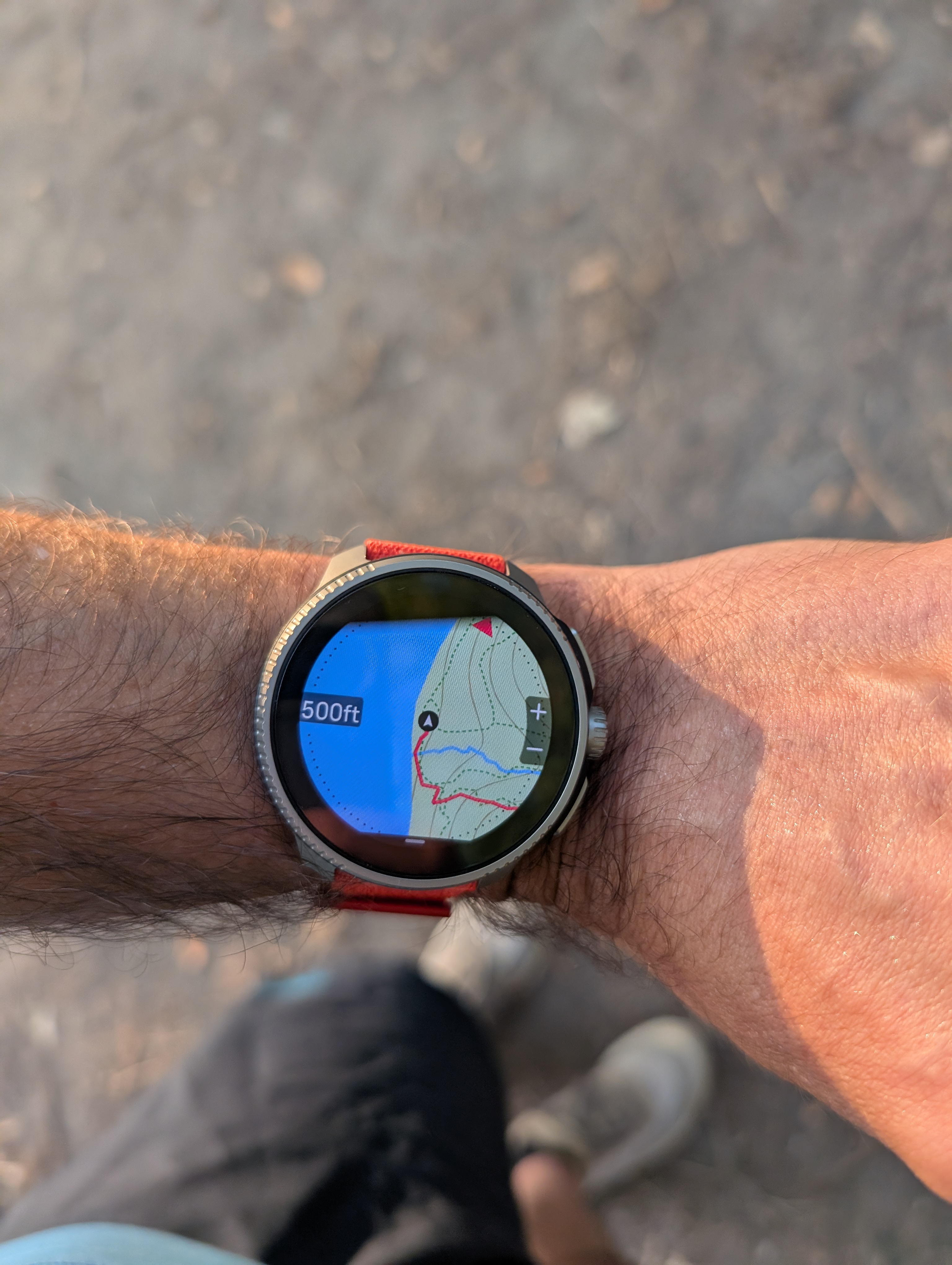
Yes, but the point is that trails are visible only at 25, 50, 100, and 200m zoom levels. At 200m zoom level, how long does it take to cover the map from the center of the screen to the edge at a running pace - 1 minute at a moderately fast pace? That means there is no way to plan ahead unless you are constantly looking at the map. Now imagine that you’ve planned a route and are following it, then you run into a closed trail. This has happened to me more than once. What are you going to do? Zoom out? Trails disappear. So there is no way to see around further than about 1 minute of running or 2 minutes of fast walking. And if you try to pan the map with your sweaty fingers, that is even worse, because the display is impossible to see after that.
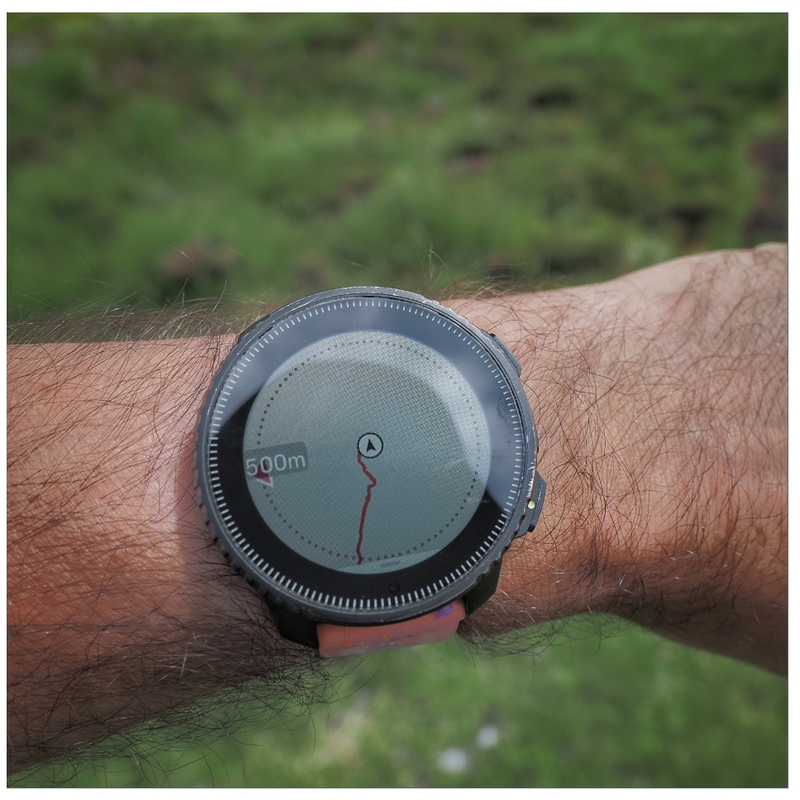
And, as I mentioned above, it is even worse when using imperial units because the last zoom level that shows trails is 500 ft = 152 meters. That doesn’t cover even 1 minute at a running pace. That is ridiculous!
I looked a video review of Coros Nomad. Despite a low display resolution and a small screen size, they manage to show trails in a perfectly legible way at zoom levels that cover much more area. And Coros renders trails in a fairly thick black dashed line that is easy to see unlike Suunto that renders trails with dark green color that is often on bright green background, which makes trails nearly invisible at 500 ft zoom level.
I am not buying another Suunto watch until this is resolved. Good map rendering is a must have feature for me, and the current version is nearly useless - not much better than simple breadcrumbs. I have actually already missed turns a few times because of the poor trail rendering.
-
For me, having the paths visible on a larger view of the terrain was very useful.
One quick glance at the watch screen and you could immediately see if a side path that looked more interesting or safer connected to the previously planned route.
Now you have to pull out your phone and only then check it.
The complete opposite of the idea of a watch with maps.

-
@maszop said in Map Rendering and Trail Visibility after Software Update 2.43.8/.12:
One quick glance at the watch screen and you could immediately see if a side path that looked more interesting or safer connected to the previously planned route.
Now you have to pull out your phone and only then check it.
The complete opposite of the idea of a watch with maps.Fully agree. And this applies not only to trails but also to creeks that we can see on your map at 500m. Now that is no longer possible too. Creeks are very important as water sources when doing longer trail adventures - trail runs and fastpacking hikes.
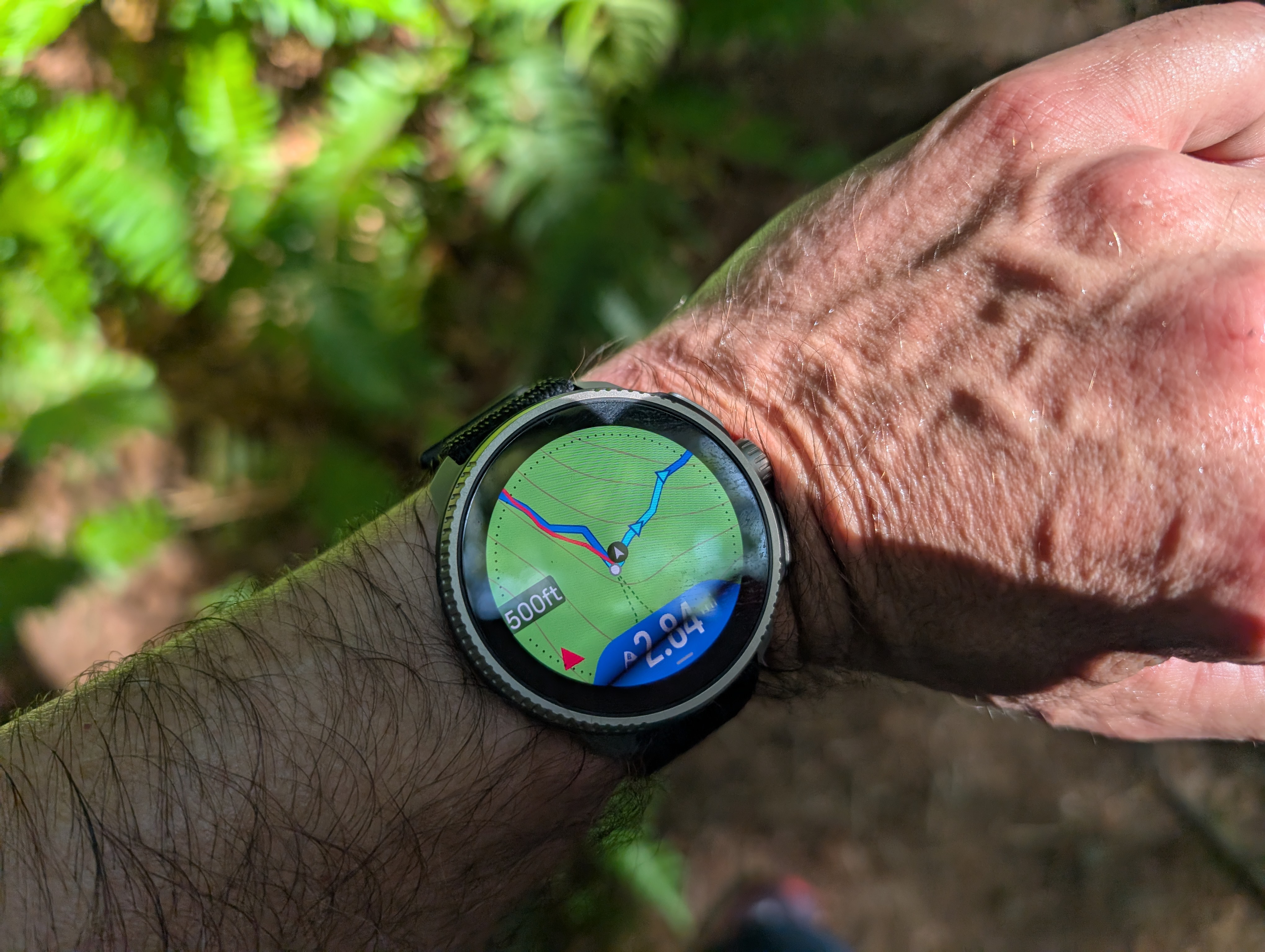
Here I was actually trying to figure out whether my route crossed the creek ahead of me. The trail goes not too far from a fairly large creek that I could hear, but it is displayed only at lower zoom levels:
For me, this map is pointless and not much better than what I had with Ambit3 a decade ago. What is even the point of a faster MCU and a larger, higher resolution display in Race 2, if the map rendering is so primitive?
-
I know I am beating a dead horse, but since we haven’t heard of any plans to address this issue, I am going to remind of it from time to time.
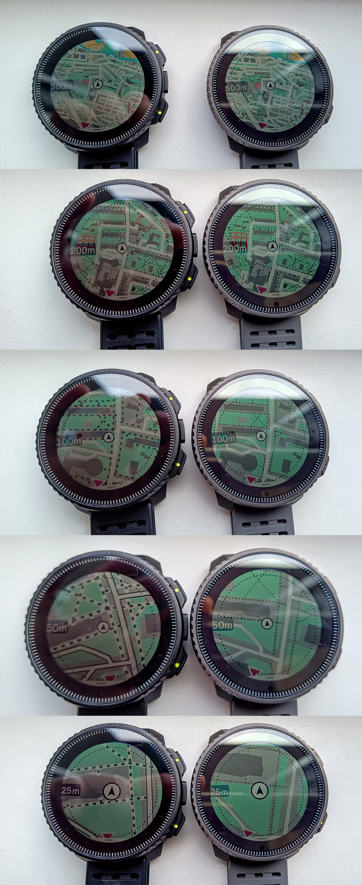
My concern is not only that trails disappear way too early when zooming out, but also that when trails are still visible, the choice of low contrast colors and low width makes it difficult to see trails, especially when running (the arm not steady) or when there are reflections on the sapphire screen, or when the screen is smudged with sweat. Even at scales of 500ft in imperial units or 200m in metric, while trails are still visible, personally I have a hard time seeing them on the map.
Consider the following pictures showing different map themes and imagine keeping the watch away from eyes and just briefly glancing at the map:
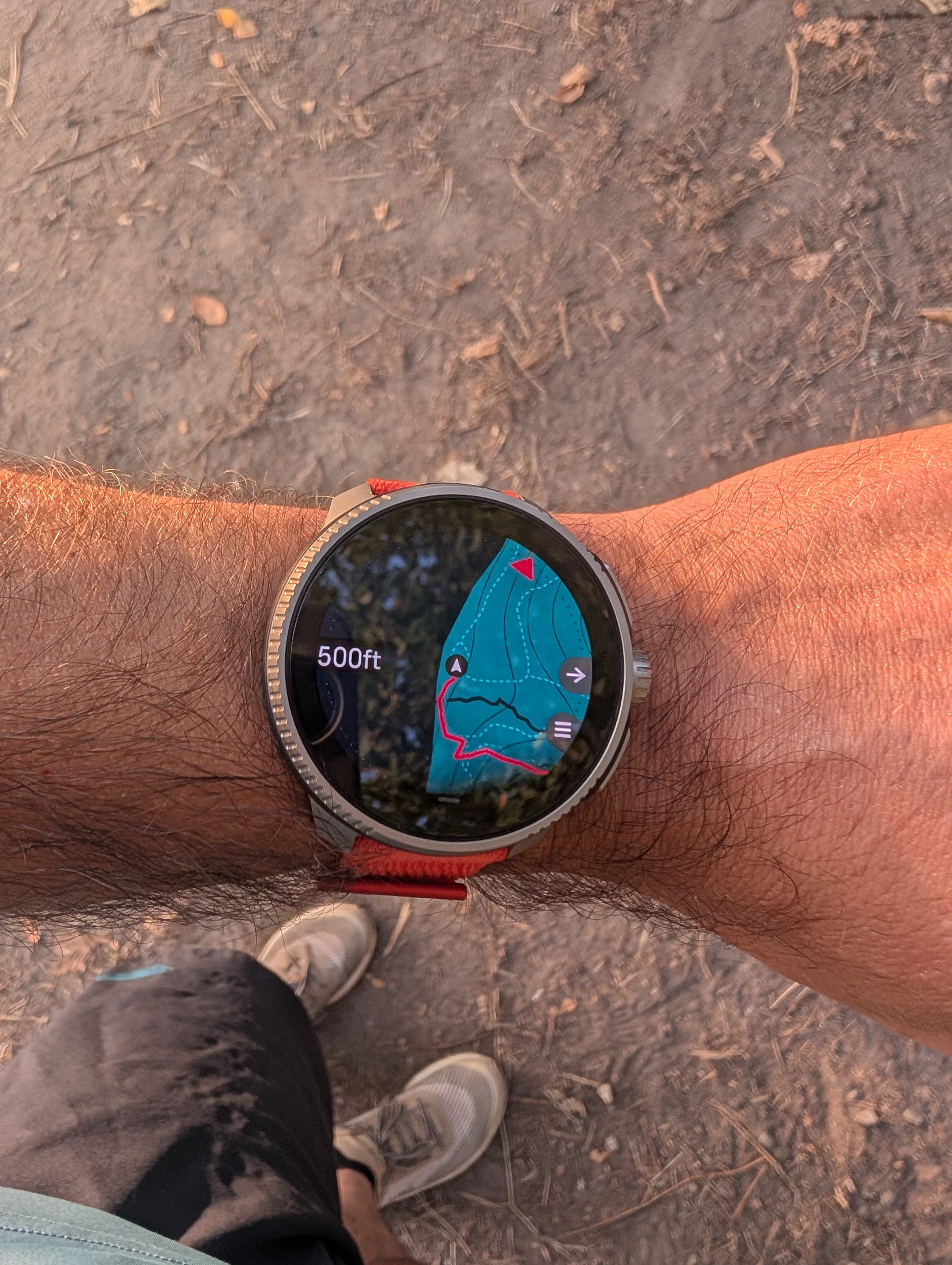
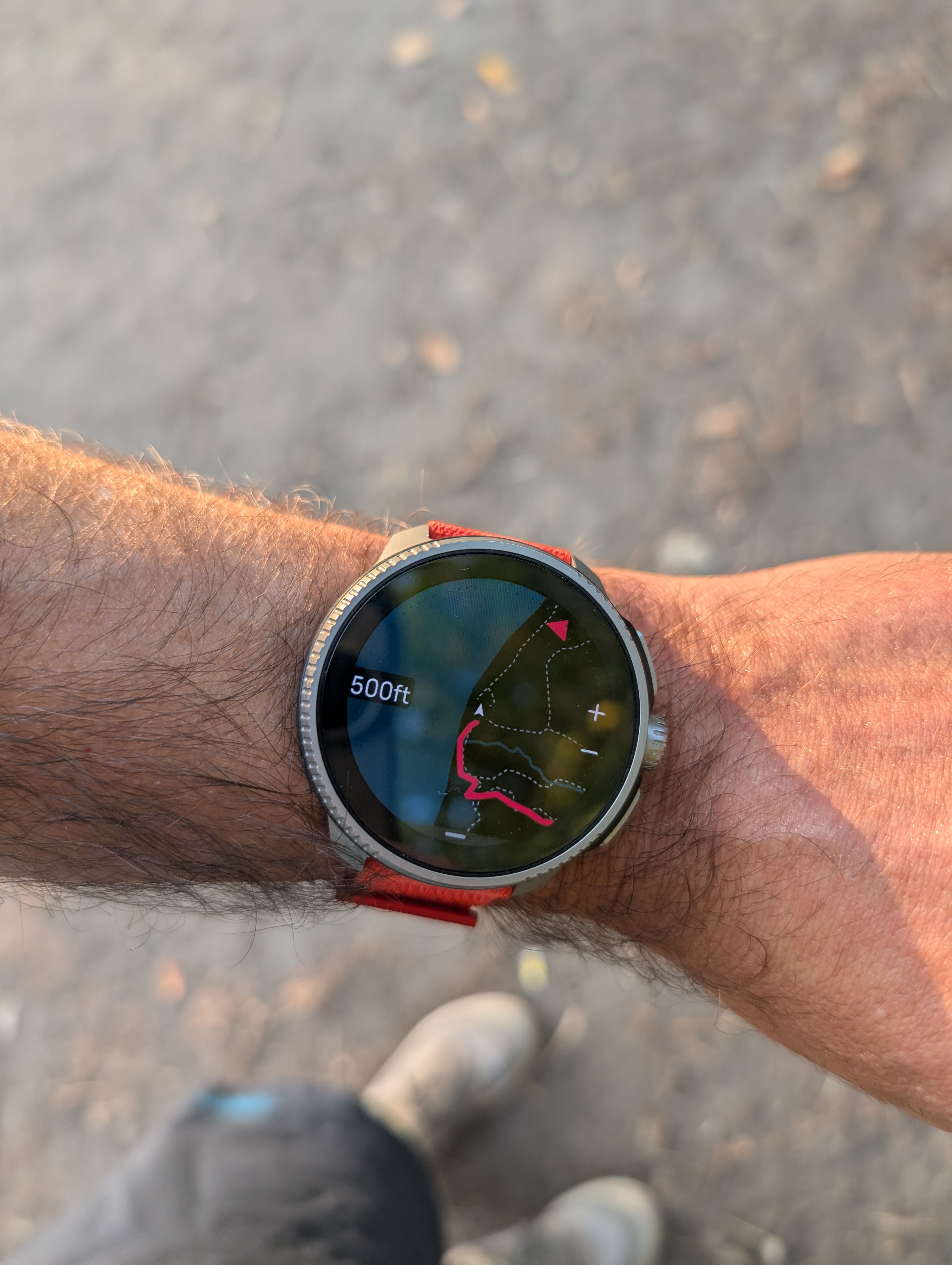
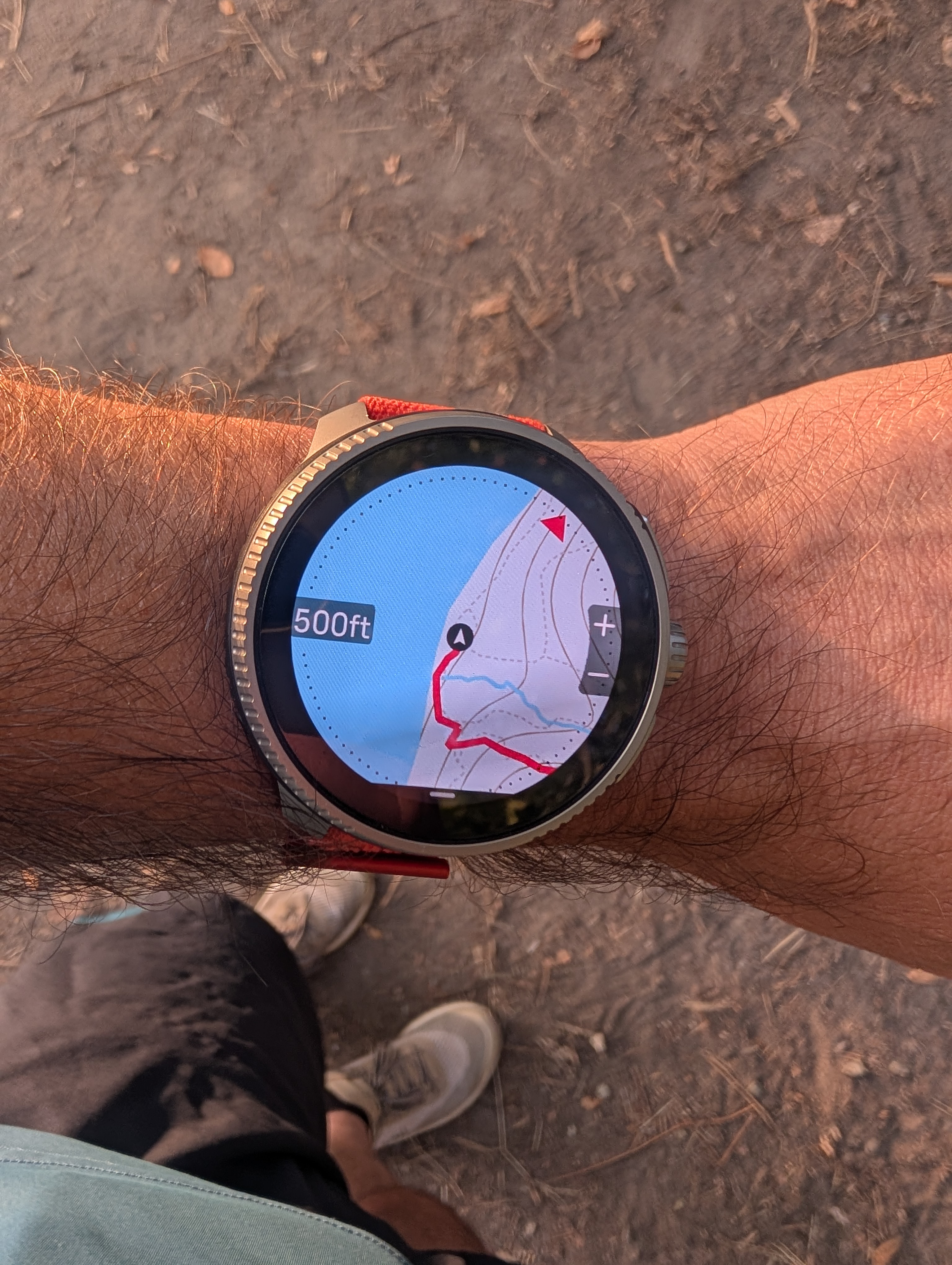
Only the high contrast map theme is somewhat useful, but even in that mode there’s way more contrast when displaying elements of the UI (e.g. + and - signs for zooming) then when displaying elements of the map. In my opinion, even the high contrast map is not high contrast enough.
-
@duffman19 said in Map Rendering and Trail Visibility after Software Update 2.43.8/.12:
I agree that it would be nice to have a better distinction between foot trails and sidewalks. The issue, however, is that OpenStreetMap data is behind all of this. And OSM is basically Wikipedia for maps, but with far less oversight. And there are many different ways to tag a simple path (path, footpath, sidewalk, cycle path, bridle path…) and then hundreds of different sub-tags for each of those designations (surface, access, direction of travel, structures, incline, smoothness, stroller access, and on and on and on…).
Nevertheless, Suunto does actually know the difference between trails and other paths. Here is a screenshot of Suunto App in winter mode when zoomed out - as you can see it still shows trails but no longer shows sidewalks:
This actually looks very clean and useful. I wish a similar rendering was available on a watch. -
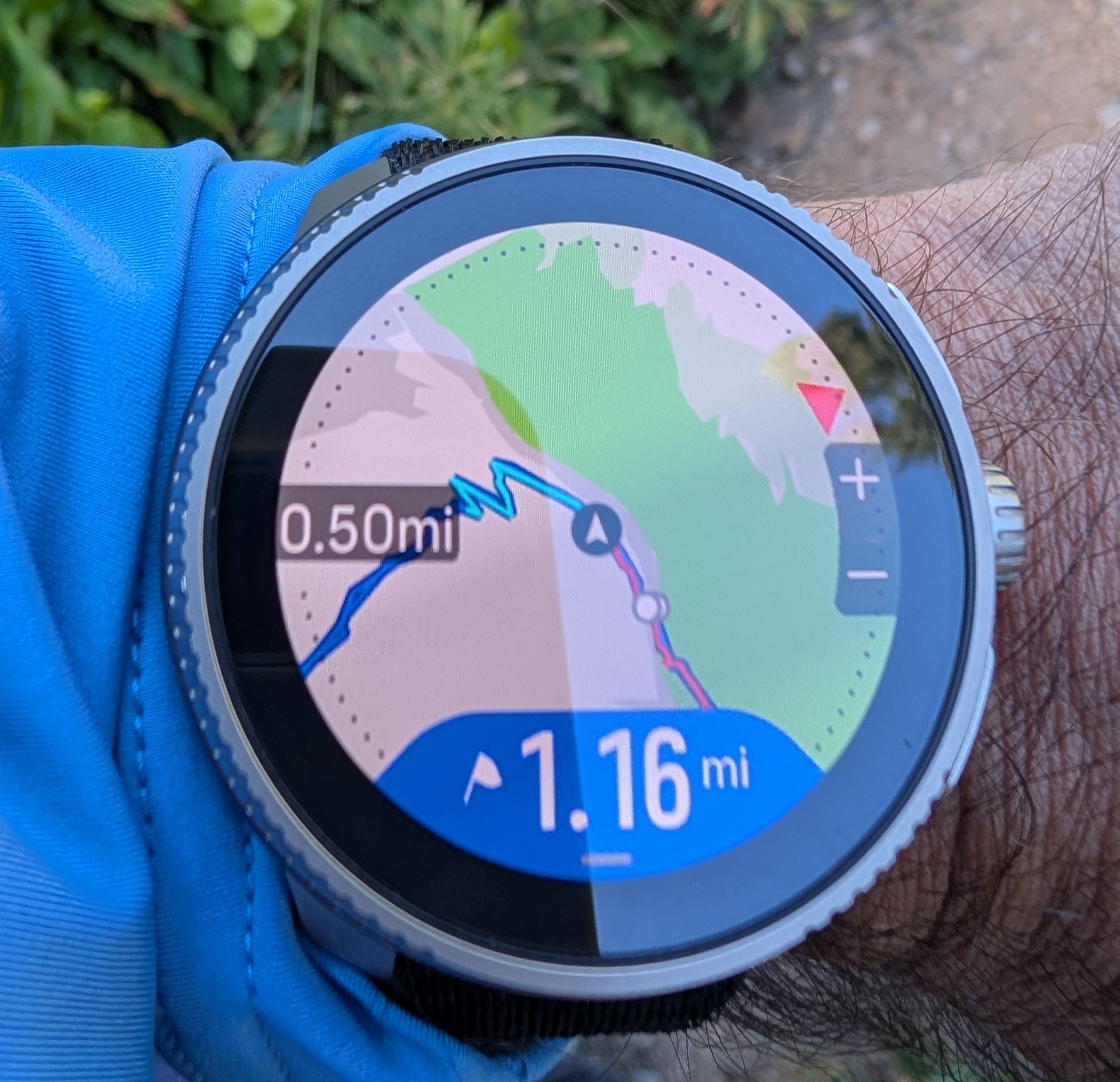
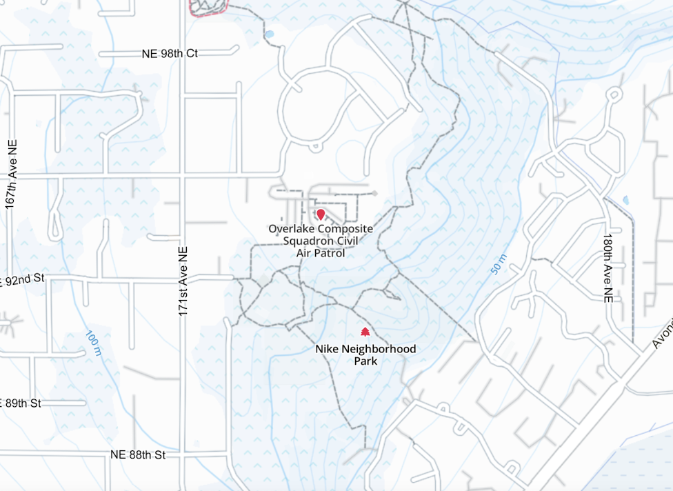
I thought this would be a great illustration of how limited Suunto maps are after the update.
This is a random picture of Garmin Fenix from internet showing some trail network with Map level of details set to medium.The green circle shows how far we would be able to see trails if this was a Suunto watch. The radius of the circle is roughly 500 ft = 0.09 mi
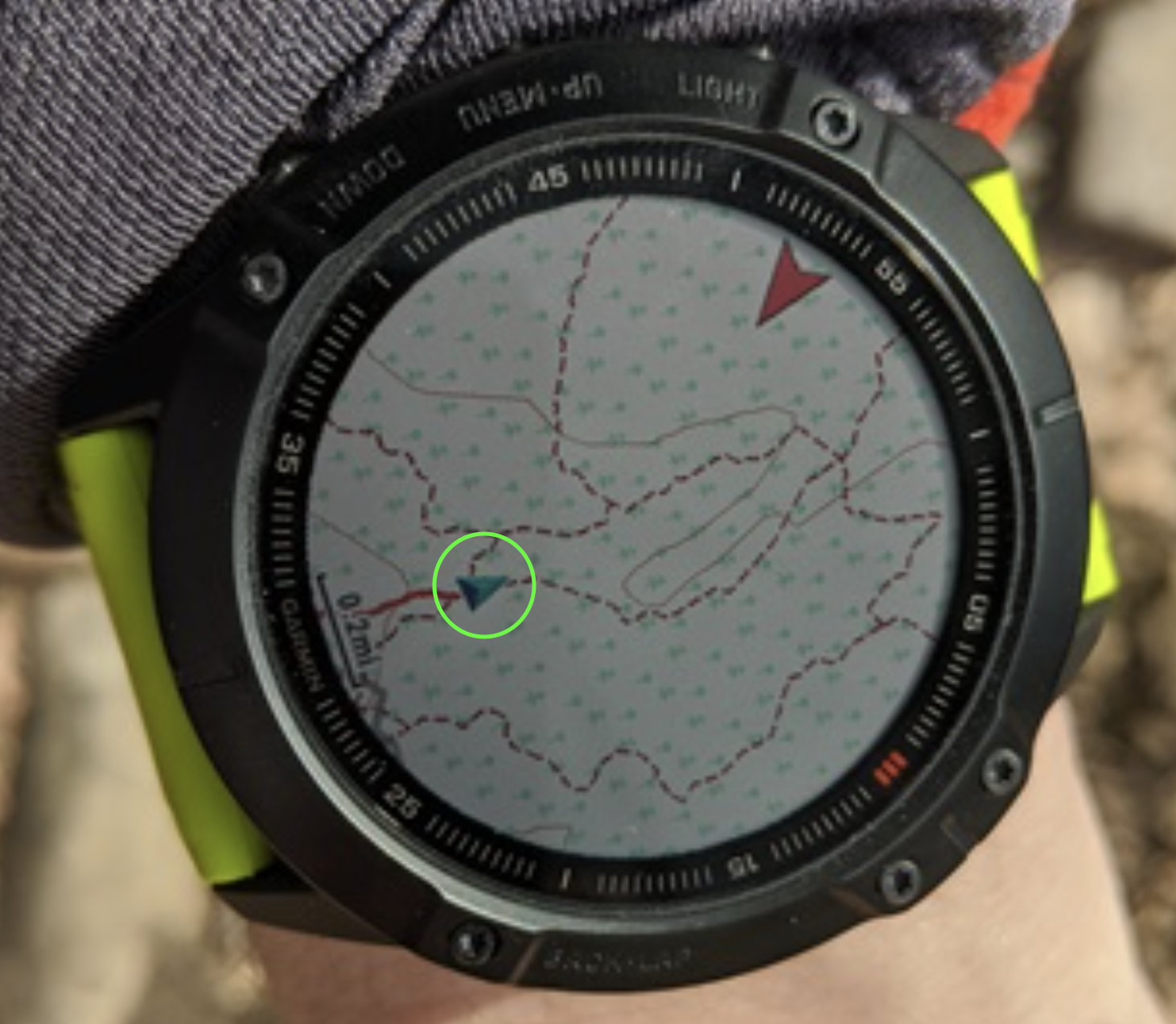
Keep in mind that Fenix can show trails even further when the map level of details is switched to High. As much as I dislike many things about Garmin, I might have to switch back if this issue isn’t fixed soon.
-
@sky-runner I think your calculations are false, the radius of the map shown is around 0,6 miles…
-
@soisan Yes, the radius of the map on this Garmin watch is about 0.5-0.6 miles. In fact, it is more when looking forward because the current position pointer is off center. But the radius of the small green circle that I overlayed on the picture is about 500 ft, and that is the maximum radius of the map on a Suunto watch where trails are still rendered. If you zoom out more, trails are gone. This was meant to show how useless Suunto map is for navigation on trails in comparison to Garmin. Without having a preplanned route, it is nearly useless.
-
@sky-runner Well, it seems there are differences between the maps of various countries. Where I live, trails are visible up to a radius of 500m (0,3 miles).
-
@soisan Are you sure those are trails and not dirt roads? Dirt roads are visible at one level beyond trails. In the USA, when the watch is configured in imperial units, trails are visible up to 500 ft (150m) and dirt roads up to 0.2mi (320m).
But I think even 500m is insufficient. Up until a few months ago I could still see trails at 0.5mi zoom level (800m). And I thought even that was insufficient.