Suunto Routeplanner
-
@kemetter
 Sounds Great!
 -
@kemetter said in Suunto Routeplanner:
This should match Suunto app quite well, but some GPX files have quite odd content. I would need the original GPX file in question to be able to resolve this.
Waypoints should load if GPX is exported from Suunto app, but from other sites it’s not a standard how they mark user named waypoints.
Here is one example, which I think I created this in Strava:
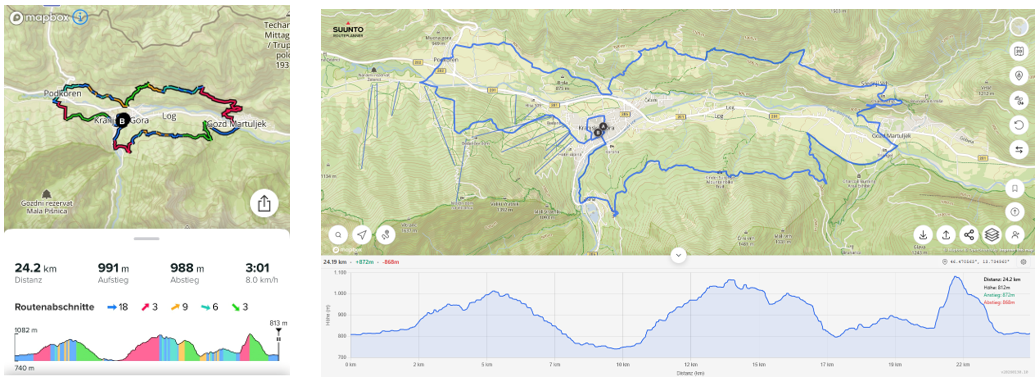
Issy Alps 50k.gpxWhen I load this in Suunto App it shows all waypoints and the distance is 50 km:
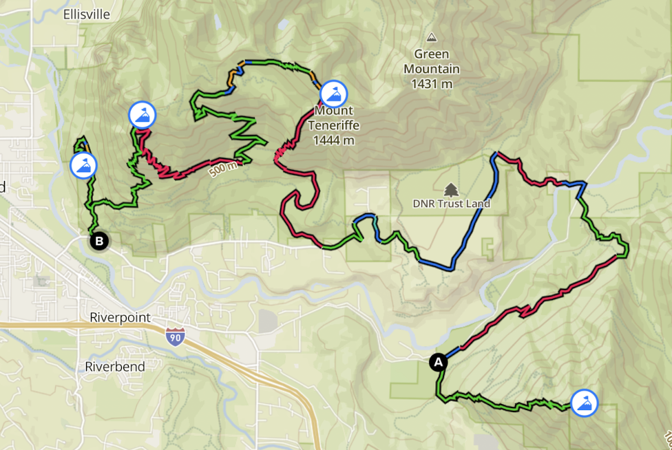
When I load the same GPX file in the routeplanner, no waypoints are shown and the distance is 42 km:
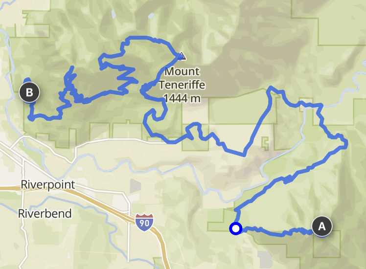
It may not be obvious by looking at the screenshots but the missing parts are from the start to the first waypoint and from the last waypoint to the finish. Basically, the route now starts at the top of the first mountain and ends at the top of the last mountain.
I’ve had similar issues with a few more GPX routes.Also, I should mention that on-route waypoints can also be present in routes that are saved as FIT files. Those can be generated by some route planners such as PlotARoute and are natively supported by Garmin. It would be great if the route planner could load routes in the FIT format too. Also, routes in FIT format can embed turn directions, and some route editors (e.g. PlotARoute) can create those too. It would be awesome is Suunto followed the same standard.
-
P pavel.samokha referenced this topic on
-
@sky-runner said in Suunto Routeplanner:
@kemetter said in Suunto Routeplanner:
This should match Suunto app quite well, but some GPX files have quite odd content. I would need the original GPX file in question to be able to resolve this.
Waypoints should load if GPX is exported from Suunto app, but from other sites it’s not a standard how they mark user named waypoints.
Here is one example, which I think I created this in Strava:
Issy Alps 50k.gpxWhen I load this in Suunto App it shows all waypoints and the distance is 50 km:
When I load the same GPX file in the routeplanner, no waypoints are shown and the distance is 42 km:
It may not be obvious by looking at the screenshots but the missing parts are from the start to the first waypoint and from the last waypoint to the finish. Basically, the route now starts at the top of the first mountain and ends at the top of the last mountain.
I’ve had similar issues with a few more GPX routes.Also, I should mention that on-route waypoints can also be present in routes that are saved as FIT files. Those can be generated by some route planners such as PlotARoute and are natively supported by Garmin. It would be great if the route planner could load routes in the FIT format too. Also, routes in FIT format can embed turn directions, and some route editors (e.g. PlotARoute) can create those too. It would be awesome is Suunto followed the same standard.
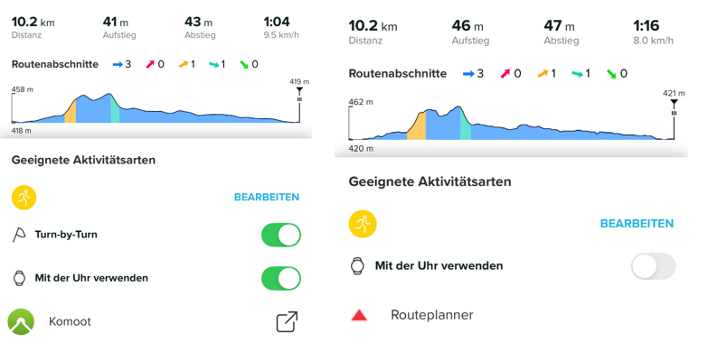
I fixed a bug with GPX loading and that file should load better now. Still some uncertainty about the user waypoints, it seems to load two of them but there apparently should exist four. I will look into that.
Regarding FIT files Routeplanner supports loading them but as they are usually made from exercise logs, there is no turn-by-turn or waypoint support when loading FIT files.
-
@kemetter many thanks for maintaining and developing this great tool.
Sadly, the area I frequent the most (Dolomites, Italy) have a poor rendering quality, frequently distorted by artefacts that cause the maps to be sometimes completely unreliable
(e.g. https://forum.suunto.com/topic/10992/artefacts-on-maps?_=1770025858529) -
@kemetter
I am very happy with the new Route Planner. It’s much more comfortable to plan routes on a PC compared to using the app, and the direct upload to Suunto is really useful. Thanks Suunto for that WebApp!I have a few feature requests that would be great to see:
Reset Button: An option to clear the currently planned route and start fresh on an empty map.
Estimated Time of Arrival (ETA) based on Pace: The ability to input a target pace to get a time estimation for the planned route. It would be great to see how long a route will take based on my expected speed directly in the planner. This is crucial for planning nutrition and logistics for long trail runs.
Turn-by-Turn (TbT) Navigation Toggle: Currently, I can’t enable or disable TbT navigation in the Suunto App for routes imported via the Web Route Planner (though it works for Komoot imports). It would be great if Suunto supported this option natively within their own ecosystem.
Colored Map Layers (Ascents/Descents): It would be helpful to have a toggle in the Web App to show colored segments for ascents/descents on the route and elevation profile, just like in the mobile app.
Garmin Vivoactive 5 | Garmin Epix | Garmin Fenix 8 | Suunto Race S | Suunto Race 2 | Suunto Vertical 2 | Coros Pace Pro
-
@tuxbuster TbT:
I just tested this. When I open the route that was synced to my Suunto account in the app, I can then toggle TbT on or off. I am on iOS.
So this one works well. -
@Egika You’re right. I tested it again: If I draw a route from scratch in the Web Route Planner and upload it to Suunto, I can enable TbT. BUT: If I open an existing GPX file in the Route Planner and then upload it to Suunto, the option for TbT in the Suunto App is missing.
-
@tuxbuster I think the reason is, that existing GPX files do not necessarily match to existing paths or roads. There is just no data basis on which any tool can decide where a turn is a turn.
To introduce turns, the app need to know if a road forks or has an intersection - this information cannot be applied to external gpx tracks that probably don’t stick to roads in the first place.I hope you can understand what I mean…
t6, S6, Elementum Terra, Ambit 3 Sapphire, Spartan Ultra Copper, Traverse Alpha, S7 Graphite LE, S9B Ambassador, S9P Titanium, S9PP Titanium, Vertical All Black, Race Titanium Charcoal, Race S Titanium Courtney, Run Lime, Race 2, Vertical 2 Titanium
-
@Egika I see what you mean. The imported GPX is treated more like a static overlay rather than a natively planned route. For TbT to work, the Route Planner would need to ‘snap’ the GPX to the map and recalculate the path based on the map data upon saving. This is the only way the system can generate the necessary turn instructions.
-
The turn-by-turn guidance is not a standard in GPX files and Suunto uses a specific way of storing “turn-by-turn guidance waypoints” into the file. Other route planners may use a different way to store them. Thus it’s working between Routeplanner and Suunto app as they are using same way to mark them, but third party GPX files use different syntax or none. Recreating tbt into a GPX file that does not have it is not trivial as it requires rerouting the complete route. It can be done, but getting good quality tbt is really challenging.
-
@kemetter said in Suunto Routeplanner:
The turn-by-turn guidance is not a standard in GPX files
Not standard in GPX files but there is a Garmin standard for route FIT files. Perhaps Suunto could adopt that.
Basically, turn directions are stored as route waypoints with special waypoint codes.
Some route editors like PlotARoute are capable of inserting turn direction and saving the route as a FIT file, and that works correctly with Garmin watches.Suunto: Ambit, Ambit 3 Peak, 9 Baro, Race S, Race Ti, Vertical 2 Ti
Garmin: Forerunner 210, Forerunner 610, Fenix 6X, Fenix 7X Ti -
@sky-runner The problem is that GPX is an open standard. FIT is a proprietary format that Garmin currently allows others to use.
-
@Egika said in Suunto Routeplanner:
@tuxbuster I think the reason is, that existing GPX files do not necessarily match to existing paths or roads. There is just no data basis on which any tool can decide where a turn is a turn.
Komoot kan add tbt notifications if you upload a gpx to their app (and sync it to suunto). The garmin connect can also do it. But you cannot sync that to suunto (nor does garmin a particular good job. You get tbt alerts that are just bends in the road)
-
@elbee said in Suunto Routeplanner:
@Egika said in Suunto Routeplanner:
@tuxbuster I think the reason is, that existing GPX files do not necessarily match to existing paths or roads. There is just no data basis on which any tool can decide where a turn is a turn.
Komoot kan add tbt notifications if you upload a gpx to their app (and sync it to suunto). The garmin connect can also do it. But you cannot sync that to suunto (nor does garmin a particular good job. You get tbt alerts that are just bends in the road)
Like said, it can be done but quality will most likely be bad, meaning you will get either too many or too few turn instructions.
-
@sky-runner said in Suunto Routeplanner:
@kemetter said in Suunto Routeplanner:
The turn-by-turn guidance is not a standard in GPX files
Not standard in GPX files but there is a Garmin standard for route FIT files. Perhaps Suunto could adopt that.
Basically, turn directions are stored as route waypoints with special waypoint codes.
Some route editors like PlotARoute are capable of inserting turn direction and saving the route as a FIT file, and that works correctly with Garmin watches.So does Garmin use FIT to store routes? But they don’t store their TbT into GPX files?
-
Like said, it can be done but quality will most likely be bad, meaning you will get either too many or too few turn instructions.
The komoot route? No, it’s not bad and quite usable. Have you actually tried it?
(There is no room in a gpx file for tbt alerts afaik. All other brands also use fit for this)
-
Overall, excellent work—I do GIS for my “day job,” and the map styling has to be some of the best I’ve ever seen, on ALL baselayers!
Only bugs I’ve found are units settings and login not being stored when returning later (might be a cookie issue on my end though), and when changing the units to imperial, the route library (when logged in) still shows overall route distances in km.
For a future tweak, It would be awesome to have elevation and sunrise/sunset time pop up as a label when clicking (or tapping) a position like in the Suunto App. And perhaps, for manual point-to-point routes, labels on the lines with bearing and distance? Just thoughts from my overly map-heavy brain though. Seriously, excellent work on this project!
-
@JebClydeNC said in Suunto Routeplanner:
Overall, excellent work—I do GIS for my “day job,” and the map styling has to be some of the best I’ve ever seen, on ALL baselayers!
Only bugs I’ve found are units settings and login not being stored when returning later (might be a cookie issue on my end though), and when changing the units to imperial, the route library (when logged in) still shows overall route distances in km.
For a future tweak, It would be awesome to have elevation and sunrise/sunset time pop up as a label when clicking (or tapping) a position like in the Suunto App. And perhaps, for manual point-to-point routes, labels on the lines with bearing and distance? Just thoughts from my overly map-heavy brain though. Seriously, excellent work on this project!
Thanks. The login is stored but clearing cache will remove it. Some browsers may by default clear cache between sessions. Regarding the imperial problem, I am not able to reproduce it. Make sure you reload the page in case you have had it open for long and try to find a way to reproduce it.
Nice feature ideas, need to think about them. Difficult to support these on both touch and desktop use though.
-
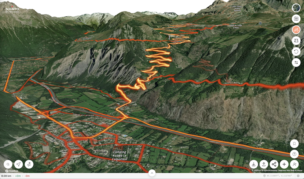
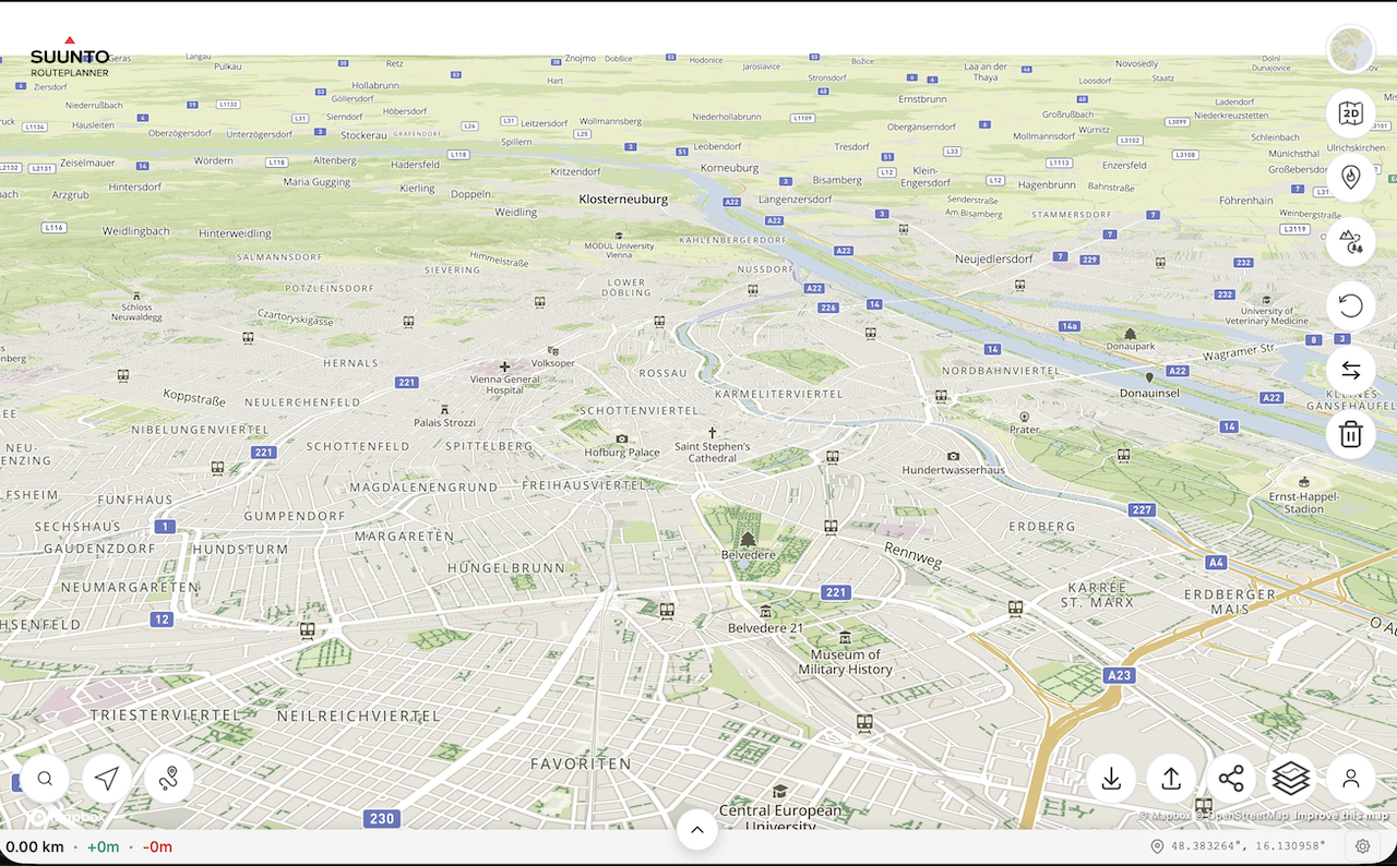
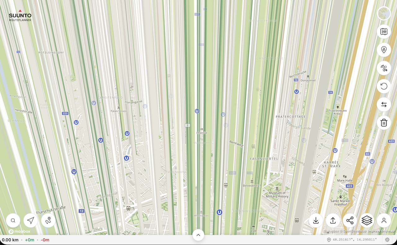
@kemetter on my Mac I have the same problem as @johann.fuehrer with the rendering of 3D model if I press the 3D button but not if I tilt the map with the mouse. On iOS devices it works normally.
First screenshot is the map tilted with the mouse, second screenshot is after pressing the 3D button without moving the map.
(MacOS 26.2 (25C56), Safari 26.2 (21623.1.14.11.9))
-
@Freezer what Mac did you try this on? Works on my M4 Mac mini…
Hello! It looks like you're interested in this conversation, but you don't have an account yet.
Getting fed up of having to scroll through the same posts each visit? When you register for an account, you'll always come back to exactly where you were before, and choose to be notified of new replies (either via email, or push notification). You'll also be able to save bookmarks and upvote posts to show your appreciation to other community members.
With your input, this post could be even better 💗
Register Login