Suunto Routeplanner
-
@Egika I see what you mean. The imported GPX is treated more like a static overlay rather than a natively planned route. For TbT to work, the Route Planner would need to ‘snap’ the GPX to the map and recalculate the path based on the map data upon saving. This is the only way the system can generate the necessary turn instructions.
-
The turn-by-turn guidance is not a standard in GPX files and Suunto uses a specific way of storing “turn-by-turn guidance waypoints” into the file. Other route planners may use a different way to store them. Thus it’s working between Routeplanner and Suunto app as they are using same way to mark them, but third party GPX files use different syntax or none. Recreating tbt into a GPX file that does not have it is not trivial as it requires rerouting the complete route. It can be done, but getting good quality tbt is really challenging.
-
@kemetter said in Suunto Routeplanner:
The turn-by-turn guidance is not a standard in GPX files
Not standard in GPX files but there is a Garmin standard for route FIT files. Perhaps Suunto could adopt that.
Basically, turn directions are stored as route waypoints with special waypoint codes.
Some route editors like PlotARoute are capable of inserting turn direction and saving the route as a FIT file, and that works correctly with Garmin watches.Suunto: Ambit, Ambit 3 Peak, 9 Baro, Race S, Race Ti, Vertical 2 Ti
Garmin: Forerunner 210, Forerunner 610, Fenix 6X, Fenix 7X Ti -
@sky-runner The problem is that GPX is an open standard. FIT is a proprietary format that Garmin currently allows others to use.
-
@Egika said in Suunto Routeplanner:
@tuxbuster I think the reason is, that existing GPX files do not necessarily match to existing paths or roads. There is just no data basis on which any tool can decide where a turn is a turn.
Komoot kan add tbt notifications if you upload a gpx to their app (and sync it to suunto). The garmin connect can also do it. But you cannot sync that to suunto (nor does garmin a particular good job. You get tbt alerts that are just bends in the road)
-
@elbee said in Suunto Routeplanner:
@Egika said in Suunto Routeplanner:
@tuxbuster I think the reason is, that existing GPX files do not necessarily match to existing paths or roads. There is just no data basis on which any tool can decide where a turn is a turn.
Komoot kan add tbt notifications if you upload a gpx to their app (and sync it to suunto). The garmin connect can also do it. But you cannot sync that to suunto (nor does garmin a particular good job. You get tbt alerts that are just bends in the road)
Like said, it can be done but quality will most likely be bad, meaning you will get either too many or too few turn instructions.
-
@sky-runner said in Suunto Routeplanner:
@kemetter said in Suunto Routeplanner:
The turn-by-turn guidance is not a standard in GPX files
Not standard in GPX files but there is a Garmin standard for route FIT files. Perhaps Suunto could adopt that.
Basically, turn directions are stored as route waypoints with special waypoint codes.
Some route editors like PlotARoute are capable of inserting turn direction and saving the route as a FIT file, and that works correctly with Garmin watches.So does Garmin use FIT to store routes? But they don’t store their TbT into GPX files?
-
Like said, it can be done but quality will most likely be bad, meaning you will get either too many or too few turn instructions.
The komoot route? No, it’s not bad and quite usable. Have you actually tried it?
(There is no room in a gpx file for tbt alerts afaik. All other brands also use fit for this)
-
Overall, excellent work—I do GIS for my “day job,” and the map styling has to be some of the best I’ve ever seen, on ALL baselayers!
Only bugs I’ve found are units settings and login not being stored when returning later (might be a cookie issue on my end though), and when changing the units to imperial, the route library (when logged in) still shows overall route distances in km.
For a future tweak, It would be awesome to have elevation and sunrise/sunset time pop up as a label when clicking (or tapping) a position like in the Suunto App. And perhaps, for manual point-to-point routes, labels on the lines with bearing and distance? Just thoughts from my overly map-heavy brain though. Seriously, excellent work on this project!
-
@JebClydeNC said in Suunto Routeplanner:
Overall, excellent work—I do GIS for my “day job,” and the map styling has to be some of the best I’ve ever seen, on ALL baselayers!
Only bugs I’ve found are units settings and login not being stored when returning later (might be a cookie issue on my end though), and when changing the units to imperial, the route library (when logged in) still shows overall route distances in km.
For a future tweak, It would be awesome to have elevation and sunrise/sunset time pop up as a label when clicking (or tapping) a position like in the Suunto App. And perhaps, for manual point-to-point routes, labels on the lines with bearing and distance? Just thoughts from my overly map-heavy brain though. Seriously, excellent work on this project!
Thanks. The login is stored but clearing cache will remove it. Some browsers may by default clear cache between sessions. Regarding the imperial problem, I am not able to reproduce it. Make sure you reload the page in case you have had it open for long and try to find a way to reproduce it.
Nice feature ideas, need to think about them. Difficult to support these on both touch and desktop use though.
-
@kemetter on my Mac I have the same problem as @johann.fuehrer with the rendering of 3D model if I press the 3D button but not if I tilt the map with the mouse. On iOS devices it works normally.
First screenshot is the map tilted with the mouse, second screenshot is after pressing the 3D button without moving the map.
(MacOS 26.2 (25C56), Safari 26.2 (21623.1.14.11.9))
-
@Freezer what Mac did you try this on? Works on my M4 Mac mini…
-
@2b2bff, hi! I’m on MacBook Air M2 (Mac14,2).
-
said in Suunto Routeplanner:
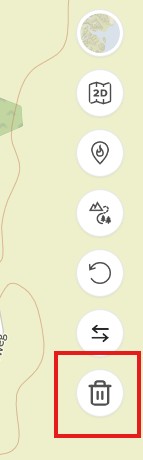
Reset Button: An option to clear the currently planned route and start fresh on an empty map.
@kemetter Thanks for the new button to clear the current route

-
@tuxbuster Oh, this is good, thanks Suunto. But I wait for slope/gradient % indication. Maybe some day…
-
@Freezer said in Suunto Routeplanner:
@kemetter on my Mac I have the same problem as @johann.fuehrer with the rendering of 3D model if I press the 3D button but not if I tilt the map with the mouse. On iOS devices it works normally.
First screenshot is the map tilted with the mouse, second screenshot is after pressing the 3D button without moving the map.
(MacOS 26.2 (25C56), Safari 26.2 (21623.1.14.11.9))
I think that’s the ‘Interstellar View’
-
Used a couple of times, would like to add that if I can log in with Suunto account, I also want to be able to me my heatmap on the site too when planning please at some point.
-
I am really glad to see this browser option from Suunto! Quick question about the Route Collection functionality. Is it possible to see all routes in a collection on the basemap at once? I am planning a multi-day trip and would like to see the option to have multiple routes visible at a time. In my case, I am trying to separate my routes by day.
-
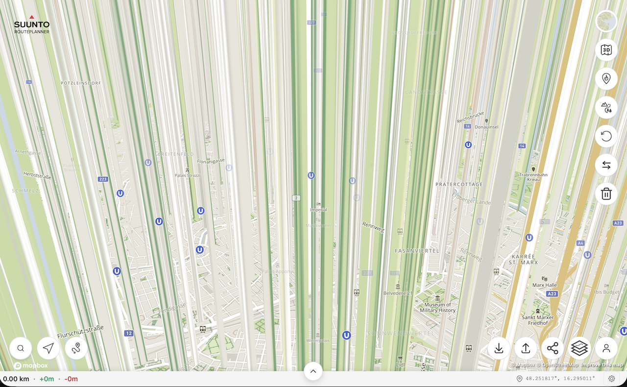
I wanted to try the route planner and found a bug that makes planning impossible.
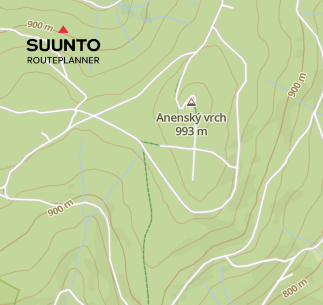
In the “Outdoor” map view, forest and dirt roads are displayed as regular roads. Only after zooming out to a certain level do they appear correctly as dashed green lines. However, at that zoom level not all paths are displayed anymore.
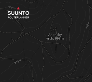
The dark map mode works exactly the opposite way. Even at the highest zoom level, forest and dirt roads are displayed correctly as dashed lines, but from the same zoom-out level they start to be drawn as regular roads.
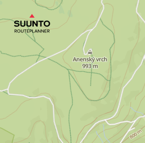

In Suunto Android app, the same forest and dirt roads are displayed correctly as full or dashed green lines.
-
Is this still being actively developed, is there official support?? I’ve not really noticed any changes since day 1 ??
I find that if I “Upload Route to Suunto”, and then bring that route back to work on it later, any saved Waypoints disappear (but are visible in the phone app).
This along with the routeplanner seemingly forgetting it created the original route and thinks its just a regular GPX, so if you “come back later”, then make changes and re-upload, then TBT is lost to the watch, unless you ‘re-mark’ routing points along the route and effectively redraw it.
Final issue with Waypoints is where I have routes which go over the same place twice, it becomes impossible to place them where I want…so if I have an out and back section, and halfway out I want a Waypoint to remind me to have a gel or something, I can’t reliably place it on the “out”, it might be on the back…
…one simple solution on this would be if the Waypoints also displayed, and were placeable, by clicking on the Altitude vs Distance chart that goes along the bottom.It would be nice to be able to grab a placed Waypoint on the Altitude graph and nudge/shift it left or right to the desired position.
Hello! It looks like you're interested in this conversation, but you don't have an account yet.
Getting fed up of having to scroll through the same posts each visit? When you register for an account, you'll always come back to exactly where you were before, and choose to be notified of new replies (either via email, or push notification). You'll also be able to save bookmarks and upvote posts to show your appreciation to other community members.
With your input, this post could be even better 💗
Register Login