Several navigation issues (feedback)
-
@Joaquin I did not pretend a comparison but to expone some points (starting with the user experience, and that is very important) and explained why the Komoot workaround needs a very serious rework. The notifications while better than in Coros or Amazfit, are not accurate enough. This is like in the previous generation and it is very clear that work and investigation needs to be done.
Keep also in mind that I throughly tested all brands but Polar in very long trail runs.
Said this, the fork shot you post is a very nice example, since:
- It’s true Amazfit does not notify some forks
- It’s true Coros notifies forks as right-left turn. While Coros’ approach is not perfect, is somehow valid since keeps you in the path.
- It’s also true that the Komoot approach is not accurate enough, and this applies to all notifications of the whole track (not just and only the forks)
-And it’s also true that the Komoot workaround means the complicated user experience and that users are even forced to use a third party social network.
Even if some forks are left (in Amazfit but not Coros), what it happens in a very long trail run is that most notifications are just turns. Since with the Komoot algorythms It seems there’s an offset being the notifications not good enough, the feeling (for the whole trail run) while better with all the notifications, is less accurate. And this is important to note and should not happen.
But there’s something that has changed in Amazfit in the very last month (I don’t think they have still fixed those forks thought). The thing is I tested very recently the T-Rex Ultra 2 (not the T-Rex 3 Pro) and the navigation is incredible improved this very last month (as said, there don’t notify forks or roundabouts yet and there were some few forks left, like the one you show but with the T-Rex 3 Pro).
In my opinion they have rewritten everything. And the explanation is that they finally managed to add the routeable thing I was explaining. Have a look at this : https://youtube.com/shorts/jGDmJTFyGwk (there’s an english audio track) . This is the very last month, and there’s even a new update improving that.
I’m posting this, not to explain the routeable thing but to say they finally found a way to make everything A LOT more clever. So yes, in my opinion, this means they changed completely their turn-by-turn implementation (or my impression is that is greately improved). Now they are here, they are very likely fixing the remaining things very soon.
Again, this is not a comparison at all (personally, I don’t have now that Ultra 2 watch and I don’t recomend their watches at all because the so many bugs and issues), but what I mean is that their navigation at this moment, is a lot better that we could think just looking at those shots in a very concrete scenario.
I also had tested the Coros Nomad 2 months ago, and while I don’t like Coros navigation, their turn-by-turn are working perfectly fine, even if you change your direction (they only notify left and right turns)
As said, I’m here because Suunto is superior in many things. Triathlon now excels and navigation, while not perfect, I feel like maps are super fast and very good. But Komoot’s algorythms are not good enough (and the user experience is not either the best) and this should be noted because the Komoot approach is convoluted and is not good enough.
Suunto Vertical 2 Titanium Sage, Suunto Run
-
@dreamer_ I’m simply trying to explain why Suunto does it this way, I think it’s good to understand why things are done this way.
And super thanks for the feedback

-
@Joaquin said in Several navigation issues (feedback):
Garmin, for example, does not rely on pre-generated turns embedded in the route file. The watch itself generates turn instructions in real time based on its onboard maps.
That is not my experience. My forerunner 935 didn’t have maps only breadcrumb, but I do get TBT notifications if I imported a route via Garmin connect. Some goes for the forerunner 965 I had before my current watch. If I selected a route I did get TBT, but if I selected “follow the route in opposite direction” I didn’t get TBT notifications.
Also, I once didn’t load a map for an area on my forerunner 965 but still got TBT notifications (althought the screen only showed a black background and a breadcrumb to follow)Maybe that changed in the last year.
-
In my opinion, on‑watch routing is highly overrated. And sometimes it can be really dangerous – in higher mountains, for example. It’s slow, unreliable, and on a tiny watch screen, you can easily miss potential errors in an automatically generated route.
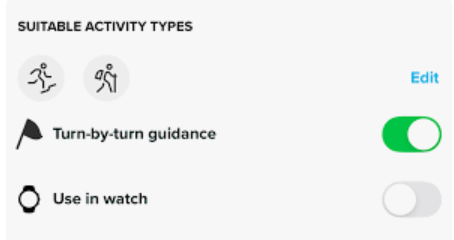
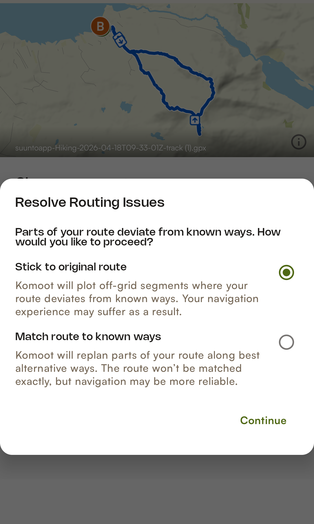
SuuntoApp is missing one pretty obvious feature. When you import a GPX file, it should ask – the way Komoot does – whether you want it to redraw and analyse the route (adding missing elevation, turn‑by‑turn directions, etc.), or just import the original GPX file without any changes, like it does now.
-
@maszop this is good improvement/feature
 I’ll pass this on to the team in case we can do something about it in the future.
Super thanks!!
-
@Joaquin Thanks. Komoot does that mainly for staying on roads and trails, whereas with Suunto it would be more about adding missing elevation and TBT.
From what I’ve seen, only Komoot (online) – using the phone’s computing power – can generate a logical route.
Garmin is just okay at best. The Hammerhead Karoo is pretty weak. Google Maps, apart from driving, is rubbish. Mapy . com is okay at best. And I’m mostly talking about using the phone’s processing power and usually having an internet connection.So I don’t know if it’s worth putting so much effort and resources into adding routing to Suunto watches, knowing it’s going to be very unreliable, except maybe in cities.
-
@dreamer_ I think there might have been a small misunderstanding, so just to clarify my point.
I was simply referring to the brands you mentioned as examples, not trying to say one approach is better or worse. Each brand has its own philosophy, and this is just ours.
Of course, we are actively working towards improving things like GPX-based turn guidance or routing directly on the watch, but we want to do it in a way that we believe is robust and reliable for the user. That’s why, for example, offline maps in the app combined with routing to the watch is part of what I’d call the “Suunto way” of building a routable map experience.
I really appreciate your feedback and the level of detail you’re bringing to the discussion. It’s genuinely valuable for us
 ️
️
-
@Joaquin said in Several navigation issues (feedback):
you will have it, but in reverse; that is, instead of going from left to right, you will see how the ascent guide will go from right to left, and you will always have the current segment, updating to your route direction
Can someone please tell the Suunto team that the elevation profile (climb guidance) updating in reverse right to left with the color swapped is a very questionable solution. I find it extremely confusing. It isn’t a good user experience in my experience.
And in general the whole idea of automatic route reversal is more trouble than it is worth 90% of the time. Just two days ago I tried "Navigate on watch now function and as soon as I used it the watch showed a notification that I have reached the destination, followed shortly by an off route notification and then followed shortly by back on route notification. I can only assume it immediately reversed the route. There are many more examples of the route reversal messing things up. For one case of when I truly want the route reversed there are 9 cases of when it wrongly reverses it.
-
@sky-runner Changing the colors in reverse is difficult, although we’re working on it. The current segment is indeed inverted,I hope we can do this at some point.
-
One thing that is not actual navigation but very much related: In yesterday’s Race I loaded the course and started navigation without TbT just to be able to see where the route would be just in case. As I run through the finish point, I got a full screen notification that I reached the end of the course and had to dismiss this notification to be able to actually stop my activity tracking.
I think the upper button should have paused regardless…
-
Edit. I just realized joaquin’s photo I was referencing is comparing a Coros with Garmin, and that Coros does also have an offset, which seems even bigger than what is seen in Suunto.
Removed bad photo (of my post)
In those photos you see only a 3 meter offset with Garmin, but I’m finding many turns with much more distance offset with Komoot’s algorythms, as explained. Even something like 15 meters several times.
Suunto Vertical 2 Titanium Sage, Suunto Run
-
@dreamer_ I didn’t remove any photo or modify the post, so I’m not sure what you’re referring to.
As I mentioned before, turn notifications depend on the vector map data that generated that turn. Even when using the same map provider, you can still have different turn thresholds depending on the algorithm or routing engine used, as well as the map update frequency of each platform.
That’s why sometimes Garmin is more reactive, other times Suunto, and other times COROS. In any case, navigation remains perfectly usable on all of them.
These are simply normal differences and limitations across platforms.
-
@Joaquin said in Several navigation issues (feedback):
@dreamer_ I didn’t remove any photo or modify the post, so I’m not sure what you’re referring to.
As I mentioned before, turn notifications depend on the vector map data that generated that turn. Even when using the same map provider, you can still have different turn thresholds depending on the algorithm or routing engine used, as well as the map update frequency of each platform.
That’s why sometimes Garmin is more reactive, other times Suunto, and other times COROS. In any case, navigation remains perfectly usable on all of them.
These are simply normal differences and limitations across platforms.
The photo was removed by me, not you @joaquin . I misunderstood one of the photos and that’s why I corrected the post
-
@dreamer_ all clear
 ️ I didn’t understand what you meant.
By the way, it would be great if you were in Zegama, Val de Aran, Mallorca, or Andorra UTMB. It would be nice to meet you, and I’m sure we’d have a nice chat about GPS gadgets. -
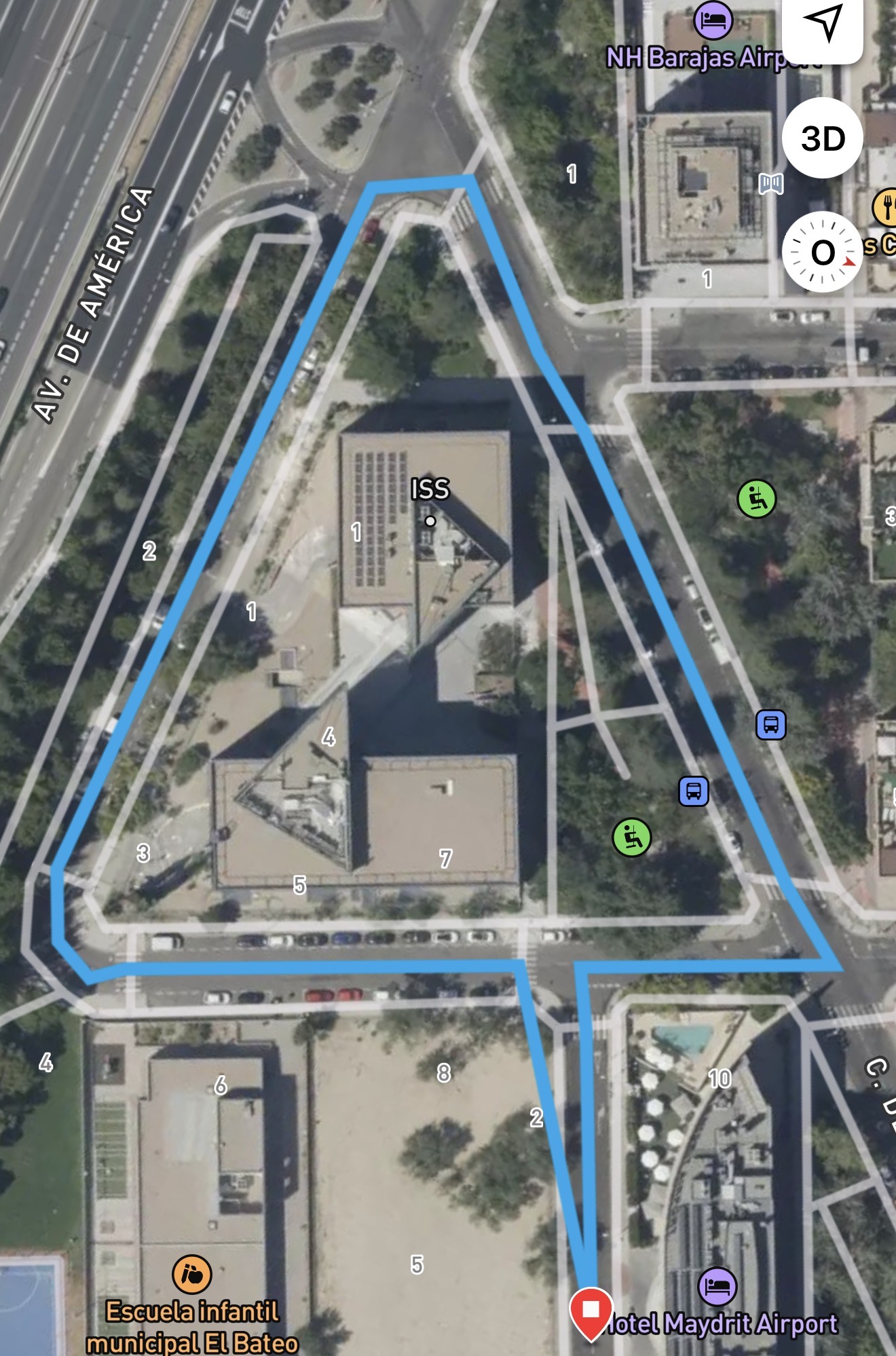
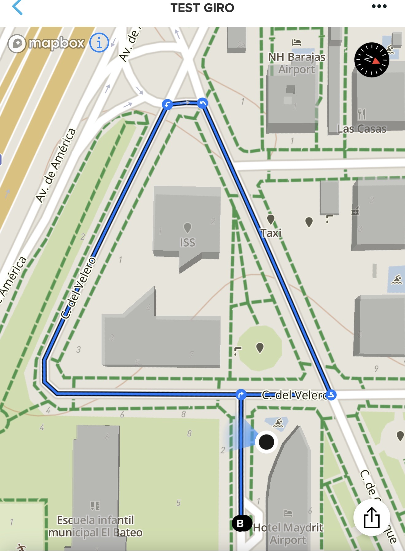
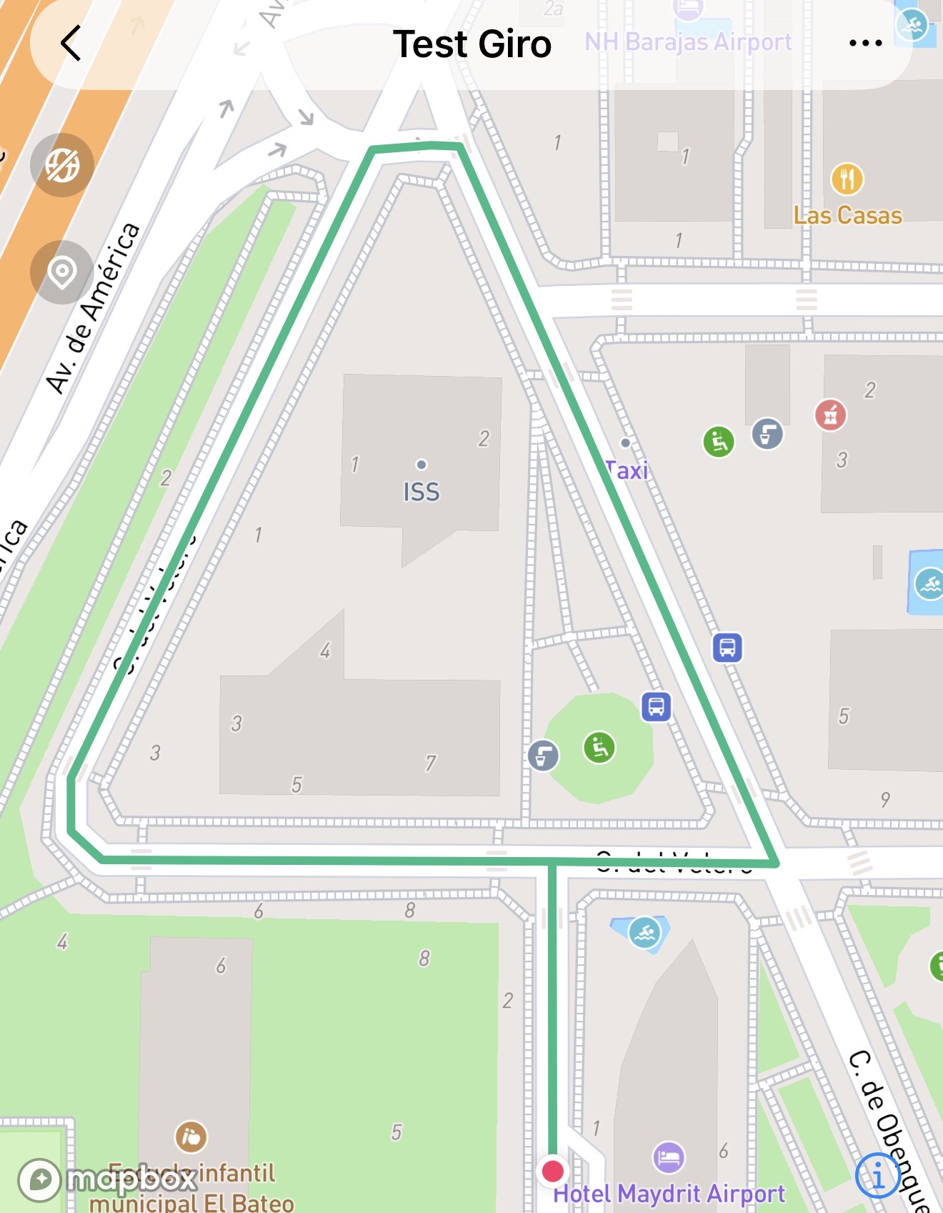
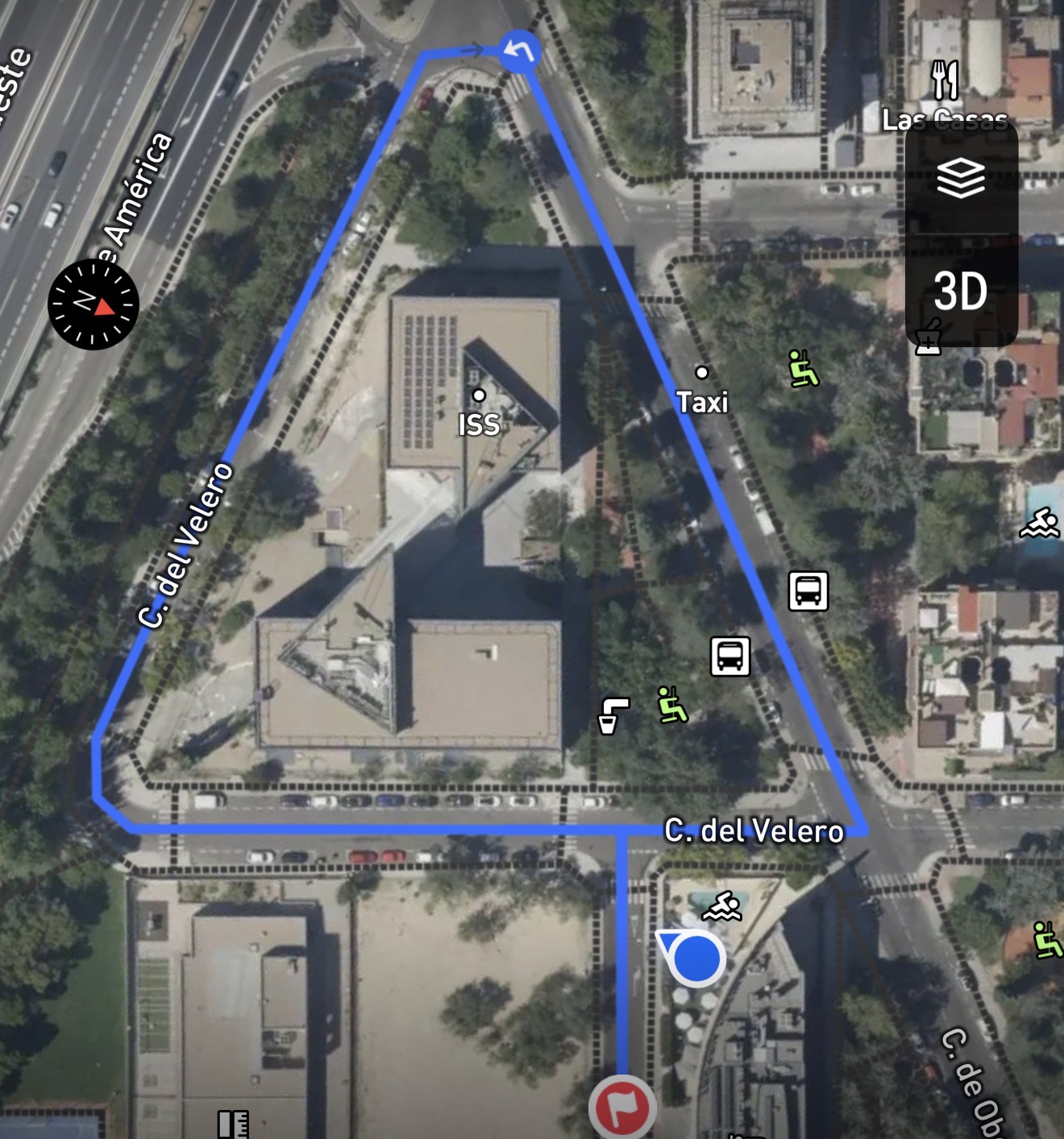
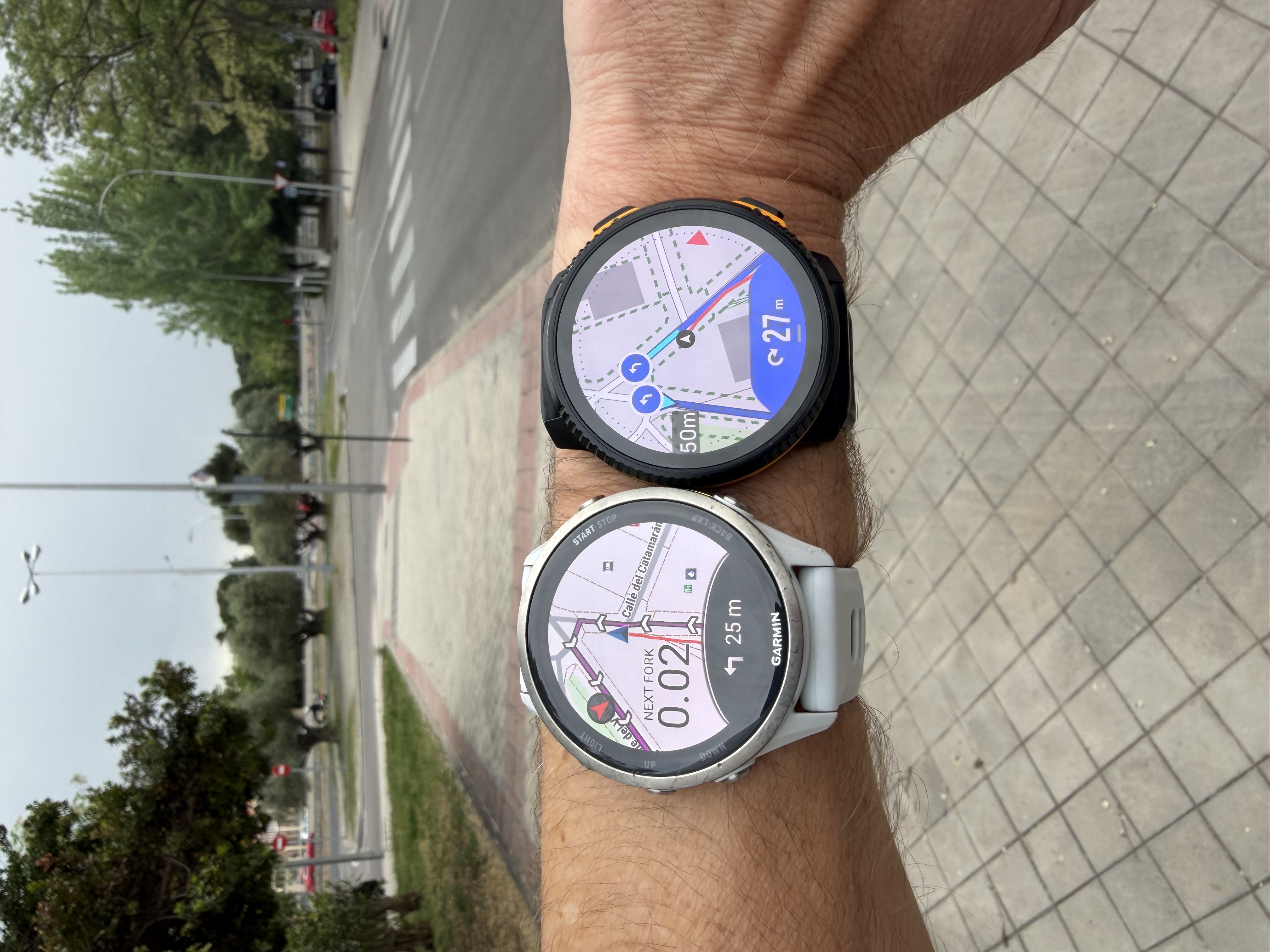
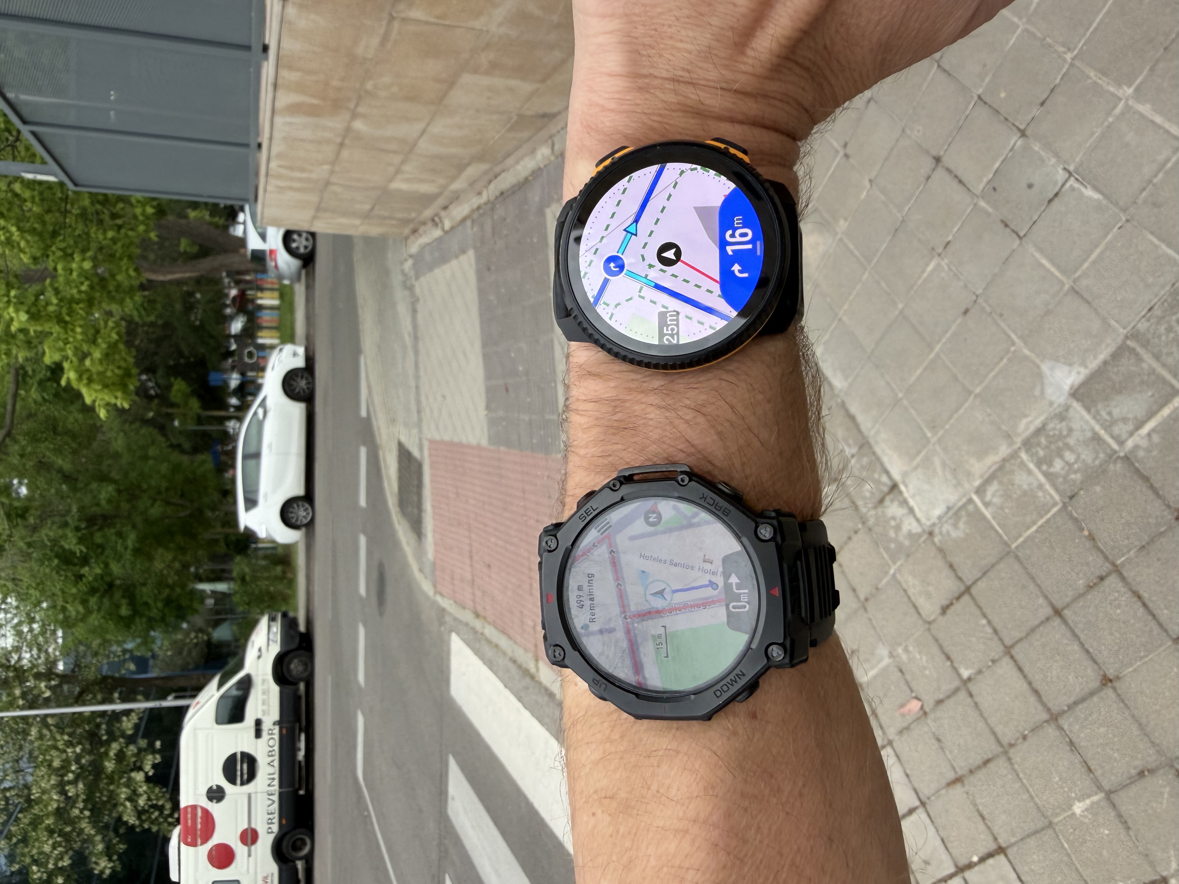
@dreamer_ I did a quick test route in Madrid, in an area where I don’t usually run, created natively in each platform (Suunto App, COROS App, Garmin Connect, and Amazfit App) to avoid any inconsistencies coming from GPX imports.
For clarity, I’ll only show the first three turns. For example, COROS only generates one turn here (the third one).
As you can see, each platform interprets turns differently depending on their routing engine, vector map data, and turn detection thresholds.
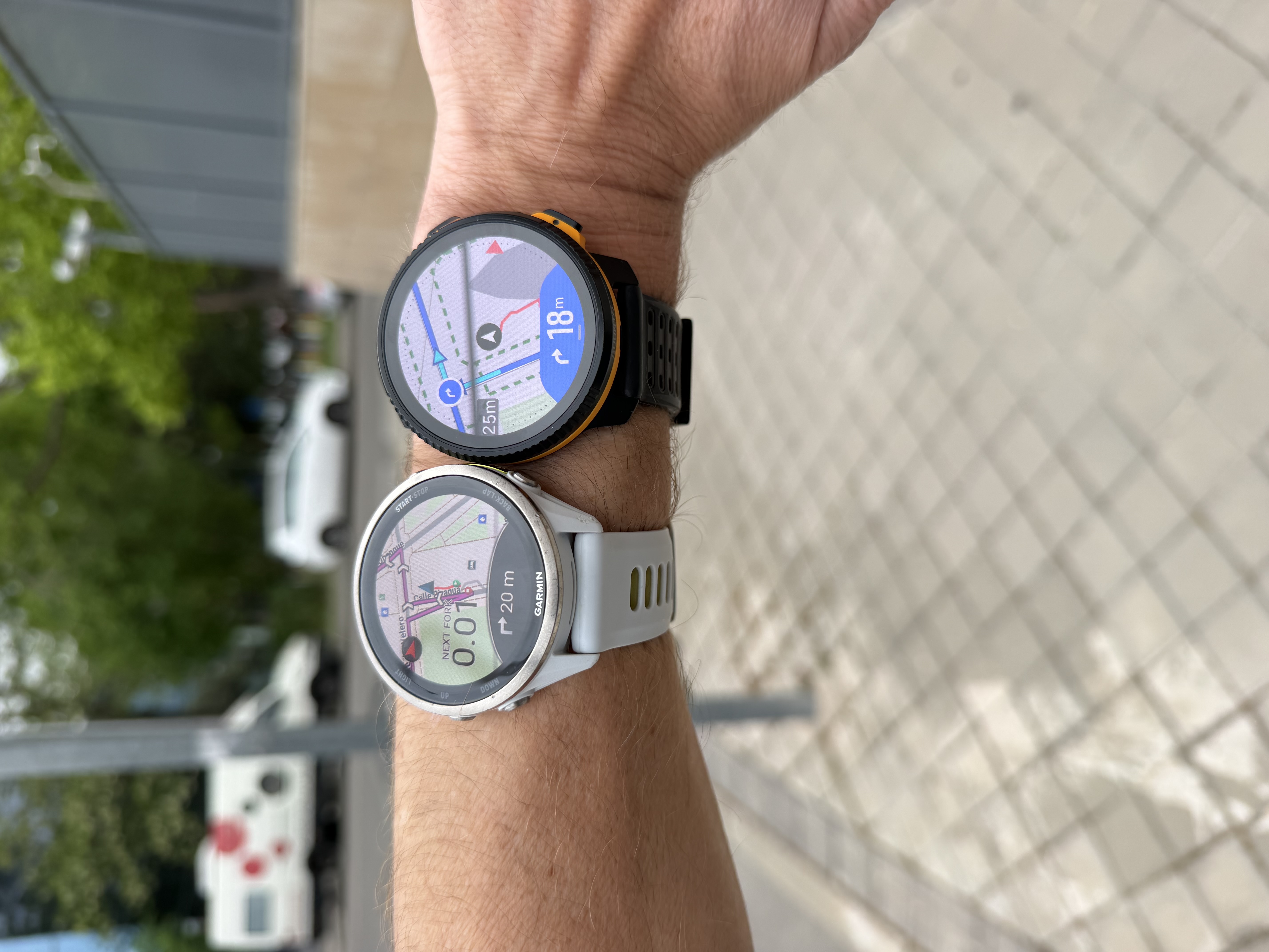
Garmin & Suunto
Very close overall. In the first two turns, a slight advantage for Suunto in terms of reactivity, and on the last one, Garmin was slightly ahead.
Technical & Product Specialist – Suunto Iberia
-
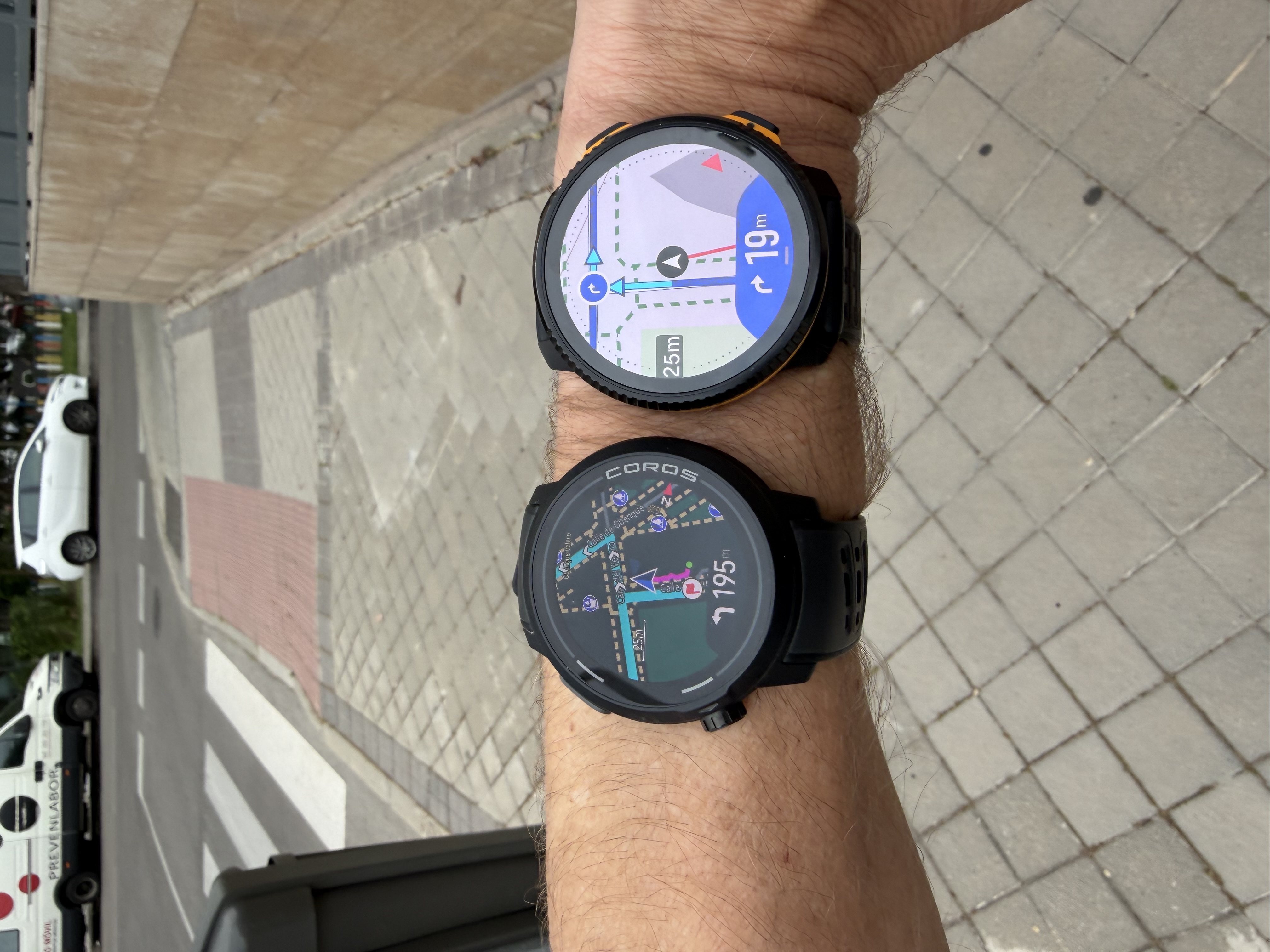
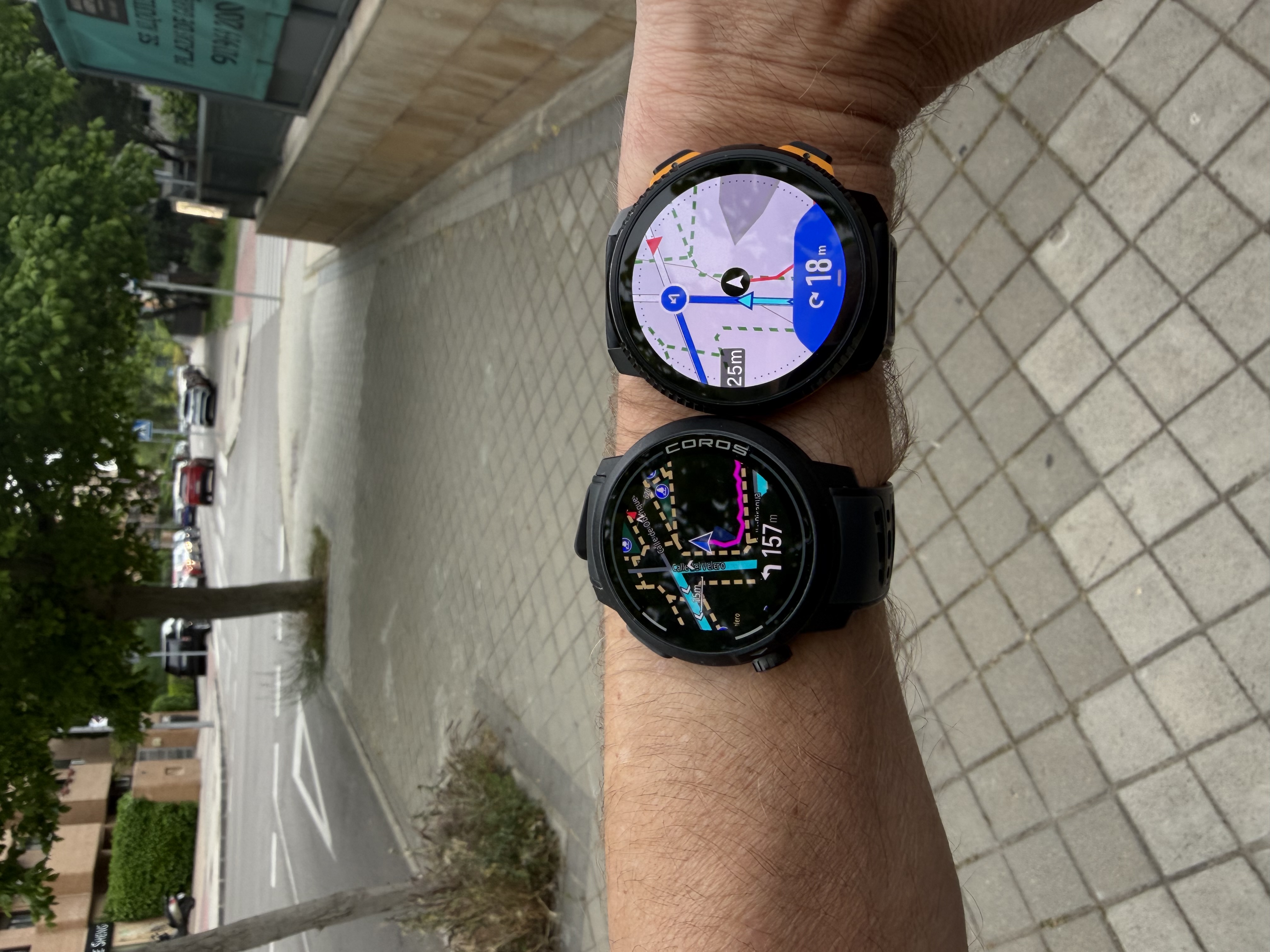
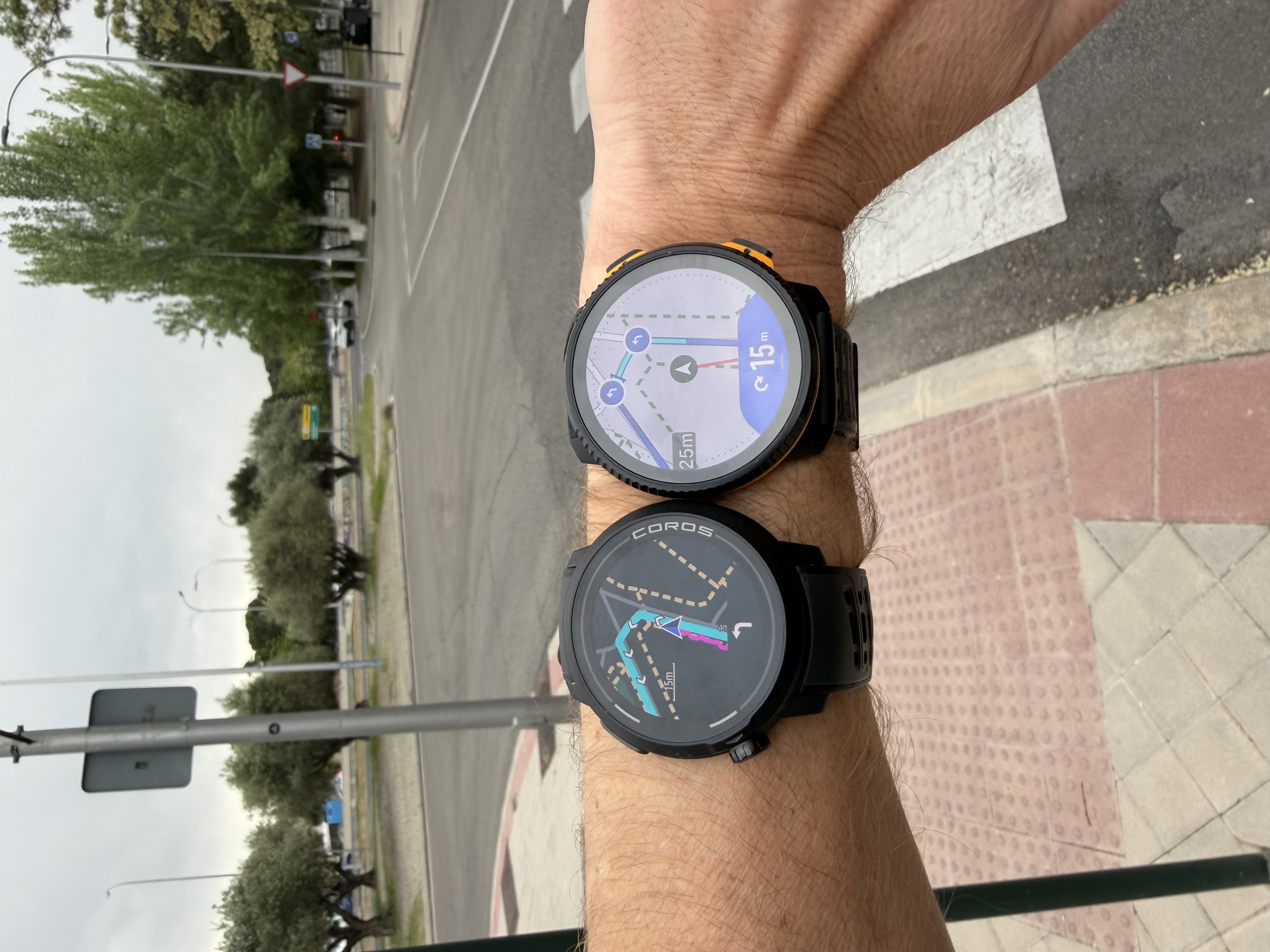
COROS & Suunto
On the third turn, which is the only one COROS detected among the first three, it clearly triggers earlier. The turn is indicated when I’m still around 15–20 m away, as you can see in the track displayed on the map.
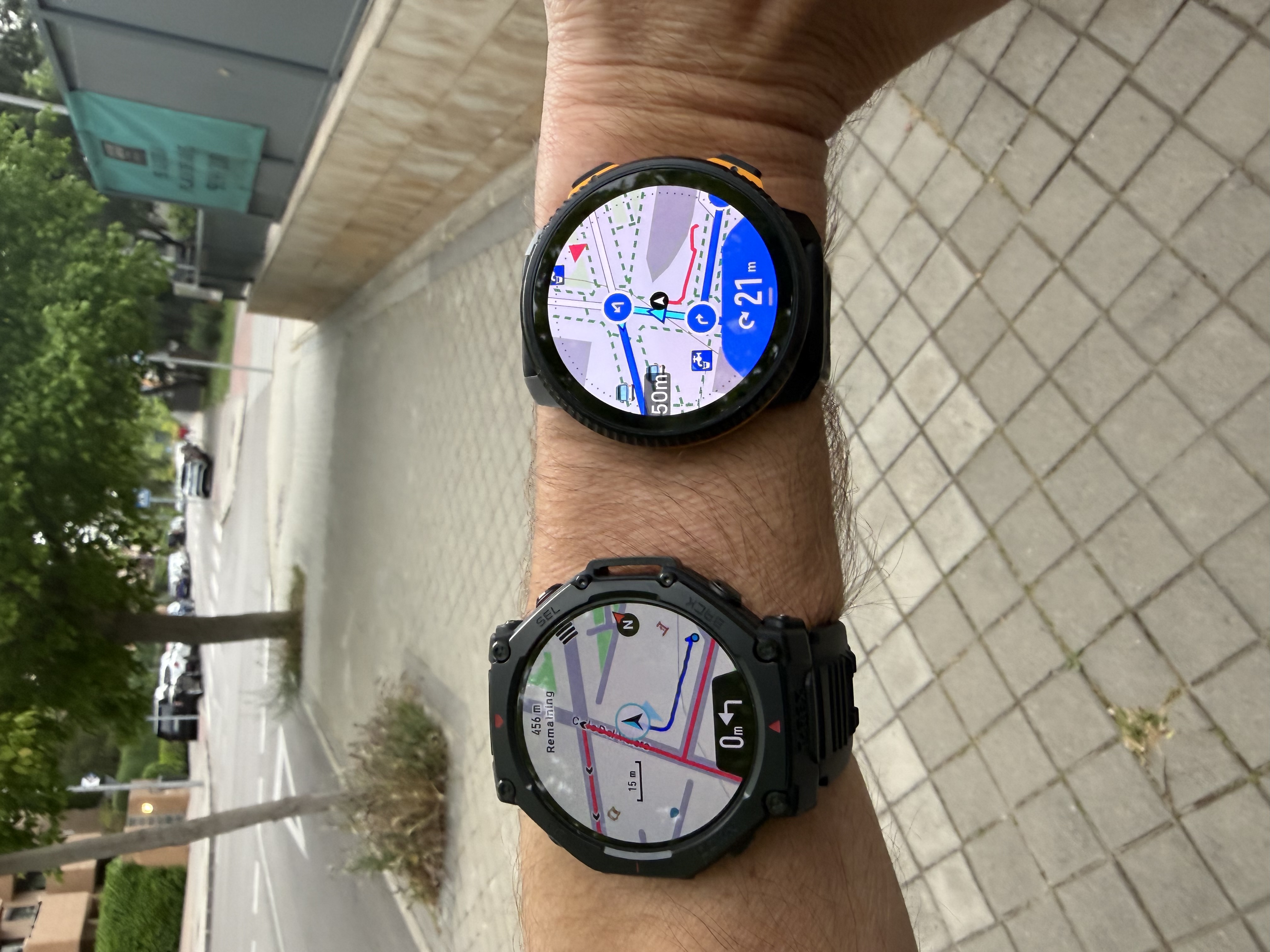
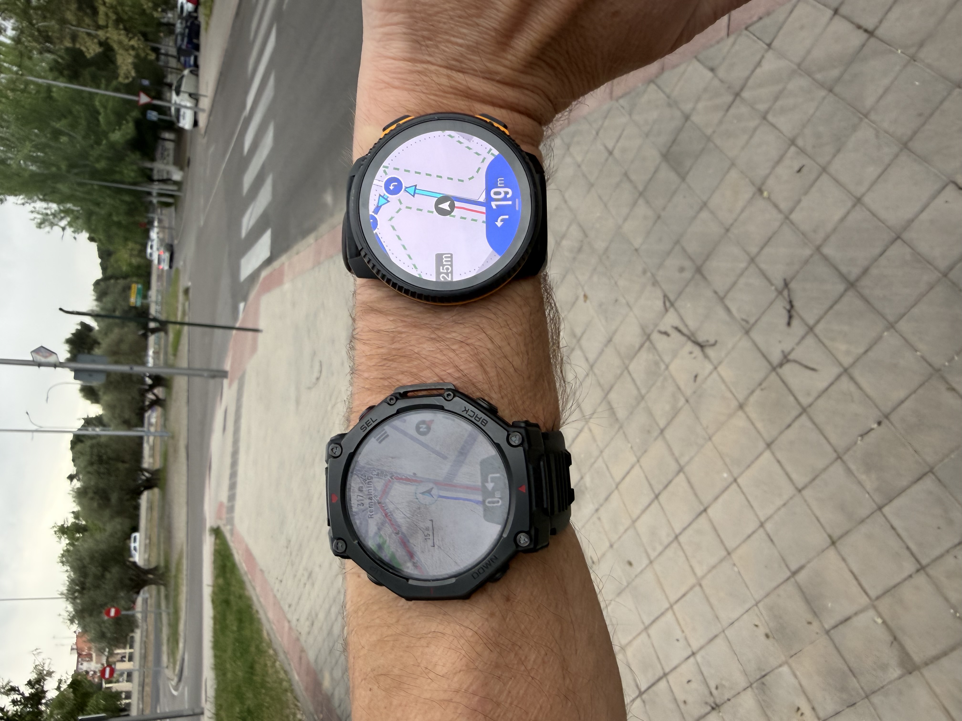
Amazfit & Suunto
Amazfit consistently triggers earlier on each turn. As shown in the images, the turn notification appears significantly before reaching the actual turning point.
Final conclusion
That said, YOU CAN PERFECTLY FOLLOW TURN-BY-TURN NAVIGATION WITH ANY OF THE FOUR WATCHES.
From my experience, Garmin and Suunto are quite similar in terms of turn reactivity and distance to turn when routes are created manually in their respective apps.
As mentioned, this will depend on the platform where the route is created, and of course your experience may vary. I’m simply sharing my tests across different locations.
We will of course continue working to improve this for all users, which is why this kind of feedback is very valuable. Thank you very much!
-
@Joaquin Looking at the watch photos - why does Suunto not pointing to the left next to the distance remaining in the 2nd and 3rd photo? It’s counter intuitive, isn’t it?
Race S
-
@2b2bff said in Several navigation issues (feedback):
@Joaquin Looking at the watch photos - why does Suunto not pointing to the left next to the distance remaining in the 2nd and 3rd photo? It’s counter intuitive, isn’t it?
This is the display, when the next turn is not within notification distance. Then it is basically a generic icon for this data field how far the next turn is.
I also think the actual direction could be shown in this state. No idea if this will come later. -
@2b2bff We don’t have a dynamic icon in the data field that shows the turning direction; we’re working on it, and it’s something I’d love to have. The correct turn signal appears after 20 meters.
-
@Joaquin I think I have found the issue.
First, I’d like to thank you for taking the time for the tests and the very detailed post.
After looking at your track, I have just realized that my track is a roundtrip track, and means the same way out and back. This is something that I always do by default when I test the navigation.And that track it also means that in the way out (going up), I also take a fork that I repeat in 2 directions and then return to the track up to a mountain. In the way back (and going down) I take the same fork doing the same repeat and then return to the track. Or sometimes I take a completely different fork, and then I return to the track.
I have tested this convoluted track in every brand of the market but Polar. And the reason is that in short trail runs or in very fast ones, sometimes you repeat parts of the tracks and knowing your watch has strong and reactive indications is interesting.
For this same reason, specially in very technical paths, is interesting to have the audio navigation indications (that can enabled/disabled with just a trigger in the navigation options of the watch for most brands of the market). About this, Garmin has audio prompts for even roundabouts.
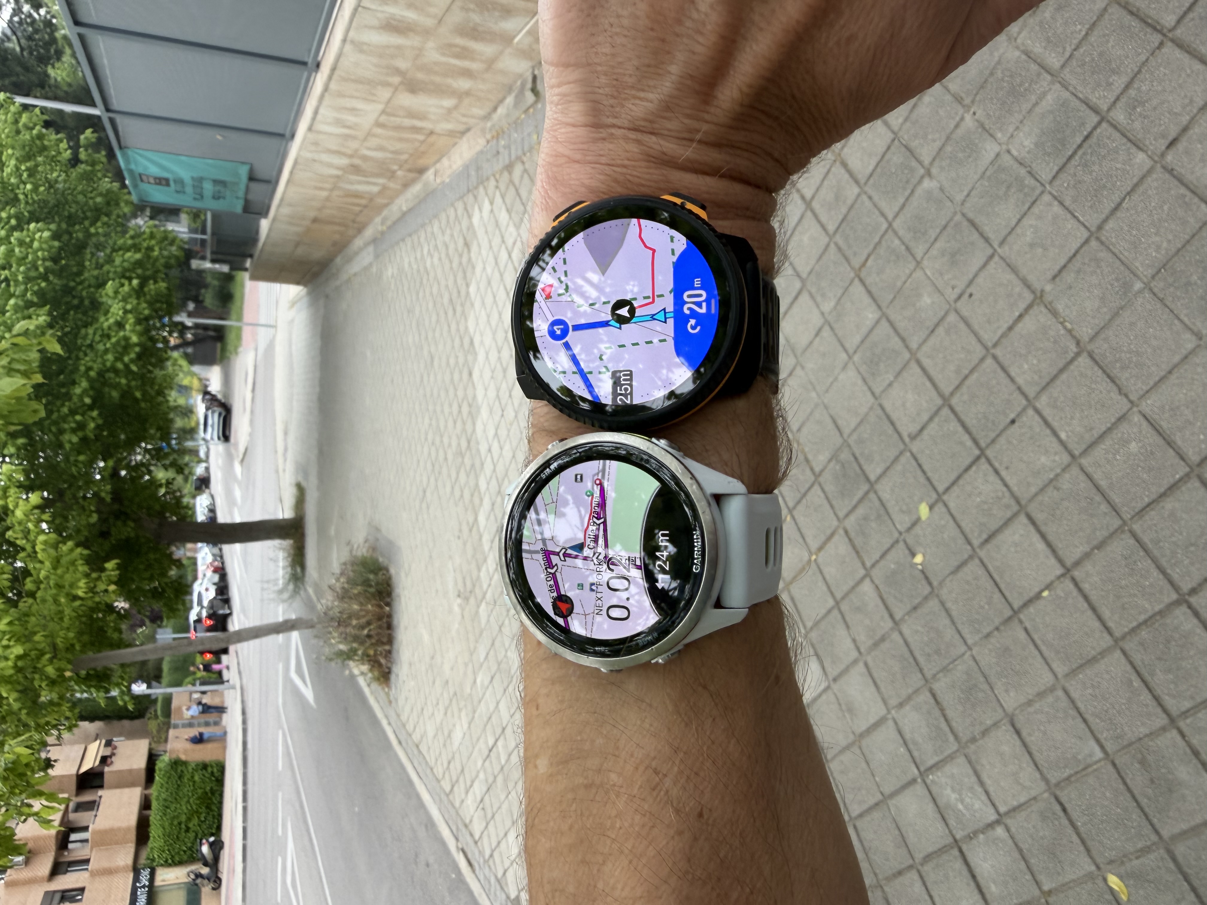
Said this. I went for an small walk to show you what I’m seeing
Have a look at this shot: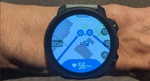
As you can see, there are 2 notifications for the roundabout (the way out, and the way back). When I arrive (way out, first time) to the roundabout, and when I’m almost at the roundabout, the watch is saying that there are still 18 meters left, and that’s impossible. There are perhaps 18 meters but to the point of the other notification (that should be triggered when you are back), not to the first one
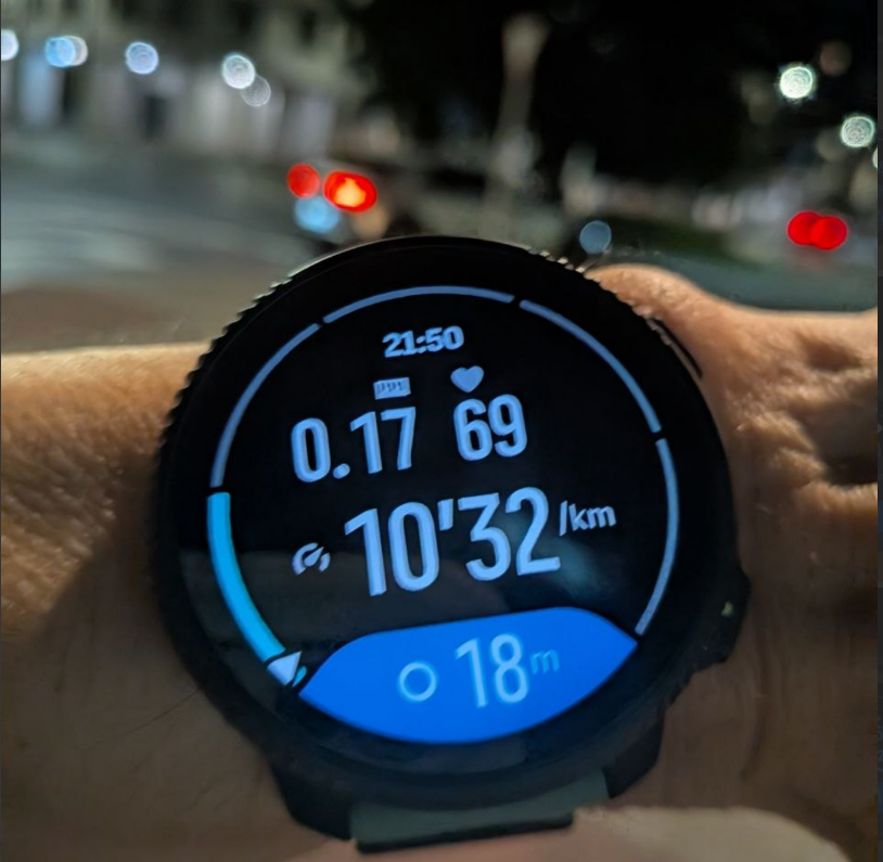
- Is it possible the watch in this roundtrip scenario is notifying the second notification, instead the first one?
Then, I walked like 300 meters and I turned back and I did not got any roundabout notification again (this works in Garmin). I think the autoreverse is not as reactive as it should be, as I was explaining.
But this is today with an extremely small test as it’s very late now here. If a run a lot longer, I have the feeling that the watch is giving notifications inside the turns and the notifications sometimes remain after those turns. And despite the notifications are ok, and in the corresponding direction, I think there’s something very strange with the distances and response time in this roundtrip scenario.
The track I’m using means also a check that enables the roudtrip inside Komoot.
Could you test a roundtrip scenario (way out and back using the same way)?
BTW, only Garmin and Suunto can notify roundabouts and forks. And I have even seen the go straight in a fork in Suunto (not only take the fork) so this is very nice (Coros and Amazfit only notify the turn left-right and Amazfit even misses several forks, if not most). I don’t understand why you are getting that “0 meters” in all the shots in Amazfit. As far as I remember, the Ultra 2 was accurate with the distances in my tracks. But I wouldn’t be surprised if they have broken something in their very last updates (which I have not tested). And in any case, that is not our problem here.
I think that in this roundtrip scenario, Suunto has something strange here. Perhaps is something that happens where I live or in my tracks, but the thing is that I only see this discrepancy with the accuracy in responsiveness and distance in Suunto (and in this roundtrip scenario).
Suunto Vertical 2 Titanium Sage, Suunto Run
Hello! It looks like you're interested in this conversation, but you don't have an account yet.
Getting fed up of having to scroll through the same posts each visit? When you register for an account, you'll always come back to exactly where you were before, and choose to be notified of new replies (either via email, or push notification). You'll also be able to save bookmarks and upvote posts to show your appreciation to other community members.
With your input, this post could be even better 💗
Register Login