Dive Route - Start and End points assume the dive begins and ends at the same location
-
I have now completed a number of dives with the Nautic and, overall, I am impressed with the computer and its capabilities.
I have been using the dive route feature and reviewing the recorded tracks, which generally appear to give a realistic representation of the turns and routes taken during the dive. However, I have noticed that the system seems to assume the dive start and end points are the same, or at least very close together.
On shore dives this is not particularly noticeable, as the entry and exit points can be close depending on the start depth and end time settings. On recent drift dives, however, this behaviour is much more apparent. In these cases, the dive begins on the south‑east side of the reef and ends on the north side, as shown in the attached image.
The extended surface interval shown on the route appears accurate, as it did take some time for the boat to collect us, but this position is still nowhere near the original entry point.
Are there any settings or adjustments that can be made to improve the accuracy of the recorded routes?
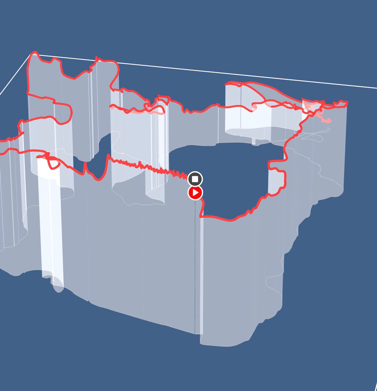
Approx route on a map
-
Having worked on this kind of subject (inertia, heading, pressure, etc.) in the aeronautical field, I understand that the calculations are made based on the information described in another thread.
Nevertheless, to be able to appreciate the quality of the restitution, it would be necessary to have other known and fixed elements such as remarkable landmarks (spots with known GPS coordinates for example). In my case, I have entered certain points in my Nautic and it would be good for them to appear on the 2D and 3D map so that we can quantify the errors and give proper feedback to the developers, rather than the simple question from the application, which asks if the restitution of the trip seems correct …
If you need a hand with the GNSS recalculations and the Kalmann filter, I can help if needed.
Hello! It looks like you're interested in this conversation, but you don't have an account yet.
Getting fed up of having to scroll through the same posts each visit? When you register for an account, you'll always come back to exactly where you were before, and choose to be notified of new replies (either via email, or push notification). You'll also be able to save bookmarks and upvote posts to show your appreciation to other community members.
With your input, this post could be even better 💗
Register Login