Software update 2.13.18 for S series (S3,S5,S9)
-
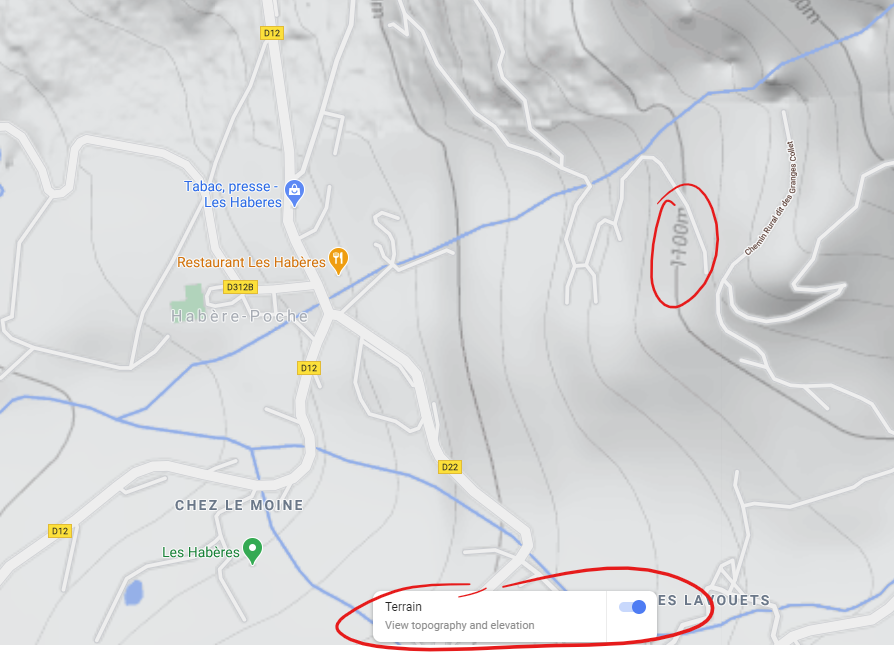
@isazi Have you considered checking the information on Google Maps for your specific location? Altitude should also be given when you enable “Terrain view” and then enable “view elevation”
-
@isazi shouldn’t a phone capable of multi GNSS and an app displaying GPS data be enough?
-
@Radu-Negoescu @Łukasz-Szmigiel I was just very lazy until today, living in flatland, but now according to this website I am something like -1 below sea level.
-
@isazi https://www.ahn.nl/ahn-viewer
Try this -
@Dimitrios-Kanellopoulos Tnx, I will keep an eye on it…
-
@stromdiddily said in Software update 2.13.18 for S series (S3,S5,S9):
@surfboomerang I’m down 100ft at my house in the day since the update…
Is it raining extremely hard?
-
@Brad_Olwin yeah weather has been pretty crazy last few days. BUT I haven’t moved around much so would have expected to see those changes come through on the baro side. Or is there a limit?
Always carry a flaggon of whiskey for snakebite; and furthermore, always carry a small snake.
User of pretty much every watch since the Ambit 3 Peak. Now back in the family w SV2 :)
-
@Radu-Negoescu it seems like elevation can be shown on very limited areas. I cannot find none of elevation numbers on google map 200 km around my living place.
-
I used beidou with gps on trail run today and it looks worse than on gps only. I am switching back to gps only. I am happy with it (gps only) as it now looks indistinguishable from my A3P tracks.

I had few seconds power drop to zero on Stryd wind device on one of my non stop run activities this summer and contacted Stryd Support, they quickly replied to me that is a known Suunto9b problem of dropping connections. I forgot to mention that here on forums as beer and bourbon mixed with some curated playlists of Coltain&Miles and news put on mute with caption seemed to be more interesting thing to be occupied with than ranting on forums about power drop on a power meter loosely attached to the laces of my left shoe. Fortunately, this problem seems to have gone away by itself.

-
@stromdiddily Don’t know but when we have major fronts come through my elevation can change by 50-100m. As soon as I exercise FusedTrack fixes it. I don’t worry too much about it. I know my house is not sinking.
Vector/T6c/Vertical 2 Ti
-
@Brad_Olwin Totally right. I noticed that too on drastic weather changes.
But to me it doesn’t make sense that the watch interprets pressure change as altitude change while it is in standby/sleep mode. It knows it isn’t moving, because the display turns off.Once you keep moving it, I imagine it can be harder to distinguish pressure change is due to weather change or altitude change.
-
@surfboomerang The interesting thing for me is almost all of my storm alerts come while I am exercising. When I go back and check with a mountain weather station, I find the watch was correct, there was a huge drop in pressure that was fast. Our weather is complicated, I am at 1550m and a few km from me is a wall that varies from 3900 to 4300m. We have complicated weather patterns and wind and the weather can change over the period of a day or a couple hours. The other issue is work for me is 1700m and traveling back and forth is more problematic for elevations not being correct in the two places.
-
@Brad_Olwin issue isn’t so much w the home location but I do rely on the watch face altitude when out backpacking. Useful in making sure I’m on the right/same level as camp…
-
@stromdiddily The work around for this is just use the auto-calibrate feature when you are at a camp. This always restores my altitude values.
-
Do you need to take watch off wrist for auto calibration?
-
@lexterm77 No, but I think it may be faster if it is off.
-
@lexterm77 I also tried GPS only today, but I have got a worse track than yesterday with Beidou. Will try few more times.
One interesting thing I noticed though, is that it seems (in a totally non scientific way) that I get better Fusedalti without Beidou. I will also check if this is the case in the next few days.
Watch: Suunto Vertical 2 Titanium Black
Blog: isazi's home
-
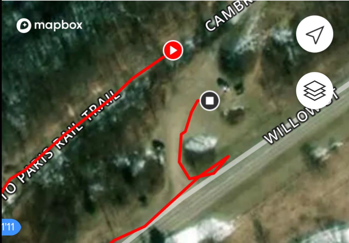
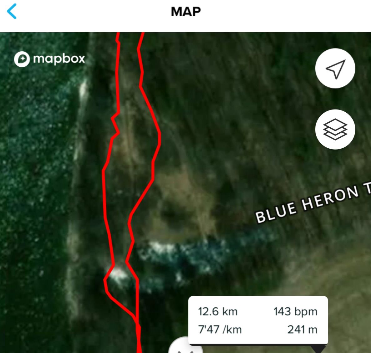
With Beidou my tracks are 5 meter apart, with GPS only they are half a meter apart.
One is GPS only around parking lot, it is spot on, couldn’t draw better myself.
Other one is trail run with beidou, single track trail is visible on sat image but tracks are like 15 meters apart.
-
My observations with current firmware (S5) as compared to older versions:
- GPS only is universally good except in deep forests or urban canyons. It’s as good as previously with Beidou.
- Beidou makes my tracks more “wobbly” and in my experience is the least useful system with current firmware.
- Glonass is ok but I don’t find it more useful in general everyday trainings (it’s superb in mountains though).
- Galileo - if there are enough sats available - is a monster. It struggles near dense and high buildings but in every other area it’s perfect for most of the times. I can’t think of a better track precision in a running watch.
Also, “offset locks” happen way less often than before. It used to be a norm when changing direction (ie. 90 deg) for the track to be locked on a constant offset by 10 - 20 meters. Now it happens rarely.
It may be placebo (as everything written above ;-)) but I feel that my tempo doesn’t drop as dramatically when entering wooded area. It used to drop from 6/min to 7/min only because I’ve entered the park from river embankment.
I also get an instant fix almost always.
It really is amazing.
-
Feature idea: use gnss data and route information to automatically select system with most satellites visible at that time, account for duration for completion of activity and terrain type (flat route no trees means you can catch sats at lower sky points while wooded area with lots vertical points on route means only high sky satellites are ones in direct line of sight or city routes) let algorithm decide best choice for you. Of course this would need to be done in app but with predetermined window of activity start time in lets say next 24hours would be passed onto a watch as calculated “best choice” for which gps system would watch choose for each route. I can see that some satellites are barely populated at some time of the day (8) while sometimes there are 12 of them. Each hour has its advantages. These satellites (most) are moving across the sky, they are not geostationary or geosynchronous orbits. If all this is complicated an artificial horizon can be optimized for universal satellite count at lets say 20 degrees above horizon and which system has most satellites is the one being chosen

Hello! It looks like you're interested in this conversation, but you don't have an account yet.
Getting fed up of having to scroll through the same posts each visit? When you register for an account, you'll always come back to exactly where you were before, and choose to be notified of new replies (either via email, or push notification). You'll also be able to save bookmarks and upvote posts to show your appreciation to other community members.
With your input, this post could be even better 💗
Register Login