Paragliding replay in app : no altitude registered
-
Hello,
I registered a paragliding activity.
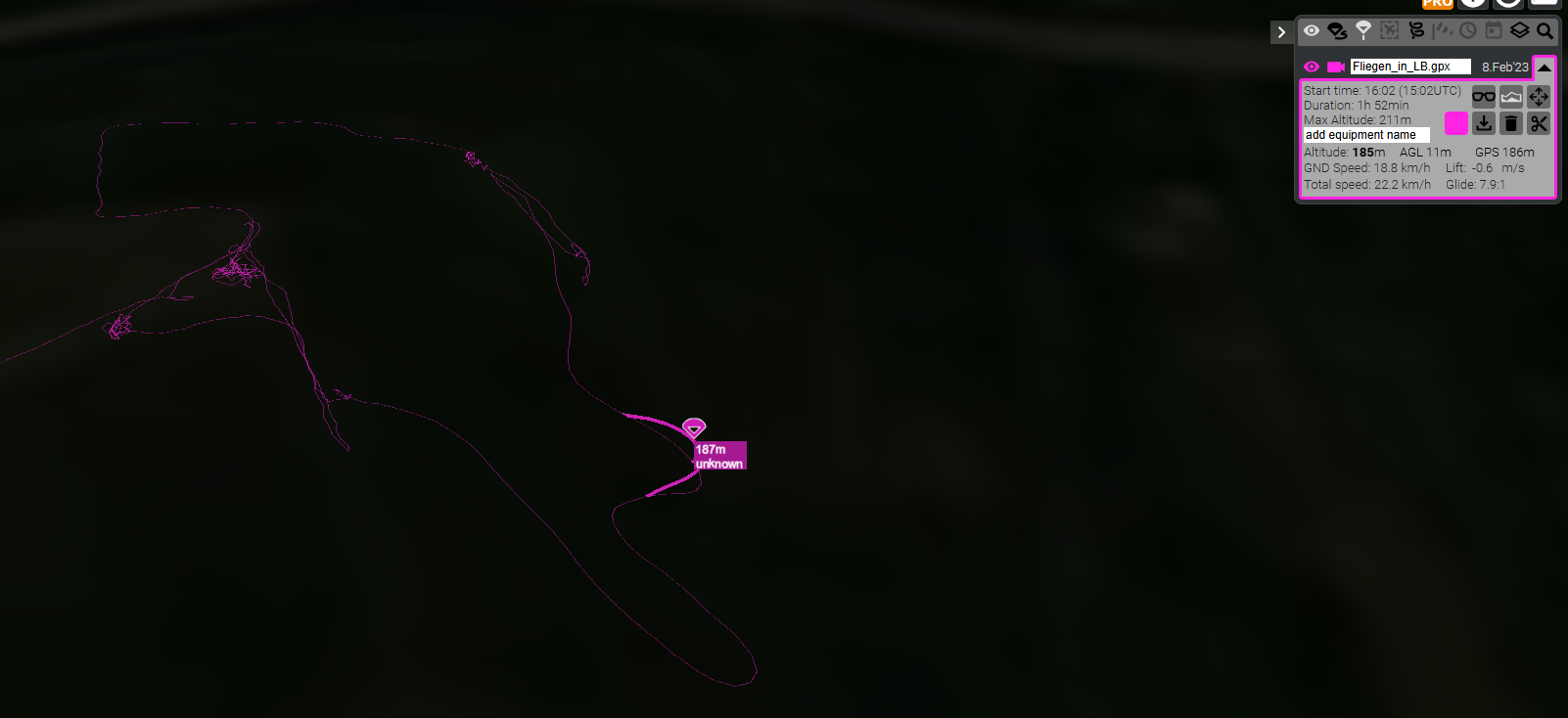
When I replayed it within the app, the replay showed the trace stuck to the ground, as if I flew on the ground and wasnt in the air.
I imported the gpx in Google Earth and same thing happened.
Could it be that the watch didnt record the altitude ?
Thank you
Regards
T
-
@treizeXiii has just been discussed a few days ago.
-
Oops, indeed…
Unfortunately, no one answered or suggested a solution or tips.
Could be a bug of the watch (no altitude recorded in gpx) or within the app.
RegardsT
-
@treizeXiii there is no solution for the user until Suunto changes it in the app.
I have submitted a suggestion to do this. -
@Egika great, Thank you
-
@treizeXiii Hello! I found this article, maybe it is related with the feature FusedAltiTM
that basically combines map-altimetry and barometric altimetry. It is not actually clear if it use GPS satellites to triangulate your 3D position. Apparently just locate your 2D coordinates and then add the elevation obtained from maps.
Anyone has precise info about how it works exactly? -
@Enrico-Di-Lavore Fused-Alti is a very different thing to what has been discussed in this thread so far.
This thread: How is a track that has been recorded at high altitude above ground (during flying) represented in the app.
Fused-Alti: Is a Suunto technology that has been around for a long time. It is used for a higher altitude accuracy during recording. It does not use map data, but combines the GPS altitude with the barometric altitude.
Both have their advantages and disadvantages:- GPS altitude is an absolute value, it is just prone to noise and thus needs long sample times to be accurate from averaging.
- Barometric altitude is super accurate in a relative way and follows changes instantly with high resolution. As it depends on barometric pressure it wanders over time.
Fused-Alti takes advantage of both and is calibrating the barometric measurement during the beginning of the activity with the GPS data. GPS altitude data is sampled to 12-15mins and then adjusting the barometric measurement.
-
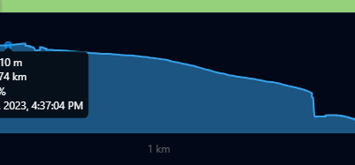
My last flight recorded with the S+ App was rather short. I imported it to gpx.studio but even while there is 20m drop at Landing I could see me flying over the ground. Maybe on a different visualizer.
Normally this works fine on other sites with tracks from any variometer which is recording both gps and baro height.
There is a setting in the Suunto App on Phone where you can choose between baro and gps height. Maybe check this before. I always have this on baro height cause it is more reliable than gps but I guess this setting is just for the app. I think the watches use baro height and one can manually set it to gps height if it is off to much.Hier the height diagramm from the gpx track of my flight with the app:
Here I uploaded the file to replay.flights. There is one short lift. But I don’t think the data in the file and the elevation data is reliable. Just found out that komoot has been using Nasa elevation data that simply was wrong in many areas and they updated it just recently. I had some steep climbs on a bike tour in turkey e.g. which was almost flat while planing.
On many tours, climb guidance from imported tours from komoot to the watch where just wrong.
Maybe try to upload your tracks to replay.flights to check if they work there and compare the files to a real variometer file.
-
@Ecki-D. the setting baro or GPS in the app is only used when recording an activity right with the app instead of a watch.
The topic of this thread is simply a rendering one of the Suunto app. There currently is no setting to have the data plotted at an elevation above ground. And this is known to Suunto.The watches just use FusedAlti as desfibed above. No way to change this setting.
Hello! It looks like you're interested in this conversation, but you don't have an account yet.
Getting fed up of having to scroll through the same posts each visit? When you register for an account, you'll always come back to exactly where you were before, and choose to be notified of new replies (either via email, or push notification). You'll also be able to save bookmarks and upvote posts to show your appreciation to other community members.
With your input, this post could be even better 💗
Register Login