Real world data
-
@andré-faria said in Real world data:
5k “walk run “ s9p in gps only
https://www.suunto.com/move/andrfaria640/60cc26410a970d0c596558feGarmin 245 (doesn’t have baro ) + decathlon hr strap
https://connect.garmin.com/modern/activity/6977857873Small 16k team bike ride:
S9p
https://www.suunto.com/move/andrfaria640/60cb342bf1f0e24ada24b377Edge 530 (decathlon hr strap)
https://connect.garmin.com/modern/activity/6973800924Same trace (±) on different times with different watches (some altitude may vary if I climbed some stairs on the way or notm but it should vary that much, although not everytime the case)
Ambit 3 peak sapphire
https://www.suunto.com/move/andrfaria640/5fc9dd2f586ad13e50eca662
Garmin FR45
https://connect.garmin.com/modern/activity/6315306290
Fenix 6s sapphire
-
@gosem said in Real world data:
@andré-faria Hi André, thanks for sharing you data
 … did I get I right, the gps data were not that nice, or? what kind of setting did you use at GPS settings? Many thanks, Martin
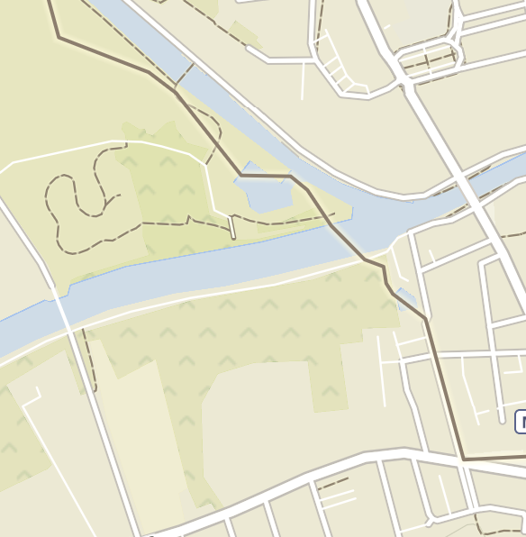
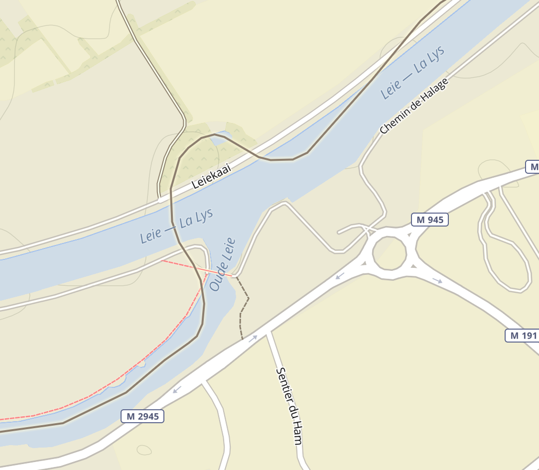
What activity is that?
I was seeking those parts and can’t find them.
I found the gps quite good, specially because this zones are tricky for gps.
Setting GPS+QZSS -
First mountain tour today with the S9P and the altitude measurement and the GPS make a very good impression.
-
I did my first ride with the S9P yesterday. Most of the data seems to be good, though the S9B OHR is way too high compared with my Wahoo Bolt + Polar OH1. It reads at least 10-15% high during a threshold effort:
S9B: https://www.suunto.com/nb-no/move/lakerveldt/60cb8f3fe9893c2c684ef50a
Bolt + OH1: https://www.strava.com/activities/5486185880
This was pre FW update to 2.16.26. I continue testing troughout the weekend where I have a swim, long run and long ride planned.
I love the form factor of the S9P compared with my SSU though!
-
Did a hike today to check out new trails and do a bit of recovery. Had a route set up and used snap-to-route feature. Here’s a comparison to F6X that was just tracking in the background, connected to HRM-TRI:
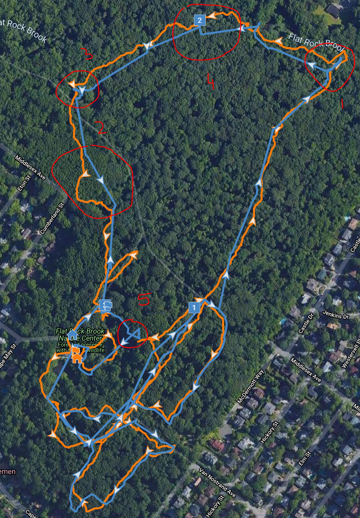
Some of the points:
- I think despite snapping, S9P is right here, I quickly went down the wrong path then came back. No way it was in the roundabout fashion of F6X.
- Here we see snap-to-route artifact cutting me straight even though trail was running around a bit. You can see plenty of those straight sections even though I was getting on and off the route to get the picture. Yes, snap was meant to do that, but looks funny on the trail
- Another case of wrong turn. S9P is probably closer to reality.
- Not sure what happened there other than snap-to-route artifact.
- Some UFO maneuvers by snap-to-route. Busted! US Navy, you found me!
All in all, given how close the network of intersecting trails was I think snap-to-route performed fairly well despite plenty of obstruction from rocks and trees. It did cut some of my wondering. Final distance is 2.57 in S9P, 2.60 in F6X.
-
The altitude on the same hike:

Even though profiles look fairly close, you can see S9P tracking me a good deal higher for most of the hike. Interestingly enough, the S9P ascent then is just 259 ft while F6X is 361 ft. When corrected in TP, F6X elevation gain is 233 ft. Given difference in GPS tracks, I’d say S9P wins again, without any corrections.
The heart rate didn’t fare as well though. S9P tracked really well first 10-12 minutes of the hike, then mostly lost it. The average were still fairly close but:
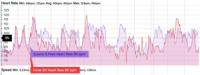
This is very unlike yesterday’s threshold run where S9P was spot on against strap, down to a beat:

Then I shouldn’t hold hiking performance against it. Fenix wouldn’t be perfect without a strap either. And I know COROS is considerably worse.
I continue to be impressed.
-
@nickk keep in mind one thing when hiking. The blood flow is restricted resulting in typically lower HR from any device. A belt reference is needed. Lifting the hand , letting some blood flow fixes that.
Unfortunately no OHR will ever fix that due to the nature of the human body (I hold my breath to be mistaken)
-
@nickk regarding the altitude.
The initial altitude of the s9P was 10 meters pretty much wrong. So at this case we check the vertical error (that is typically 5-20m). If the error is higher than the difference it you apply we keep it uncalibrated but slowly letting it adjust (so a kalman filter). If the conditions provide we retrospectively correct.
In your case as you can see we slowly corrected the altitude instead letting it jump to some not correct value that would have cought the users eye, and also would have provided subsequent wrong ascents and descents.
I hope it makes a little sense
-
@dimitrios-kanellopoulos That’s fine with me. As I said: I don’t think F6X would have done better without a strap, and I know for a fact both COROS and Polar are no better. COROS was a total basket case when I tried its OHR on several hikes.
-
@nickk agree. Same here. I tested coros apex pro for a few and ohr was better than the s9b but worse than the s3 and worse of course than the s9P.
-
@dimitrios-kanellopoulos I always use a strap for hiking. On my hike today, the altitude measurement was almost perfect. The S9P was only 2m higher at prominent points with official altitude information.
-
Just tried a first short and easy swim. I have the impression that the GPS is considerably better than my SSU. Total distance is quite spot on. Heart rate is still erratic.
-
Hiking today, will post a comparison against Polar OH1 if I can!
-
So first day in the French Alps, I think the Peak’s OHR is working very well for me. Here it’s against a Polar OH1 paired to the baro.
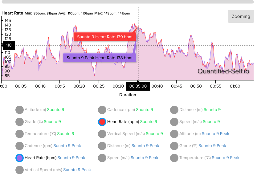
Hiking, no poles.
-
@isazi looks good. On the next hike I will test it with the hiking poles and see if it works that well.
-
@isazi
Hey, where are you near in the French Alps? -
@mff73 spending a week mountaineering in the Écrins!
-
@isazi
Enjoy, nice and perfect massif for this. -
@isazi nice place to hike or trail


Less than 2 hours from my house but i don’t know there very well
-
@isazi How do make this comparison?