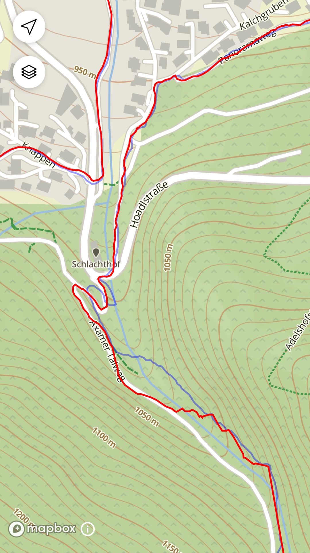
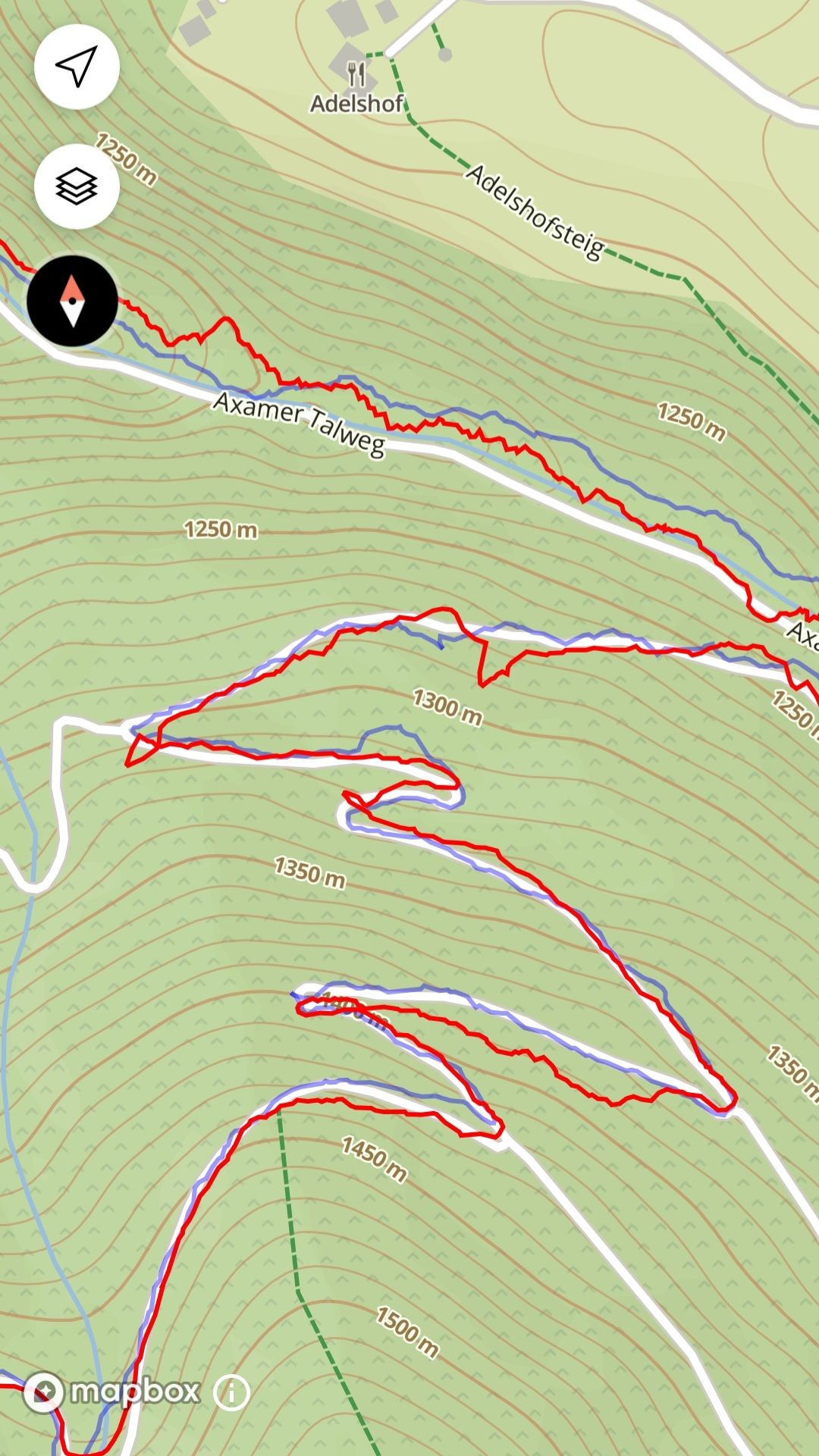
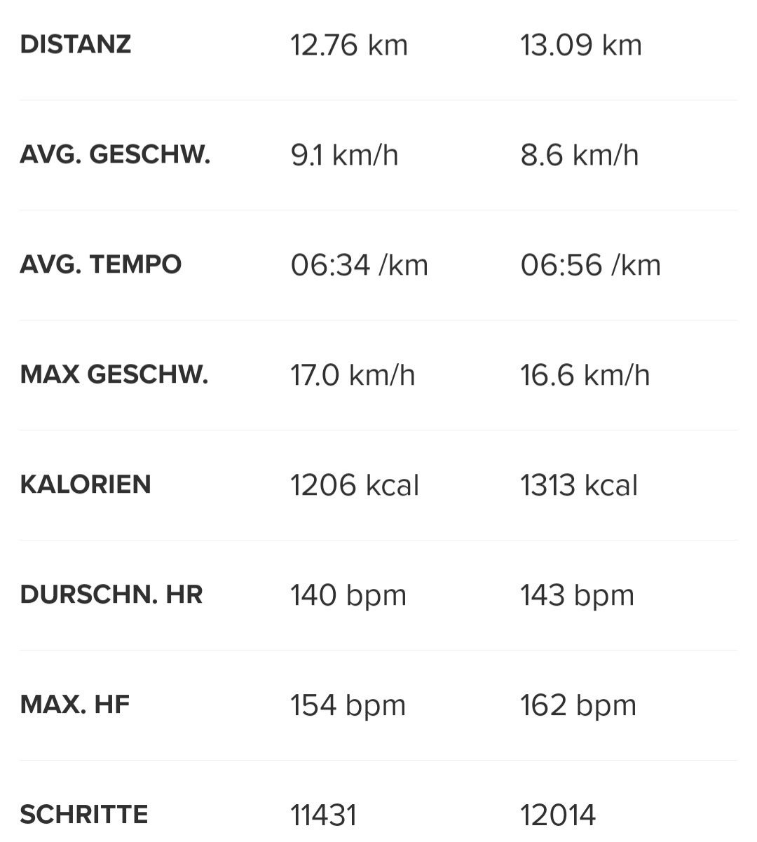
GPS normal?
-
@theguyfromthesummit but that‘s the question. Elevation most of the time is the same than with my Apex Pro during trailrunning. But distance is not. S9P always records more km. Today Apex Pro 11,39km/504m+ vs S9P 12,14km/496m+. Of course I don‘t know which is correct. But seeing the track makes me think that S9P overestimates the distance a bit. Ok, in the end you get a better pace with S9P

-
@_marcus_ I also saw this comparing my S9B and a Forerunner 945
Usually S9B has +0.5-1.5km … -
I’ve a similar discrepancy in distance between an Ambit 3 Peak/ Polar M450 and S9B. The distance is always a little longer on the S9B for both Cycling and Runs.
Also the GPS tracks on the S9B never look quite as smooth as the other devices. Similar to the ‘jagged’ tracks on the screenshots in this thread.
Maybe the ‘jagged’ tracks are where it’s picking up the little bit of extra distance?
I’ve tried different GPS settings and soft resets, but nothing helps.
I actually tend to use the Ambit 3 Peak as my default device because I know it’s more accurate. Especially if I’m pacing a run.
-
@jokeen2020 If you use auto-pause, the distances differ, because different devices are more or less aggressive about what constitutes “moving” and what is a pause.
-
@theguyfromthesummit occasionally, there are issues with the GPS (the system itself). I am not saying that this is the case, but it happened to me that a track was completely off one day and the next it was back to normal.
-
@mdzott It behaves like this for at least 2 months now. So I don’t know where this is coming from
-
I don’t use the auto-pause on any of my devices.
-
@jokeen2020 Same here, I don’t trust it
-
@theguyfromthesummit have you tried just GPS only without any additional system?
In the mountains with challenging conditions usually I get good results with GPS+GLONASS though.I remember the Sony chipset had this wobbling issue at the beginning.
Just to check: It your watch firmware up to date?
Have you tried to follow the procudure:- soft reset watch (12 upper button)
- load AGPS data from the Suunto App
- wait a few minuted for the watch to parse the data
- get GPS fix
- wait a little for the GPS fix to stabilize before heading off
Cheers from northern Germany

-
@jokeen2020 yesterday,I went for an exercise and Ive turned on auto-pause. When I was passing through underground passage, auto-pause was activated probably due the lost of GPS as my speed was much more that 2km/h

-
@egika Thanks for the suggestions. But I already tried that.
Today it was really bad - LTE on the phone and S9B had no GPS all. Even at the summit without any challenging terrain my S9B couldn’t even show my loaded route due to no GPS signal
-
@_marcus_ said in GPS normal?:
@theguyfromthesummit but that‘s the question. Elevation most of the time is the same than with my Apex Pro during trailrunning. But distance is not. S9P always records more km. Today Apex Pro 11,39km/504m+ vs S9P 12,14km/496m+. Of course I don‘t know which is correct. But seeing the track makes me think that S9P overestimates the distance a bit. Ok, in the end you get a better pace with S9P

My training partner has a Garmin Enduro and I use a S9P. On our hill runs of 20km(ish) and 500m or so of vert I usually finish up to 400m ahead of him whereas he gets a significant chunk of ascent…

I’m happy to read that it looks like the S9 ascent ‘issue’ is being addressed in an upcoming update; over the course of a week I reckon I must lose hundreds of metres of vert ?!
-
@miniforklift said in GPS normal?:
@_marcus_ said in GPS normal?:
@theguyfromthesummit but that‘s the question. Elevation most of the time is the same than with my Apex Pro during trailrunning. But distance is not. S9P always records more km. Today Apex Pro 11,39km/504m+ vs S9P 12,14km/496m+. Of course I don‘t know which is correct. But seeing the track makes me think that S9P overestimates the distance a bit. Ok, in the end you get a better pace with S9P

My training partner has a Garmin Enduro and I use a S9P. On our hill runs of 20km(ish) and 500m or so of vert I usually finish up to 400m ahead of him whereas he gets a significant chunk of ascent…

I’m happy to read that it looks like the S9 ascent ‘issue’ is being addressed in an upcoming update; over the course of a week I reckon I must lose hundreds of metres of vert ?!
And which one is closer to real value of ascent?
On my experience some Garmins if they have the continuous altimeter calibration on produce higher ascent numbers. -
@andré-faria on my skimo tours we compared Fenix 6x Pro, S9B and COROS Vertix. S9B elevation was 5-10% lower than the others. But it had more kilometers.
On trailrunning elevation is close together between S9P and Apex Pro, but S9P records more kilometers and its GPX Track has more wobbling eben when I go straight up. Or with other words: Apex Pro track is smoother and more realistic.
I am curious about elevation in winter with the S9P -
@theguyfromthesummit
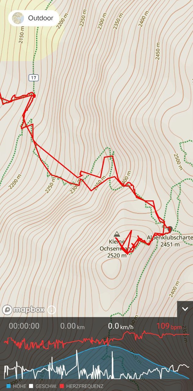
Here the GPS track
I followed the paths and pressed pause at the summit, so all this jumping around was during the way up or down…
-
@andré-faria said in GPS normal?:
And which one is closer to real value of ascent?
On my experience some Garmins if they have the continuous altimeter calibration on produce higher ascent numbers.Always difficult to judge, it depends on terrain and the definition of ascent (that may seem straightforward, but it is not).
The S9 baro and peak have issues (currently) with hilly terrain, while they perform very well in continuous uphill/downhill. The ascent/descent algorithm is being worked on, and current testing shows very good results, without making it too sensitive.
Truth is often in the middle, e.g. running on very flat terrain in Amsterdam Suunto often gives me 0 ascent/descent, while Garmin gives me tens of meters of up and down that do not exist.
-
@theguyfromthesummit that looks like a pretty terrible track, and it also looks like there was no GNSS signal at all in multiple points. In my experience the S9 baro works very well in the mountains, so this is very strange. Are you on trails or climbing? Are there steep gorges around? It should really not look like that.
-
@isazi
The first part of the ascent looked like photo 1.The last view meters were steeper, but actually only one side was obstructed by the peak (a bit of scrambling)
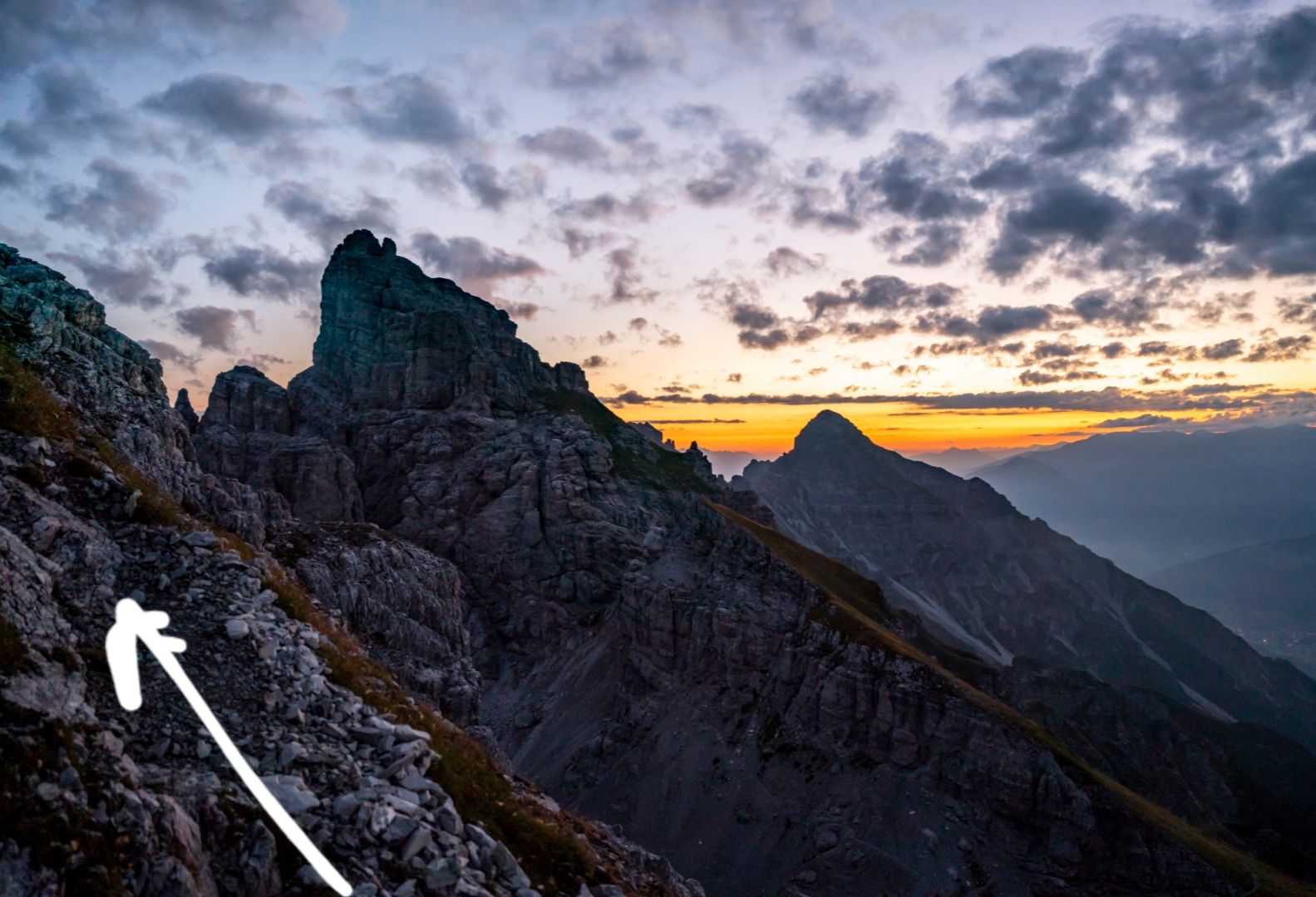
The final meters wer exposed (photo 2)
My phone had always a nice GPS connection.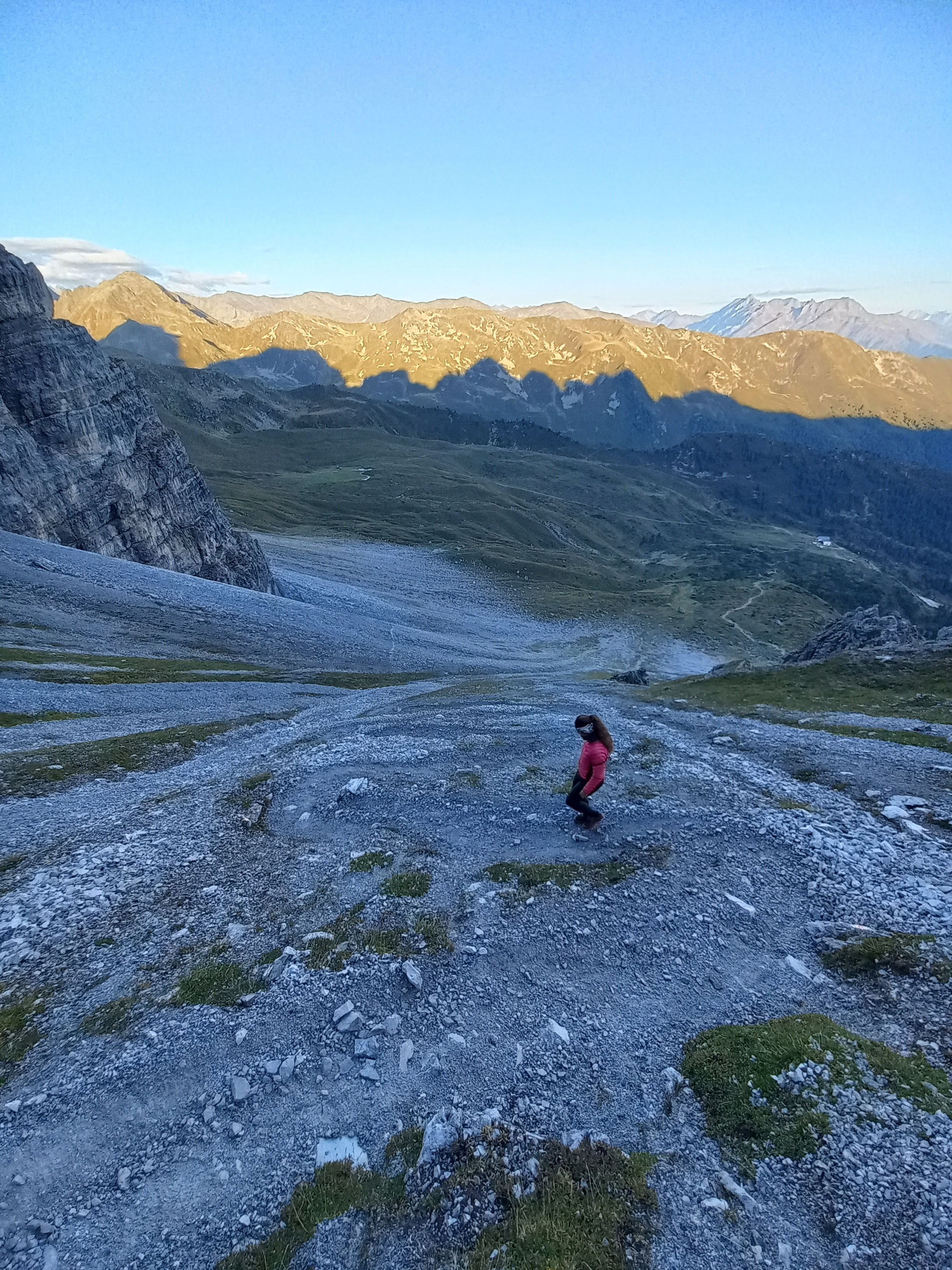
-
@theguyfromthesummit sorry of off-topic, but which summit is that? Looks great!
-
@theguyfromthesummit it looks like I expected, the track in those conditions should not be this bad, and should not lose satellite fix

You said your watch was working better in the past. Anything changed? Do you think a hard reset (reinstalling the firmware with a clean sweep) could help?
