Map Rendering and Trail Visibility after Software Update 2.43.8/.12
-
I’m not sure if this came from the new firmware or the updated maps, but I ran in a new issue this morning: the base map turned solid blue.
Example, it turned blue from here: (44.66635N 6.59406E)
to here: (44.65173N 6.58086E, ~2km from the first point)
Between the two, it looked like this

-
@tuxella where are you? Country?
-
@GiPFELKiND French alps, between Gap and Briançon. The coordinates (in the previous message) give a more precise location.
-
@Squirrel said in Map Rendering and Trail Visibility after Software Update 2.43.8/.12:
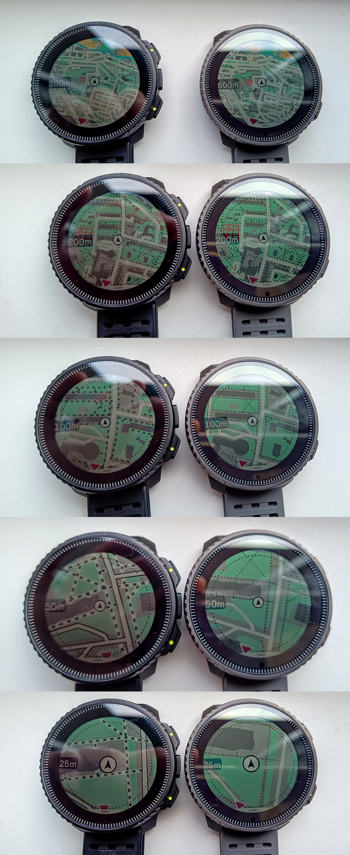
I think the radius of that circle represents the distance shown at 9 o’clock, e.g. 500m, but I could be wrong.
I think you are right but these dots are still redundant and just a visual noise on the map which readability is already not the best. They are close to the screen edge so it doesn’t matter whether they are shown or not.
-
@Squirrel I looked at that yesterday, the scale is only a half of the screen. If there is 200m scale, it’s from the dotted circle edge to the center of the map (the dot in the middle). So with 500m label, the diameter of the dotted circle/map is 1km.
I looked at another map and find something 200m long and then looked at this on watch to make it clear to me.
-
@Jan-Suchánek okay, until today THATS a NEW information think for all of us
 thank for your Work

-
@GiPFELKiND You’re welcome, just prove it again just for sure and it’s as I wrote. Btw, I found that the easiest way to measure that, is to enable the ruler function on watch map
 .
.
But I’ll remove the dots around map and even if the scale is measured to them, it couldn’t affect it much or the map could be rendered a bit zoomed… -
@Jan-Suchánek I would prefer to have 1/3 of the map “behind” me and “2/3” in front of me at least as a choice, so that I could see the track I missed … and see all the options before me.
using a Suunto Vertical & Suunto Wings; mostly running (AKA stomping around) and cycling through the northern german "wilderness", and wherever else I have the chance to do so
OS - Android 16/Pixel Pro 7 -
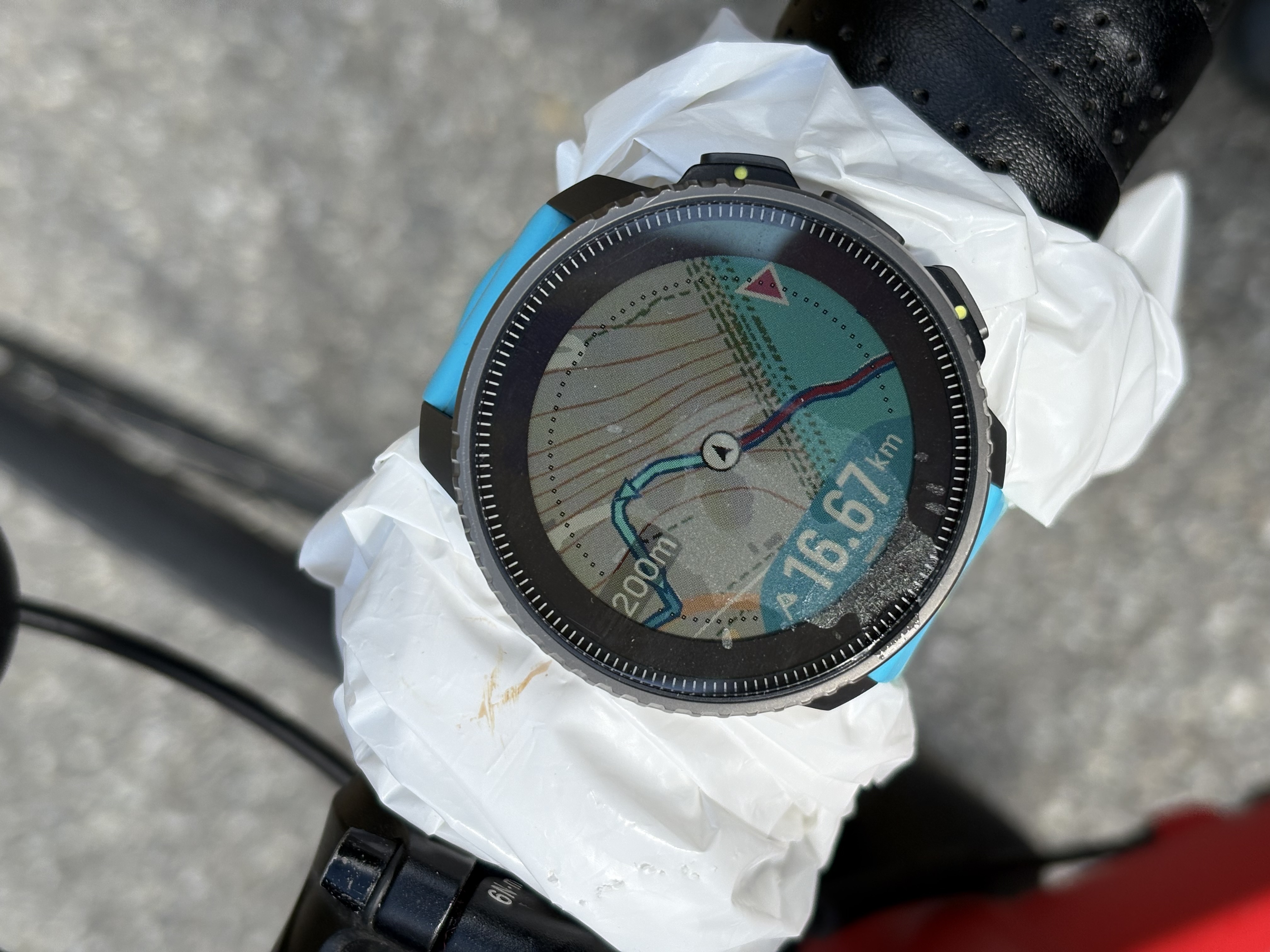
@Jan-Suchánek FWIW … At “200m” zoom, the distance from the centre of the position marker to the dot ring is 200m, plus 25m to the edge of the MIP display. (Measured using the Vertical’s built-in ruler.)
-
@Shrek3k Yes: at least the option for that would be useful. Having the position marker in the centre generally works better for a fixed “North Up” map. (Which also has its fans.)
-
@Fenr1r On Race, the dots disappear with ruler function, but I measured 215m from center to the edge of display. So it seems, that the dots-display edge distance is 15m with 200m scale.
-
@Jan-Suchánek Curious. 225m on Vertical. Dots disappear, too, but obviously not an issue for the full display radius.
-
@Jan-Suchánek said in Map Rendering and Trail Visibility after Software Update 2.43.8/.12:
@Squirrel I looked at that yesterday, the scale is only a half of the screen. If there is 200m scale, it’s from the dotted circle edge to the center of the map (the dot in the middle). So with 500m label, the diameter of the dotted circle/map is 1km.
I looked at another map and find something 200m long and then looked at this on watch to make it clear to me.
From your post I’m not quite sure if you actually agree or not with my previous assessment, but you essentially came to the same conclusion.
radius = poloměr
diameter = průměrPersonally, I don’t find the scale circle distracting and find it better than on Garmin map, where the whole thing seems weirdly shifted off center. The edge of the display could be used as a scale boundary, but I think seeing slightly beyond scale boundary is advantageous.
-
@Shrek3k said in Map Rendering and Trail Visibility after Software Update 2.43.8/.12:
@Jan-Suchánek I would prefer to have 1/3 of the map “behind” me and “2/3” in front of me at least as a choice, so that I could see the track I missed … and see all the options before me.
I think one reason Suunto chose not to do this is that it is much easier to render the map rotating around a middle point rather than an offset one. I do agree with you that seeing more of “where I’m heading” is often more important than “where I’ve been.” However, this would probably have a negative effect on the smooth, fast operation of the map navigation screen that is so often praised.