Map Rendering and Trail Visibility after Software Update 2.43.8/.12


-
I am starting a new thread to bring more visibility to the topic of map rendering after software update 2.43.8/.12.
It seems that the goal was to make map look cleaner in the city where there a lot of footpaths and sidewalks. But perhaps the unintended consequence of this updates is that maps are now much less useful when used outdoors.
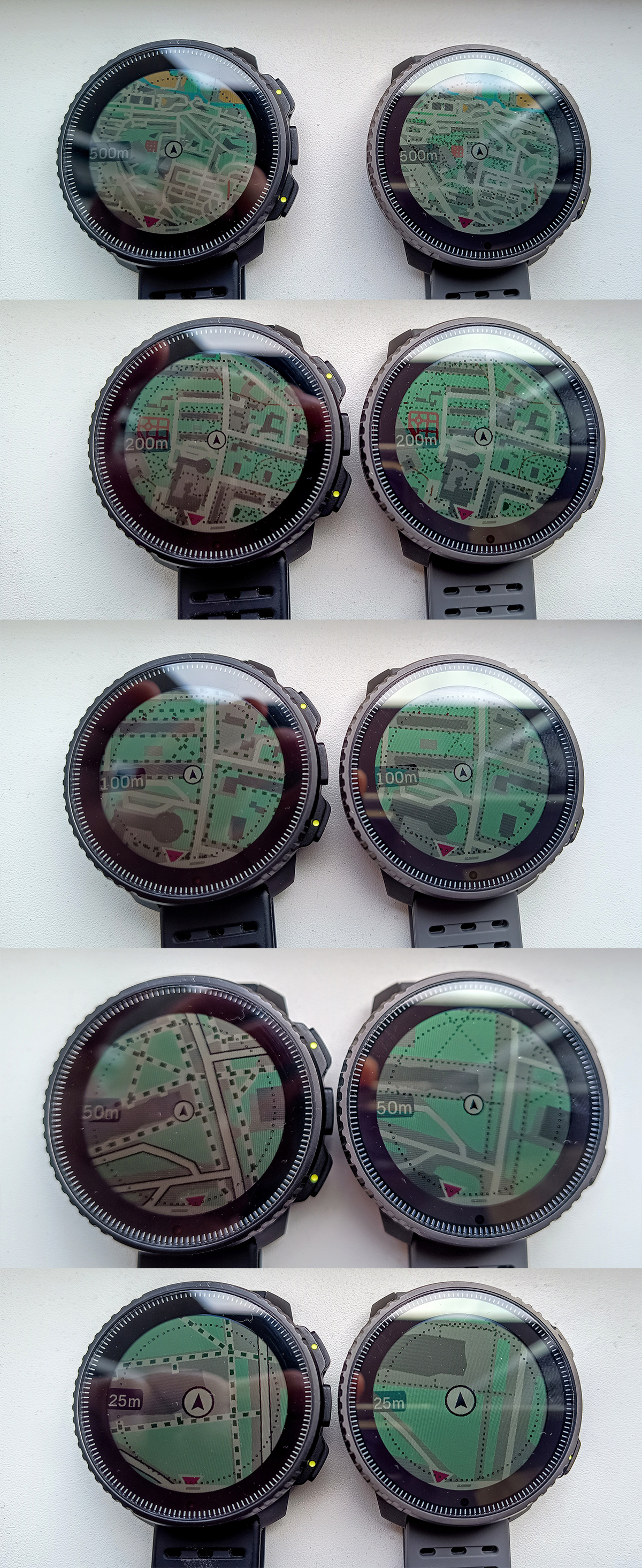
Before the update, trails (footpaths, sidewalks, etc.) disappeared at the 1km? (1mi) level.
On the current software, trails (footpaths, sidewalks, etc.) disappear at the 500m (0.2mi) level. Service roads (driveways, parking lanes, alleyways, etc.) disappear at the 1km (0.5mi) level. And residential roads disappear at the 2km (1mi) level.
Here are some pictures copied from https://forum.suunto.com/topic/13169/software-update-2.43.8-.12-2025-q2 thread:
New maps on the left vs. old maps on the right when used in a city:
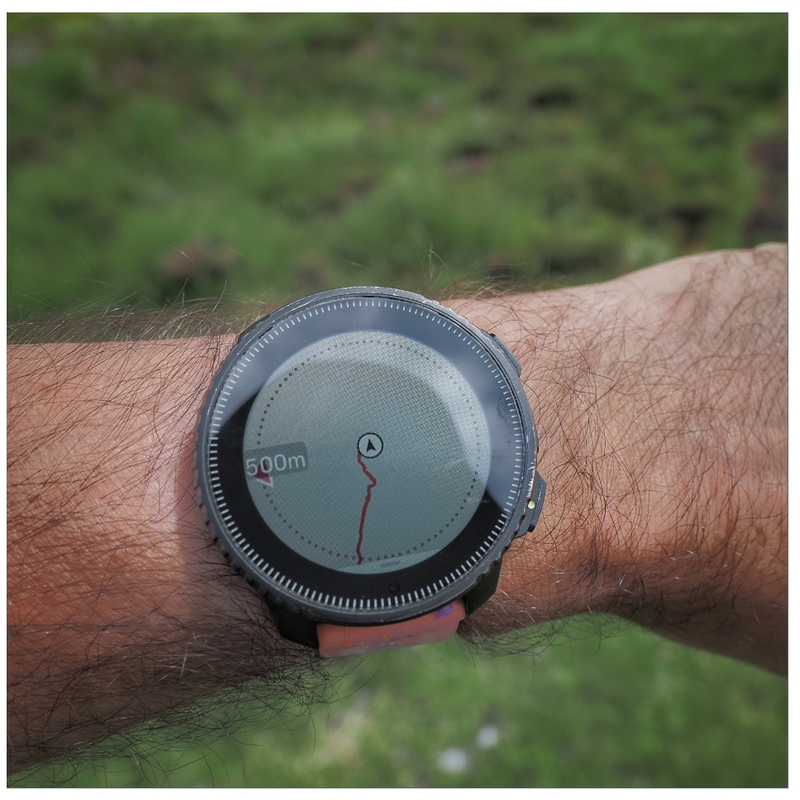
New map when used outdoors:
Please note that the new map rendering is worse for watches configured in imperial units where trails now disappear two zoom levels earlier than before - 0.2mi vs. 1mi.
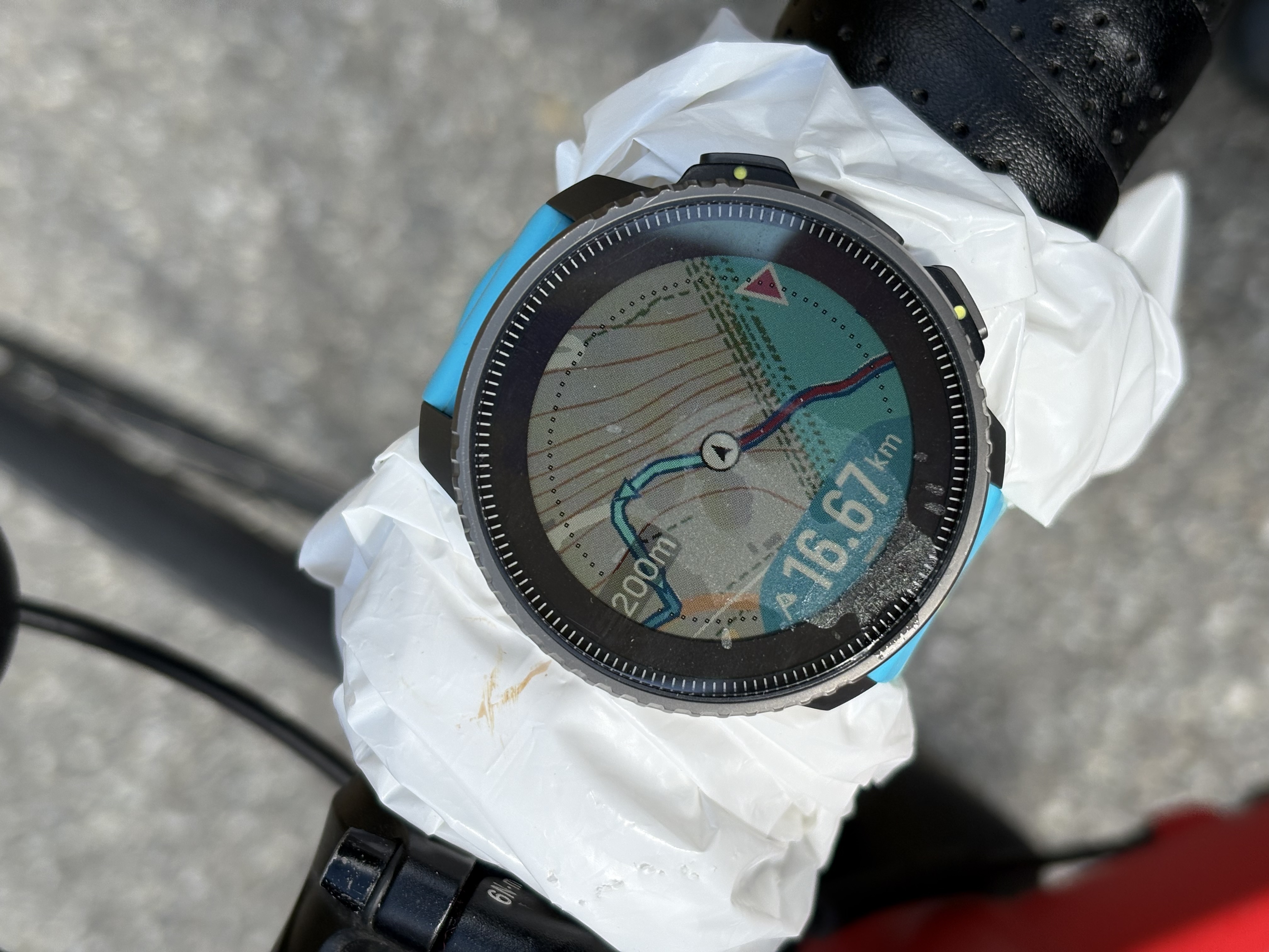
In addition to that, on the current software, trails become very thin and very difficult to see at the 200m (500ft) level, which makes them especially difficult to see on devices with AMOLED displays because pixels are smaller. The choice to low contrast colors makes this problem even worse. Even the high contrast map theme uses gray on black to render trails, which isn’t exactly high contrast. On the standard map, when running outdoors, trails often appear as dark green on green, which is a poor, low contrast color combo.
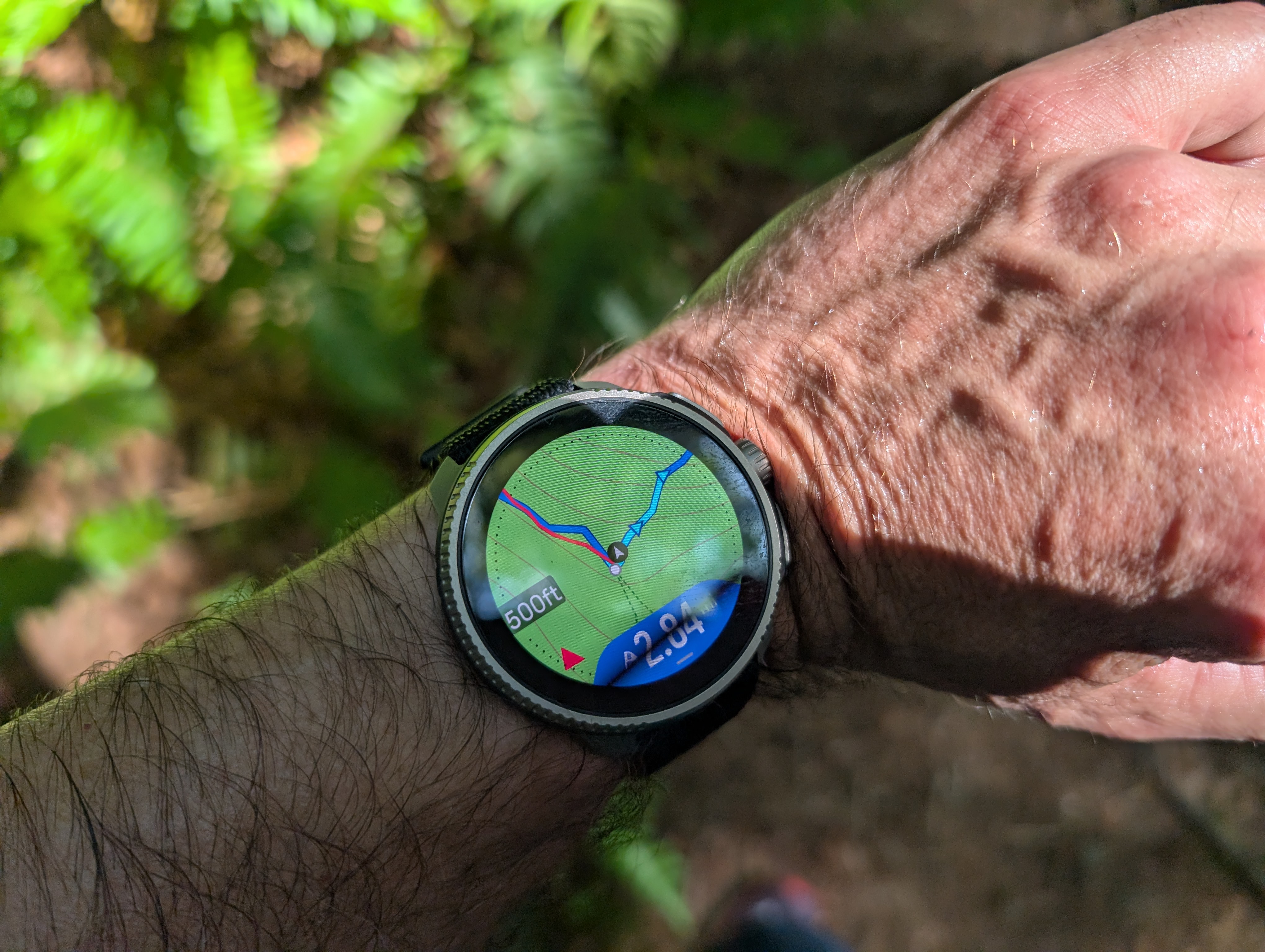
On Suunto Race or Race S, the last zoom level where trails can be comfortably seen is 200 ft (=60m) which covers just 20-30 seconds of running.Here is Suunto Race showing a new map at 500ft zoom level. Note that there is a trail that forks from the center of the screen towards the bottom of the screen, but it is very difficult to see when running (when the watch isn’t steady):
-
Also, I can’t understand what for are those stupid dots in circle shape around the edge of the display. I’ll appreciate map without them.
-
@Jan-Suchánek said in Map Rendering and Trail Visibility after Software Update 2.43.8/.12:
Also, I can’t understand what for are those stupid dots in circle shape around the edge of the display. I’ll appreciate map without them.
I think the radius of that circle represents the distance shown at 9 o’clock, e.g. 500m, but I could be wrong.
-
I totally agree that having trails only visible at the 500 ft level is a huge step backwards.
-
I’m not sure if this came from the new firmware or the updated maps, but I ran in a new issue this morning: the base map turned solid blue.
Example, it turned blue from here: (44.66635N 6.59406E)
to here: (44.65173N 6.58086E, ~2km from the first point)
Between the two, it looked like this
